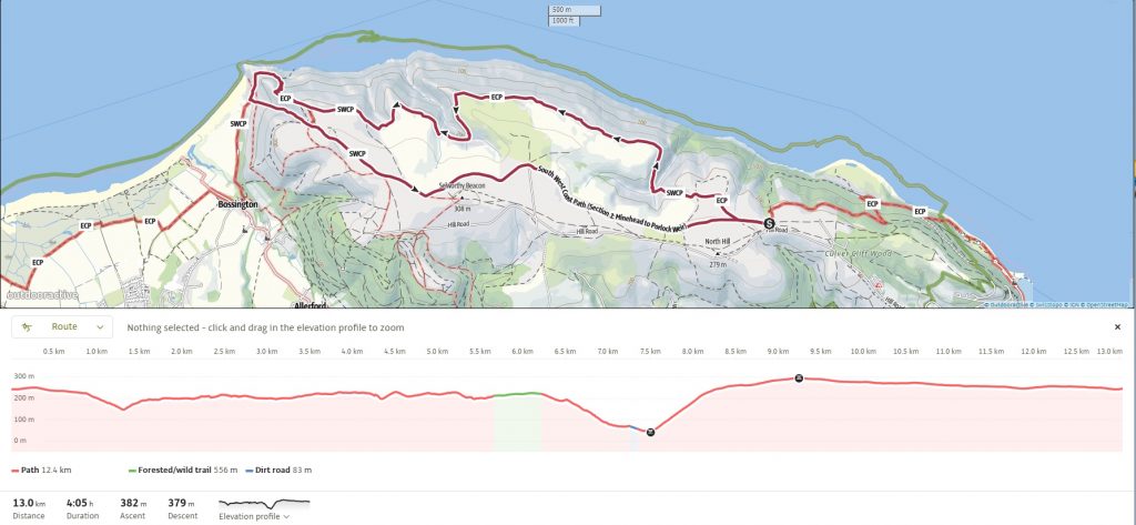
From high up on the Exmoor cliffs, we swapped the former moorland tracks for the new “Official” route along the Rugged Path—a coastal roller-coaster that clings to the cliffs between Minehead and Bossington. This 12.4km loop is a true leg-burner, featuring drops into deep combes and narrow trails high along the cliffs above the Brockholes. After a white-knuckle zigzag descent down the side of Hurlestone Point, the return journey kicked off with a steep scramble up Hurlestone Combe, making for a spectacular but demanding trek.
SWCP 1 Revisited: The Rugged Path Walk
Difficulty: Strenuous
18 March 2026
The START FROM North Hill
We began our journey at the top of North Hill. Originally, the SWCP headed inland toward Selworthy Beacon, but we were here for the newly Official Route along the “Rugged Path” The path immediately throws you into a series of “ups and downs” that define the Exmoor coastline.
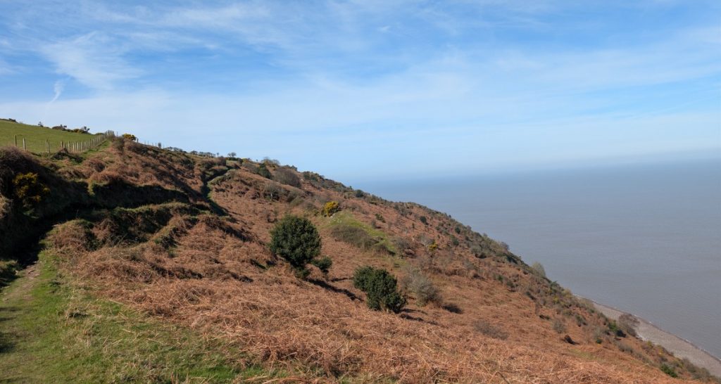
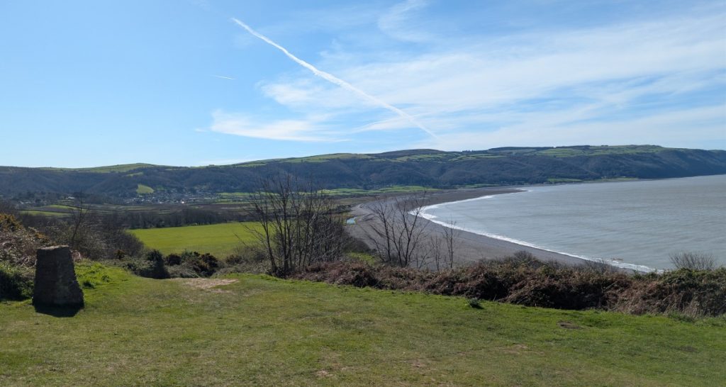
The Brockholes and Minehead Bluff
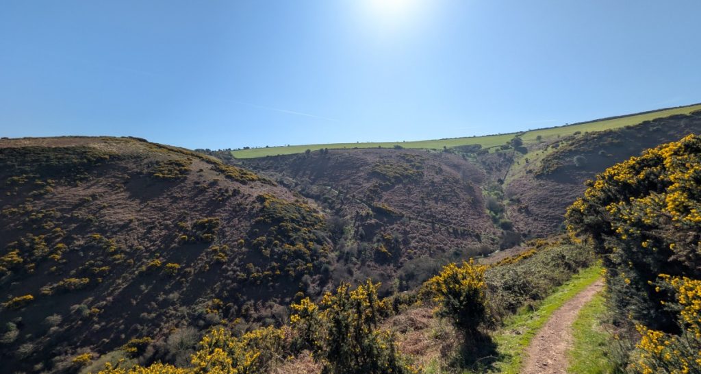
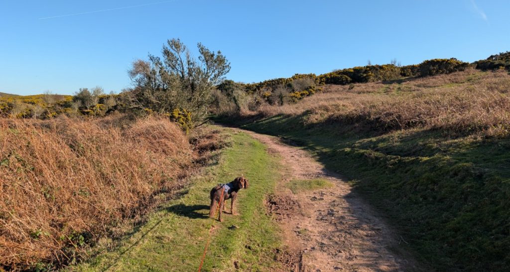
The trail drops steeply into Grexy Coombe, climbing out, we walked along the cliffs past Eastern and Western Brockholes. These are old quarry sites, now reclaimed by gorse and heather. We turned inland above Minehead Bluff and walked above Eastern Combe. Roxie found her highlight early—a bubbling stream at the bottom of the combe that was perfect for a mid-hike splash.
Hurlestone Point: The Zig-Zag Descent
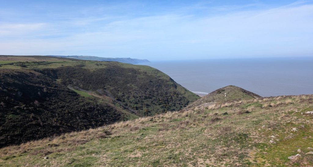
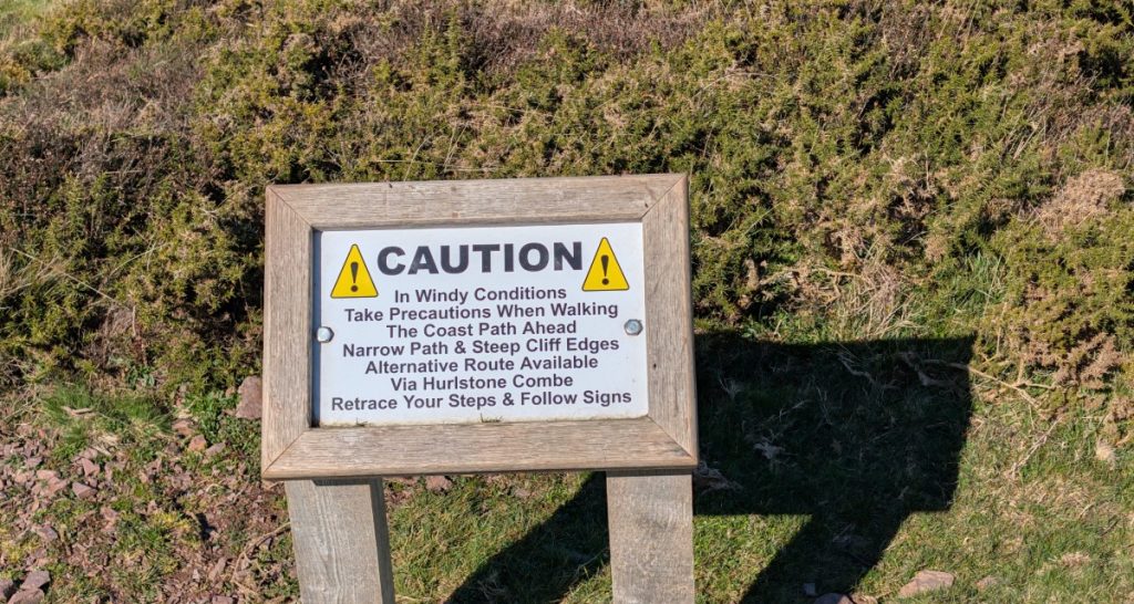
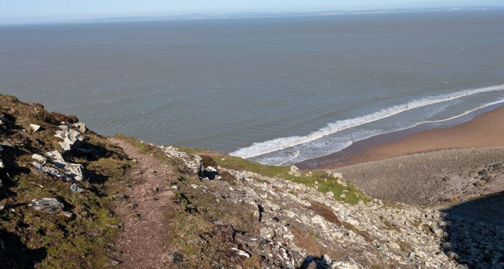
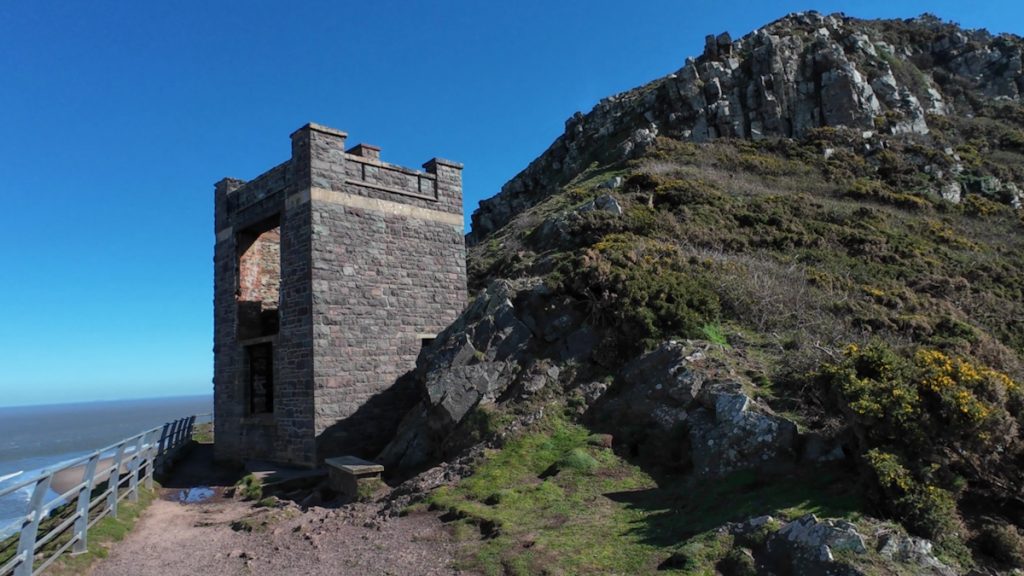
After passing the “Turn back if windy” warning signs (thankfully just a breeze today!), we rounded the shoulder of the hill above Hurlestone Point. The descent is a 60m drop down a difficult, rocky zig-zag path. It leads to the old Coastguard Lookout, where we stopped to take in the vast views across the pebble ridge to Porlock Weir.


The Crux: Hurlestone Combe
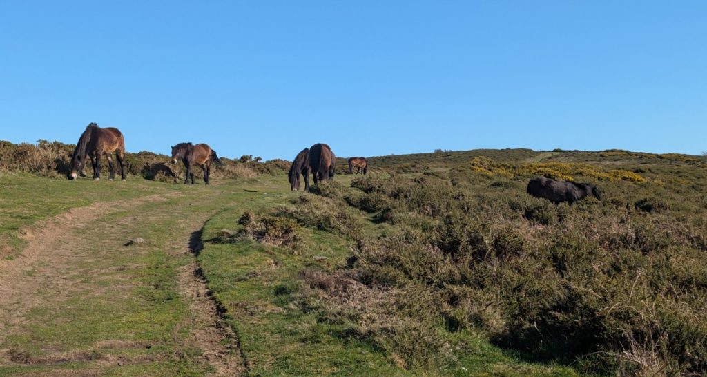
The climb back up Hurlestone Combe was the real “sting in the tail.” It is a very steep, relentless ascent. I found it challenging and had to set a slow, steady pace, but the reward at the top was a group of Exmoor Ponies grazing peacefully on the ridge of Bossington Hill.

The Return: Selworthy Beacon
The final stretch took us across the high moorland, passing just below Selworthy Beacon (308m). From here, it was an easy walk back to the car, with the Bristol Channel shimmering to our left.
Walk Summary: North Hill – Hurleston Point Round Trip
- Distance: 12.4 km (7.7 miles)
- Elevation Gained: 538 m (1765 ft)
- Difficulty: Challenging – undulating then steep descent at Hurleston Point followed by a challenging climb back up Hurleston Combe
- Moving Time: 3h 50m · Elapsed Time: 5h 12m
- Highlights:
- Grexy Combe & The Brockholes – hidden Iron-Age hill fort and historic stone quarrying sites
- Henner’s and Eastern Combe – quiet Exmoor habitat for red deer, warblers, and a dog-friendly stream
- Hurlstone Point & Coastguard Lookout – ruined tower, Porlock views, and a steep, technical descent