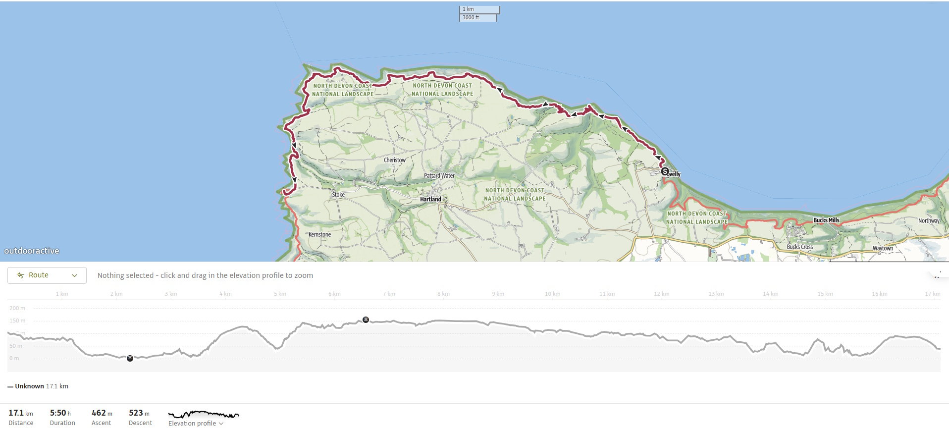
The hike from Clovelly to Hartland Quay on the South West Coast Path is widely regarded as one of the most challenging and dramatic sections of the entire 630-mile route. Stretching roughly 17 km (10½ miles), this stage traverses rugged coastal terrain, deep combes, and towering cliffs, offering relentless ascents and descents but rewarding walkers with breathtaking seascapes, ancient woodlands, and striking geological features.
For our first walk of the new year, we picked up the trail at Clovelly. I’d stayed overnight in Woolacombe and left the car at Hartland Quay, taking a taxi from Rod of BPS back to the start — the only practical option in this remote stretch where buses are few and far between.
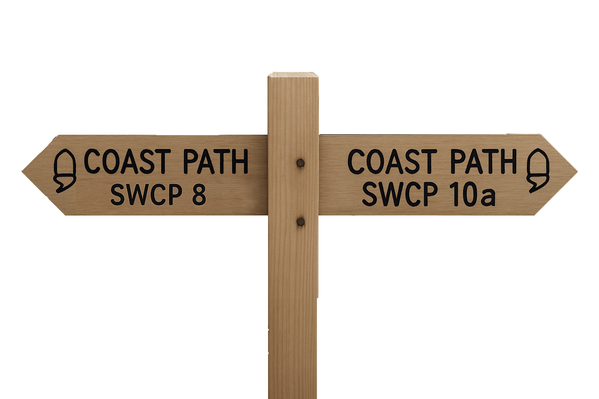
SWCP 9: The Walk
Challenging – Moderate to strenuous
1 April 2025
From Clovelly into Woodland
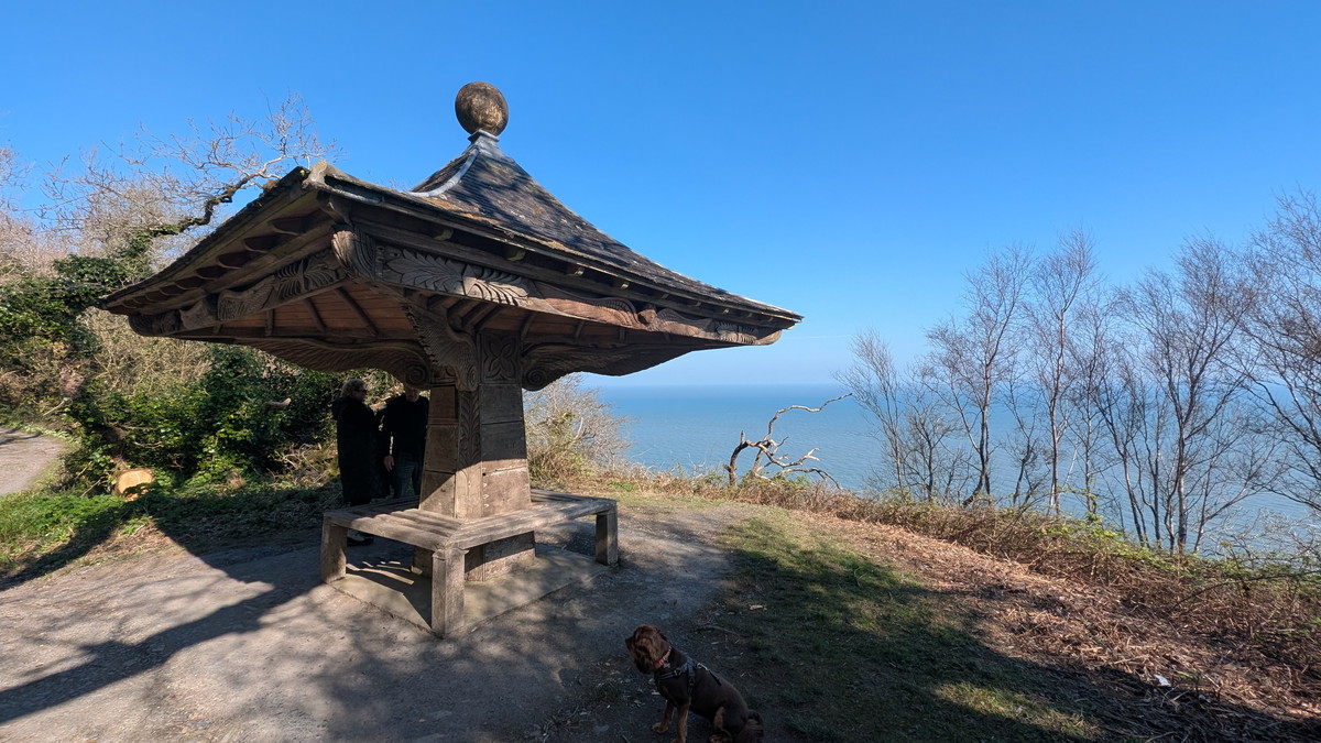
We began our walk at the top of Clovelly, where Hobby Drive ends and the steep cobbled street descends into the village. A short stretch along the road brought us to an area of parkland on the edge of the Clovelly Estate, where a rough track led us deeper into the woodland. We reached The Angel Wings—a decorative shelter built in 1826—nestled among woodland trees.
Continuing on, the path gradually opened out onto Gallantry Bower, a prominent hilltop offering our first expansive views of the coastline ahead.
Mouth Mill & Brownsham Cliff
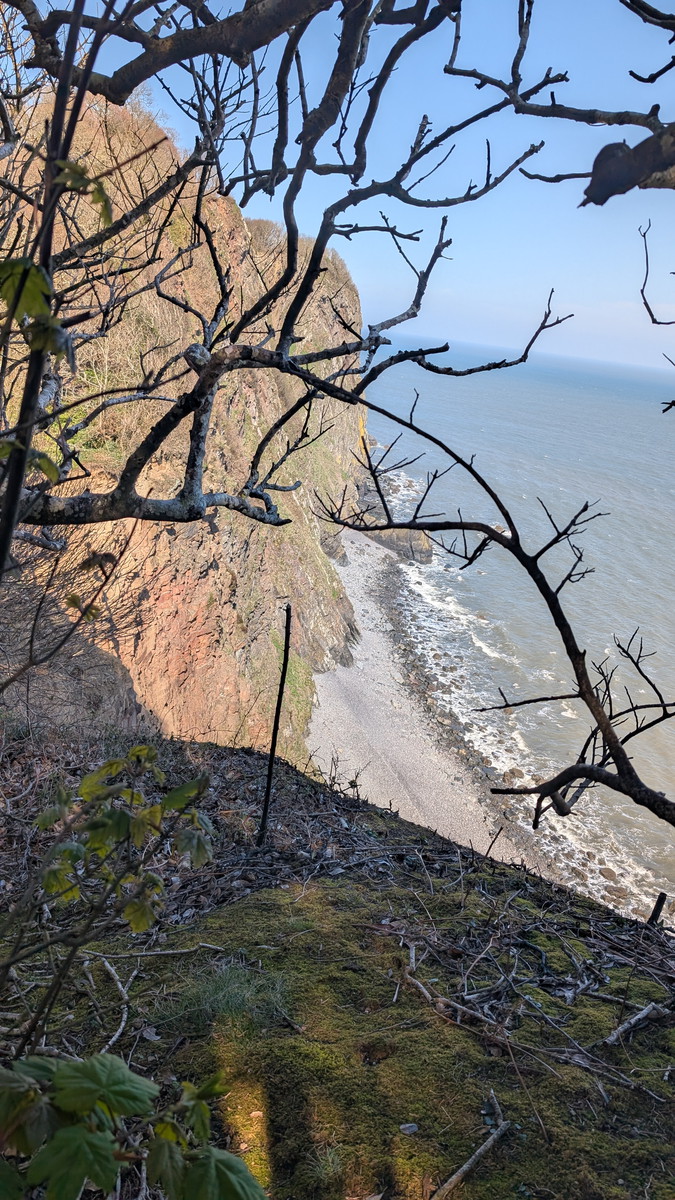
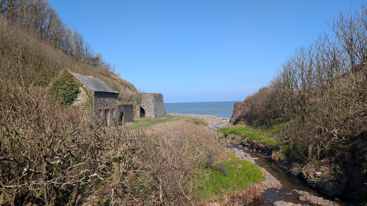
From there, we descended through a long stretch of woodland towards Mouth Mill, catching glimpses of the striking cliffs beyond. Another walker shared that the twisted cliff layers are textbook examples of tectonic folding, their twisted layers a vivid reminder of the region’s geological drama.
Climbing out of the valley, we tackled a steep ascent up to Brownsham Cliff, passing through open pasture and emerging onto exposed coastal heathland. The terrain ahead grew increasingly challenging as we followed undulating cliffs, repeatedly descending into steep, wooded combes and clambering back out the other side. This section tested our stamina, but the views made every effort worthwhile.
Blackchurch Rock & Shipload Bay
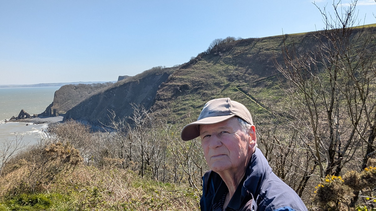
As we continued westward, we were finally able to look back and catch a glimpse of Blackchurch Rock, which we had passed close to earlier but had remained hidden from view at the time.
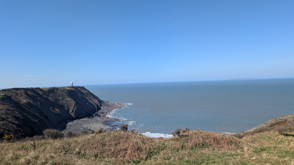
We skirted the edge of Shipload Bay, a spectacular cove shaped by ancient landslides and ongoing erosion. It’s the only sandy beach between Westward Ho! and Welcombe Mouth, though now virtually inaccessible. Once a notorious smugglers’ haven, donkeys were used to carry contraband up the treacherous cliff paths—paths that, along with the National Trust’s wooden steps, have long since been lost to the sea. Today, only a sliver of beach remains, far below the sheer cliffs. Towering above the bay, the Radar Station stands sentinel, a stark contrast to the wild natural surroundings.
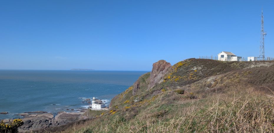
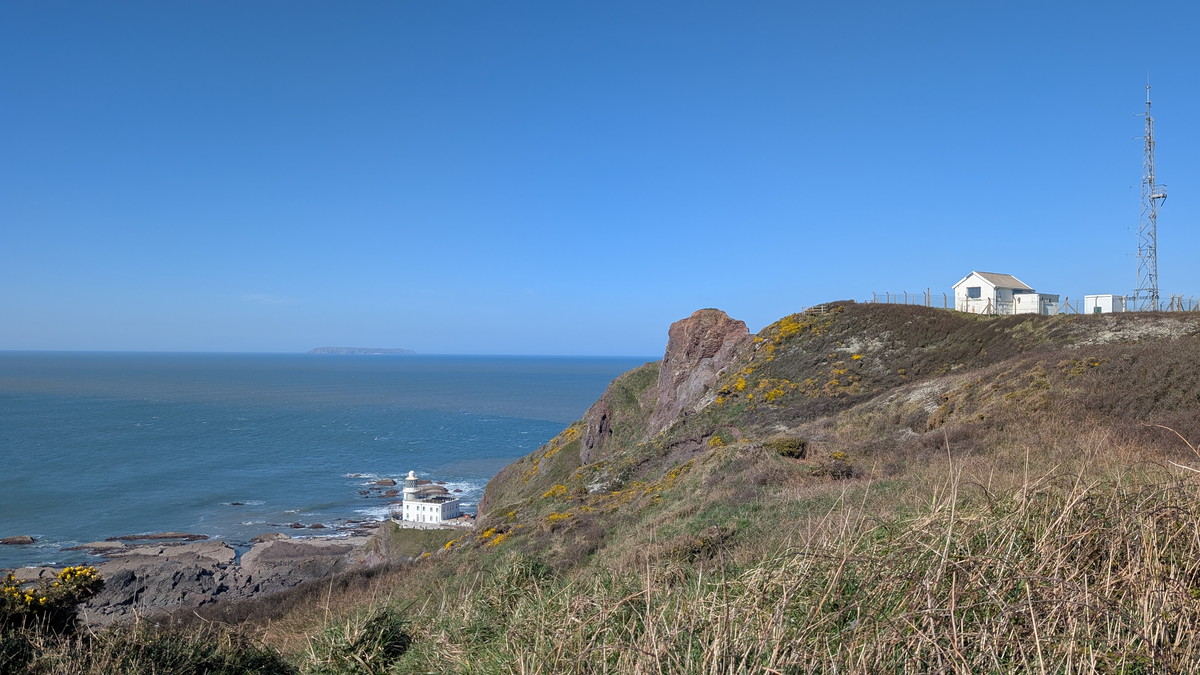
Hartland Point & Beyond
Past the bay, we soon reached Hartland Point, where a short flight of steps led us to a path cutting across the headland. Built in 1874, Hartland Point Lighthouse, though now decommissioned, still clings to the cliff edge. It remains an iconic landmark where the Bristol Channel meets the Atlantic Ocean.
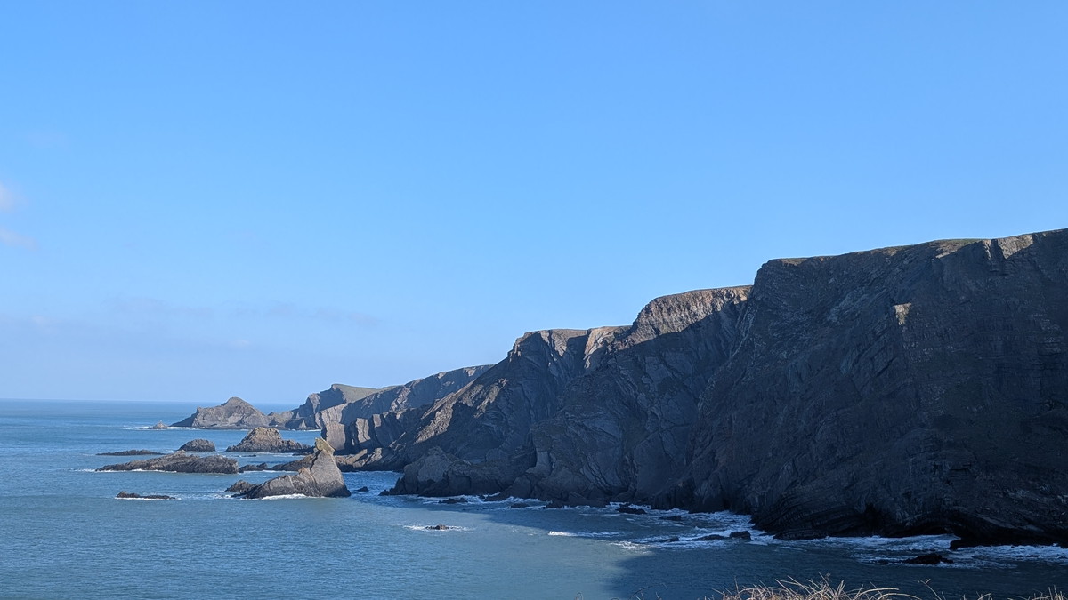
Rounding the headland, the path turned southwest towards Hartland Quay, bringing us into the wildest stretch of coastline yet. Towering sea cliffs and plunging valleys lay ahead, each descent and ascent more rugged than the last. A particularly steep drop into Uppacott Valley, followed by a demanding climb out, pushed us further, but the unfolding scenery was unforgettable.
Hartland Quay Finish
The geology became increasingly spectacular as we approached Hartland Quay. Here, the Hartland Quay Formation reveals itself in jagged ridges and blade-like fins of Carboniferous sandstone and shale, twisted and tilted by ancient tectonic forces, then carved by the sea into dramatic shapes.
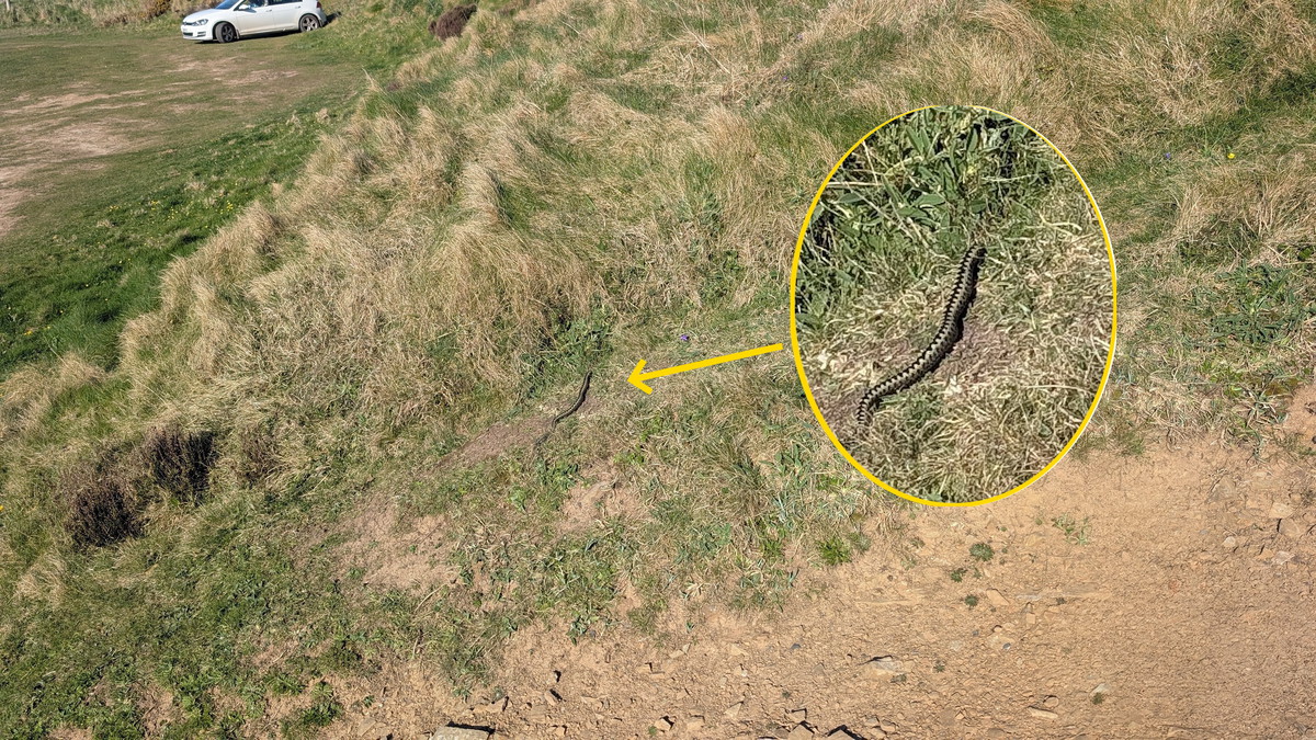
The final descent to Hartland Quay was steep but a welcome sight after the ups and downs of the day. As we took a short diversion towards the car park, we were surprised to find an adder basking in the sun on the rocky track. Fortunately, it noticed us before Roxie noticed it and quickly slipped away into the grass. With the excitement over, we continued on to the car and then drove down to the Hartland Quay Hotel.
Once a thriving port, Hartland Quay was largely destroyed by a storm in the 19th century. The former customs house still stands and has been converted into a museum and hotel. The coastline here is renowned for its towering folded cliffs and the unrelenting crash of Atlantic surf against rock faces that soar over 75 metres (250 feet) high.
We had a quick drink at the Hotel (it would have been rude not to!!) before driving to the village of Welcombe where we would be staying for a couple of nights.
Walk Summary: Clovelly to Hartland Quay
- Distance: 18.2 km (101.3 miles)
- Elevation gained: 611 m (2,003 ft)
- Difficulty: Challenging – steep combes, relentless climbs, remote terrain
- Moving Time: 5:34 hrs | Elapsed Time: 6:33 hrs
- Highlights:
- Clovelly & Hobby Drive – wooded track past the 1826 Angel Wings shelter
- Gallantry Bower – hilltop with first sweeping coastal views
- Mouth Mill – secluded cove with buildings and dramatic folded cliffs
- Brownsham Cliff – steep climb to open heathland
- Blackchurch Rock – iconic sea arch framed by contorted strata
- Shipload Bay – smugglers’ cove with radar station above
- Hartland Point & Lighthouse – landmark where Channel meets Atlantic
- Uppacott Valley – steepest descent and climb of the day
- Hartland Quay Formation – jagged folded cliffs of sandstone and shale
- Hartland Quay – historic port turned hotel and museum above the surf