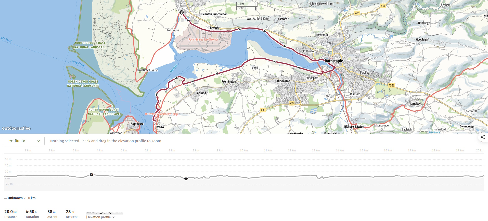
The section of the South West Coast Path from Braunton to Instow is a gentle, low-level walk, quite different in character from the dramatic clifftop paths that define many other stretches of the trail. It covers about 21 km (13 miles) and forms part of the Tarka Trail, a multi-use route (walkers, cyclists, and wheelchair users) that follows the line of an old railway along the estuary of the River Taw and then the Torridge. This walk is rich in natural beauty, estuarine wildlife, and local history, even if it lacks the rugged ascents and cliff-top drama found further west or north.
Instead of rugged ascents, this stage offers salt marshes, sweeping estuary views, maritime relics, and abundant birdlife. It’s a stage rich in natural beauty and history, making for a peaceful and rewarding day’s walking.
We stayed at the Wayfarer’s Arms in Instow for this stage and the next. Instow itself is one of the most dog-friendly villages imaginable — even the beach feels incomplete without them!
As this area is more developed than previous sections, public transport is available. However, we chose to continue using taxis, as the bus routes loop around the estuaries, making journeys longer, and I wasn’t sure how well Roxie would manage the extra travel time. (Spoiler alert- she loves bus journeys and we would have been fine and I would now be a lot richer!)
We used Jason of ‘WhereTo’ taxis for both trips.
SWCP 6: The Walk
Easy
28 August 2024
From Braunton to the Taw Estuary
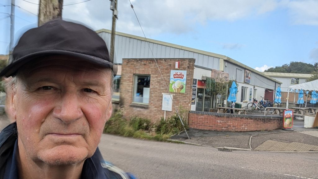
Jason dropped us off at the Quay Cafe, where we’d arrived on the previous section.
From the Quay Cafe, we followed the clearly marked Tarka Trail, a flat, multi-use path along the route of the old London & South Western Railway. We walked past the Royal Marine Barracks at Chivenor before the view opened into the salt marshes of the River Taw estuary by the Waterside Coffee House and Bar.
Into Barnstaple
We walked along beside the estuary for around 8 km (5 miles). The Path is flat and easy-going, with wide estuary views opening out as we approach Barnstaple.
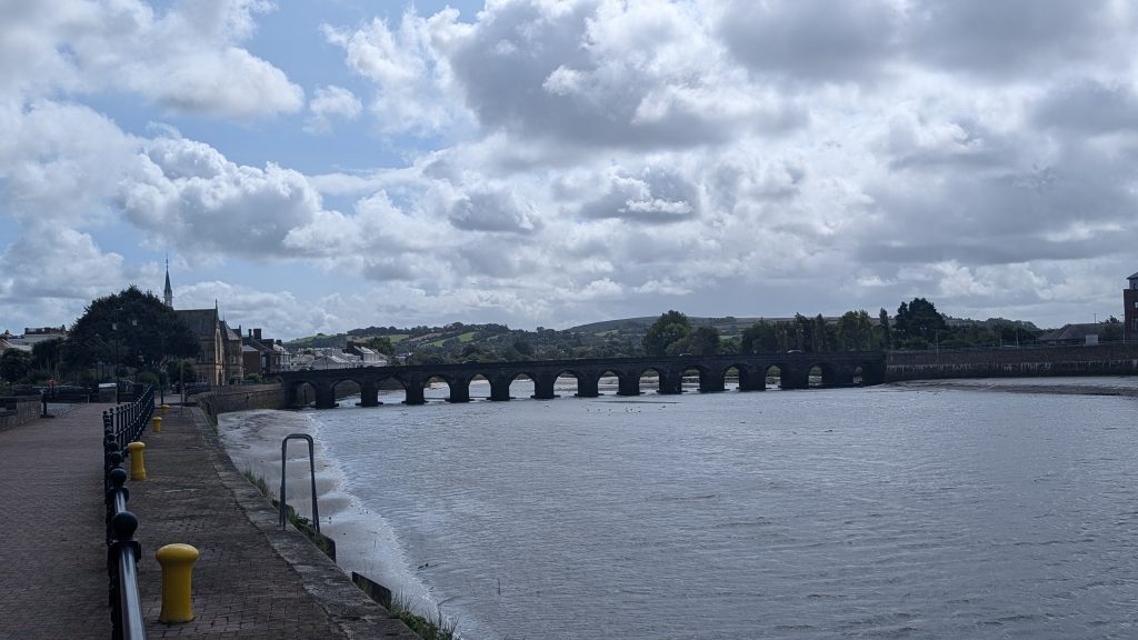
Eventually, the path leads under the modern Taw Bridge (A361), which dominates the skyline — a sleek concrete structure built in 2007 to relieve traffic from the town. We then left the Tarka Trail briefly to cross the River Taw via the 13th-century Barnstaple Long Bridge, a magnificent medieval structure built of stone and later widened for traffic. Originally with 16 pointed arches, it’s one of the oldest and longest medieval bridges still in daily use. We had fantastic views up and down the estuary as we crossed.
Barnstaple is the largest town on the North Devon coast, with shops, cafes, and the Museum of Barnstaple and North Devon just off the route. It is the oldest borough in England (chartered in 930 AD) and is worth a pause. Historically, it was a major port until silting limited access.
After the bridge, there are 2 alternative routes. One passes by a new riverside development while the original loops inland around a commercial area before rejoining the Tarka Trail and returning to the river bank.
South Bank of the Taw
We continued southwest along the southern bank of the River Taw, following a flat, easy-going stretch that moves slightly away from the water’s edge, skirting around salt marshes and wetland habitats. The trail meanders through a tranquil estuary landscape, crossing old railway bridges and raised embankments. Along the way, we passed numerous reminders of the former North Devon Railway, including disused signal posts and other structures—a glimpse into the area’s transport past.
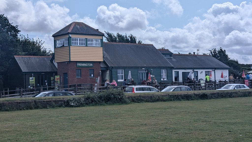
Shortly before reaching Fremington Quay, the trail leads to a worthwhile stop at the restored railway station, now home to a popular café and a small heritage centre. In the 19th century, this quay was once the busiest port between Bristol and Land’s End, playing a major role in the export of ball clay, a fine material used in porcelain production.
Towards Instow
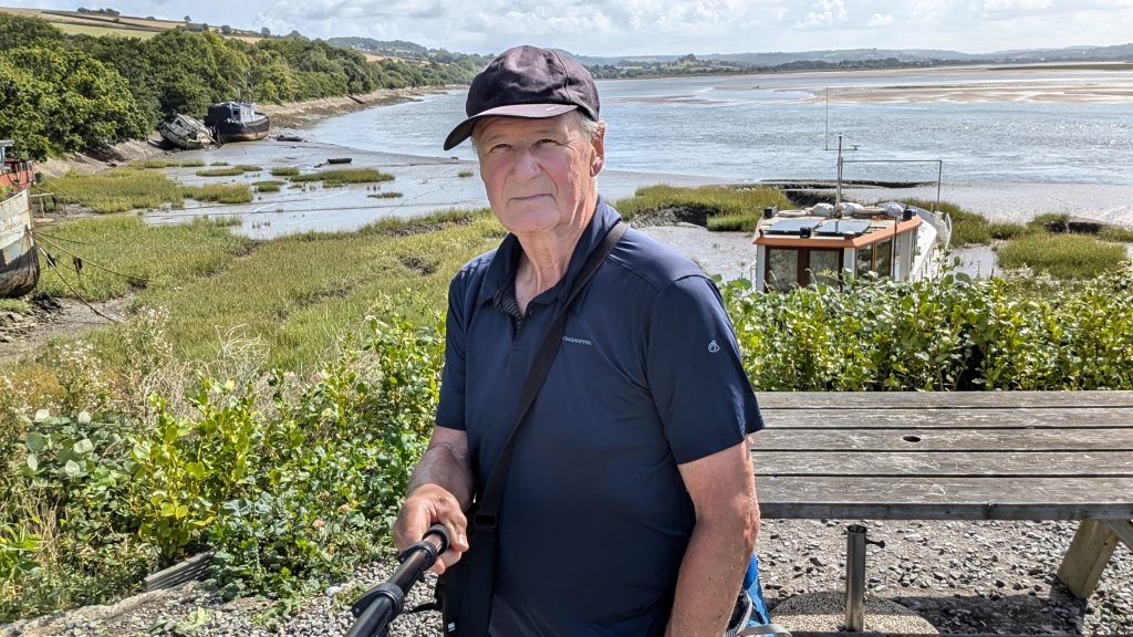
We followed the Tarka Trail until we neared Instow, where the South West Coast Path leaves the tarmac and loops gently around a low headland before joining the beach. As we walked, I found myself picking blackberries from the hedgerows lining the path—somehow they seemed to carry a hint of the sea, a salty-sweet flavour.
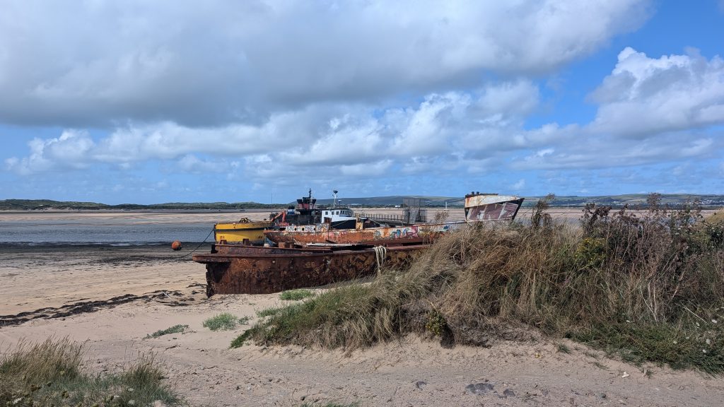
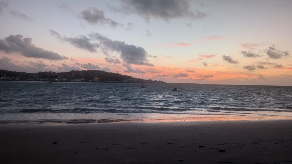
Our path then skirted the back of Instow Sands, a broad, open beach with sweeping views across to Appledore, the Torridge estuary, and the point where the Taw and Torridge rivers meet. We passed several maritime relics—an old quay, abandoned boats, and weathered timbers poking through the sand. With the tide out, we were able to finish the final stretch walking comfortably on firm sand, right along the shoreline. After being on the lead all day, Roxie was finally able to run free and stretch her legs.
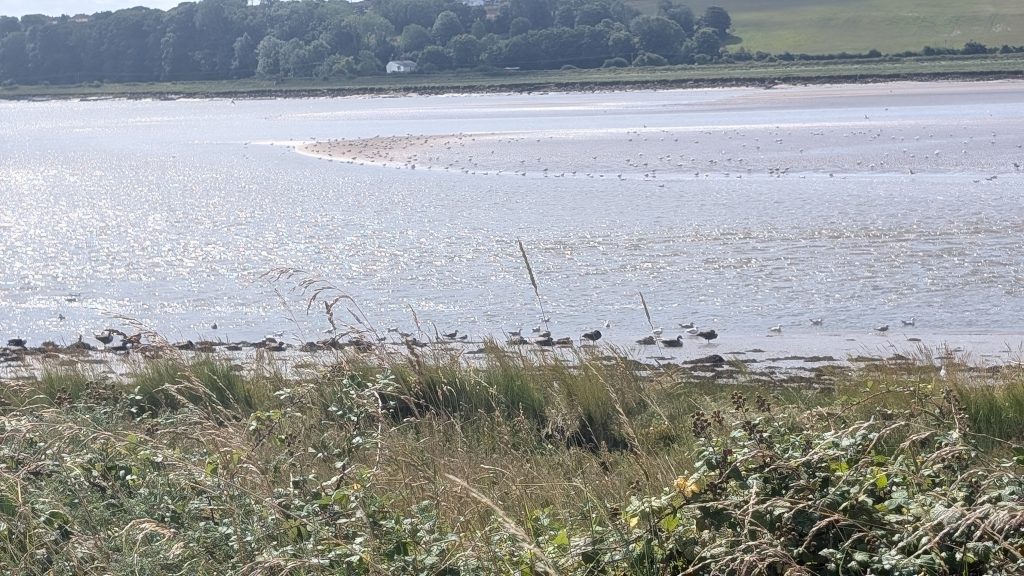
Wildlife Note: This stretch is part of the North Devon UNESCO Biosphere Reserve. Look out for sea holly, samphire, and wintering flocks of wigeon and brent geese.
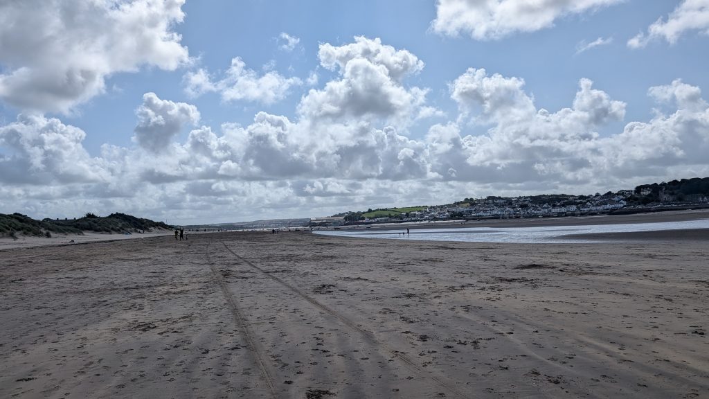
Instow Sands & Village
Instow is a peaceful estuary village with a sandy beach, backed by dunes, popular with dog walkers and families. It has a history as a minor naval port and is home to a Royal Marines training base (the Armed Forces are occasionally visible during drills). There’s also a preserved signal box at Instow, the last manually operated level crossing on this branch before closure in 1982.
Across the water lies Appledore, which you can reach via a seasonal ferry.
The beach and surrounding estuary are part of the North Devon UNESCO Biosphere Reserve, reflecting the ecological richness of the area.
Walk Summary: Braunton to Instow
- Distance: 20.8 km (12.9 miles)
- Elevation gained: 16 m (64 ft)
- Difficulty: Easy – flat walking on former railway, family and dog-friendly
- Moving Time: 3:41 hrs | Elapsed Time: 4:52 hrs
- Highlights:
- The Quay Café, Braunton – natural starting point from the previous stage
- Chivenor Barracks – Royal Marine base with wide estuary views beyond
- Taw Estuary Saltmarshes – birdlife-rich flats and creeks
- Barnstaple Long Bridge – 13th-century stone bridge with superb views
- Barnstaple Town – historic borough with shops, cafés, and a museum
- Fremington Quay – once a clay-exporting hub, now a heritage café stop
- Tarka Trail & Old Railway – embankments, bridges, and railway relics
- Maritime Relics – abandoned boats and quays along the shoreline
- Instow Sands – wide, flat dog-friendly beach with views to Appledore
- Instow Village – quiet estuary village with pubs, dunes, and naval history