The walk from Woolacombe to Braunton marks a striking shift in landscape — from wild, rocky cliffs to open, sweeping sand dunes, salt marshes, and estuary-side walking. While it lacks the cliff-top drama of the Exmoor sections, it offers its own beauty in the form of wide horizons, historic wartime landmarks, and one of the most dynamic coastal dune systems in the UK.
We did this walk during a family holiday in Woolacombe. As there were two of us, logistics for this walk were relatively easy. As many SWCP walkers do, we parked one car at the end and drove back to the start in another.
SWCP 5: THE WALK
Moderate to easy
11 July 2024
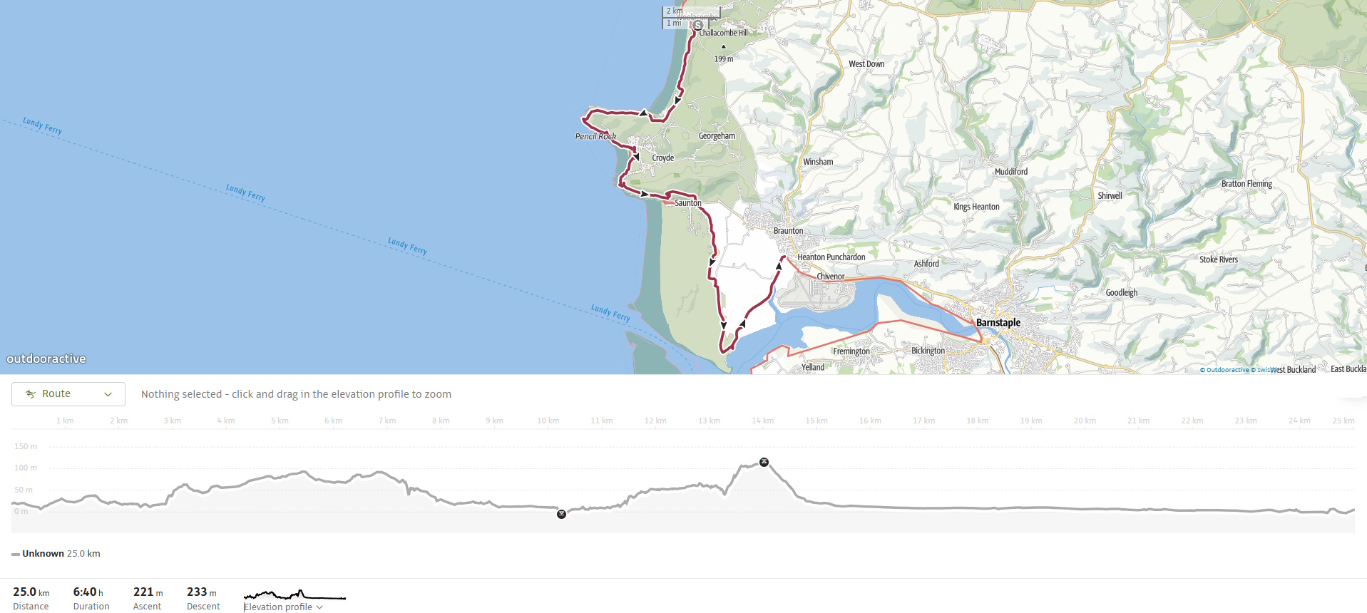
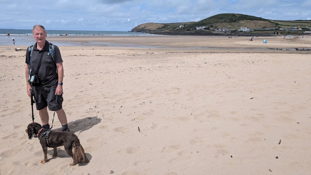
Woolacombe to Putsborough
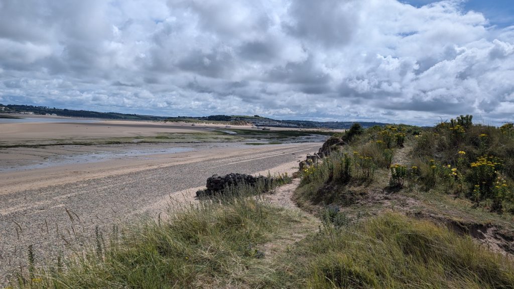
Leaving Woolacombe, we took the road behind the beach and headed up the hill. Instead of continuing all the way to the Marine Drive car park, we cut onto a path that wound through the dunes. We walked this path for some time before ascending a set of steps, which brought us onto Marine Drive for the final approach to Putsborough.
After a couple of kilometres (about a mile and a half), we reached Putsborough Sands, a quieter section at the southern end of the bay. This area is popular with surfers and wild swimmers, but is far less commercial than Woolacombe.
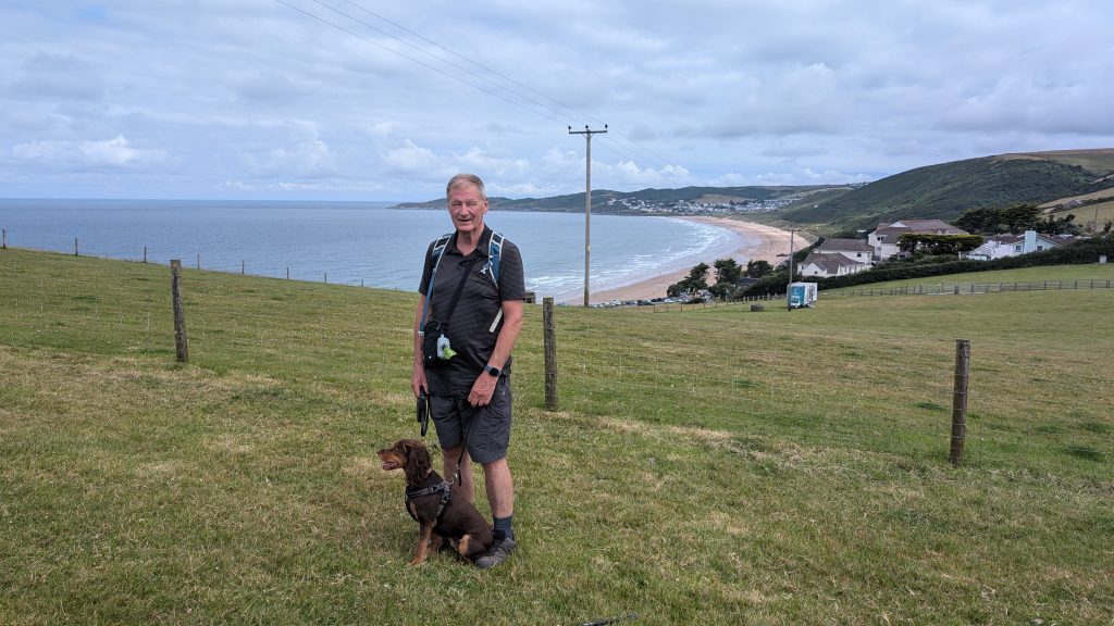
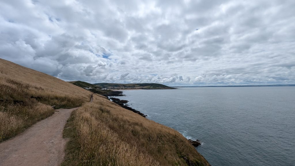
Baggy Point
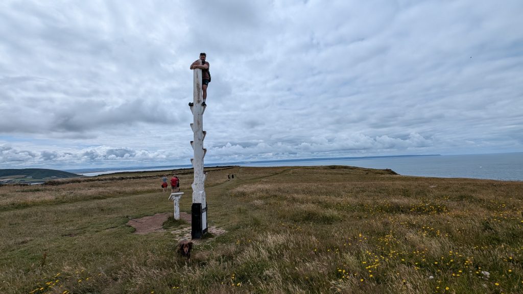
From Putsborough, we began the Baggy Point loop — one of the few areas of elevation on this leg. We ascended gently along the coastal trail that follows the cliff top edge around Baggy Point itself towards Croyde.
Baggy Point is one of the most geologically and visually striking headlands in North Devon. It is managed by the National Trust, and is a designated SSSI. Its wave-cut platforms reveal amazing examples of folded and faulted rock strata, particularly visible at low tide. These rocks are Devonian sandstone, heavily deformed by tectonic pressure. The cliff tops are rich in thrift, sea campion, and gorse, and peregrine falcons nest on the cliffs.
While on Baggy Point, we enjoyed views across the water to Lundy Island, as well as down to Bideford Bay. In the distance, the coastline stretched toward Hartland Point, indicating the path of our upcoming journey.
Croyde Bay
After rounding the point, we descended toward Croyde Bay, with the path easing downhill across pastureland and sand-strewn paths past the National Trust car park for Baggy Point and into the more commercialised area of Croyde Bay.
The village of Croyde sits back from the beach. It is a charming surf village, full of character, with thatched cottages, pubs, and cafés. The beach itself is a crescent of golden sand backed by dunes and famed for its consistent surf.
Croyde is very familiar to me. As a teacher, I organised several summer camps in Croyde for children at my school.
The official Coast Path crosses the beach at the base of the dunes. As Croyde is not dog-friendly in summer, we instead kept behind the first dunes, rejoining the beach at the quieter southern end.
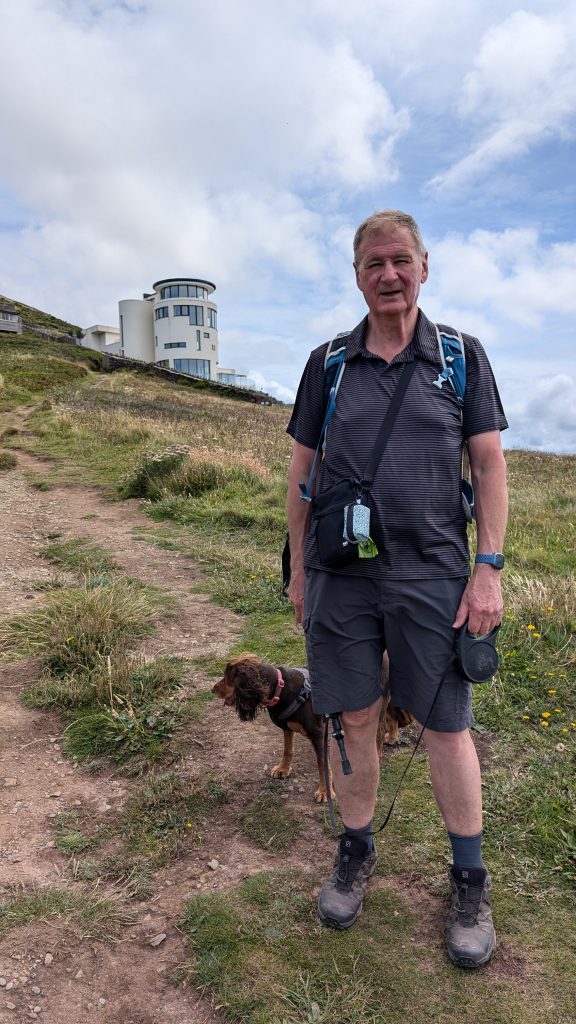
We climbed up off the beach, followed the path around to a striking ‘lighthouse‑like’ building featured on Grand Designs —Simon’s House — then crossed the busy road.
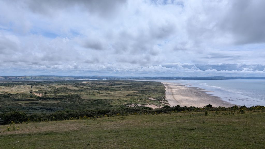
Saunton Sands & Braunton Burrows
The path skirted the road briefly before opening to the vast sweep of Saunton Sands — three miles of unbroken beach backed by dunes. The Art Deco Saunton Sands Hotel overlooks the bay.
From here, there are two options for the route. You can either follow the busy road or take a more scenic, but steeper, path up and over the hillside. We chose the second option and, after a strenuous climb up some steps were rewarded with superb views across the bay and into Braunton Burrows. Eventually, the trail dropped to the road again and rejoined the official Coast Path as it entered the dunes.
From here, we followed the official Coast Path, which stays slightly inland, following sandy tracks behind the dunes rather than walking along the beach itself, although you can walk along the beach itself if you choose.
Military history: Parts of the Burrows are still used by the MOD for training exercises, especially around Sandy Lane. You may pass remnants of WWII landing craft obstacles and tank traps among the dunes.
The American Road & Crow Point
At this point, we were only around 2 miles from Braunton, the endpoint of the walk but there was still another 6 miles to go! We headed South into the Burrows. At first, we followed a sandy track past a golf course. Eventually, we rejoined the American Road at the Sandy Lane Carpark. The American Road is a long military causeway built by U.S. forces during the war and was used for transporting troops for rehearsals for the D Day landings.
It was a scorching day, and the walk along the hot, dusty road seemed never-ending. Eventually, we arrived at an information board near Crow Point, marking the beginning of the path back toward Braunton. Eager to finish our trek on what had become a long, hot day, we didn’t explore further, but we noticed paths radiating out from the board through the low dunes leading to Saunton Sands beach and Crow Point itself.
Braunton Marshes & Velator Quay
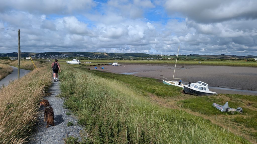
We walked through a car park and paused to look over the elevated bank at the Taw Estuary beyond, where, with the tide out, the beach and mud flats extended far into the distance. From the car park, our path continued along the toll road providing access to the area. We walked along the top of the raised mound, likely part of the flood prevention system, on our left lay salt marshes and creeks, while on our right were the tidal flats of the Taw Estuary, dotted with occasional channels and stranded boats.
These Braunton Marshes are among the most important reclaimed wetland areas in the UK — historically drained using a system of catchwater channels and leats during the Napoleonic era.
The estuary is a haven for wading birds, including curlew, redshank, little egret, and oystercatchers. The area also supports otters, and you may see signs of them along the water’s edge.
It was 2 miles or so before we reached the village of Braunton. We first passed Velantor Quay and then a small industrial estate. At a roundabout near the Quay Cafe, the Coast Path veered to the right, but we turned left toward the former station, which now serves as the main car park, leading us back to our car.
Braunton is the largest village in England. It has pubs, shops, and a small museum, which includes exhibits on WWII, the coast path, and the old railways. It is also the start of the Tarka Trail which follows the route of the former Barnstaple to Ilfracombe railway.
Walk Summary: Woolacombe to Braunton
- Distance: 26 km (16.3 miles)
- Elevation gained: 341 m (1,118 ft)
- Difficulty: Moderate – generally easy walking with a few climbs (Baggy Point) and some long sandy stretches
- Moving Time: 5:39 hrs | Elapsed Time: 6:46 hrs
- Highlights:
- Baggy Point – folded Devonian sandstone, wide sea views
- Woolacombe & Putsborough Sands – sweeping beaches at the start
- Croyde Bay – lively surf village with sandy beach
- Saunton Sands – three miles of sand backed by dunes
- Braunton Burrows – vast dune system, flora, and WWII remains
- The American Road – historic WWII track
- Crow Point & Taw Estuary – birdlife and tidal flats
- Braunton Marshes – reclaimed wetlands, otters and waders
- Velator Quay & Braunton – quay, village centre, and Tarka Trail link