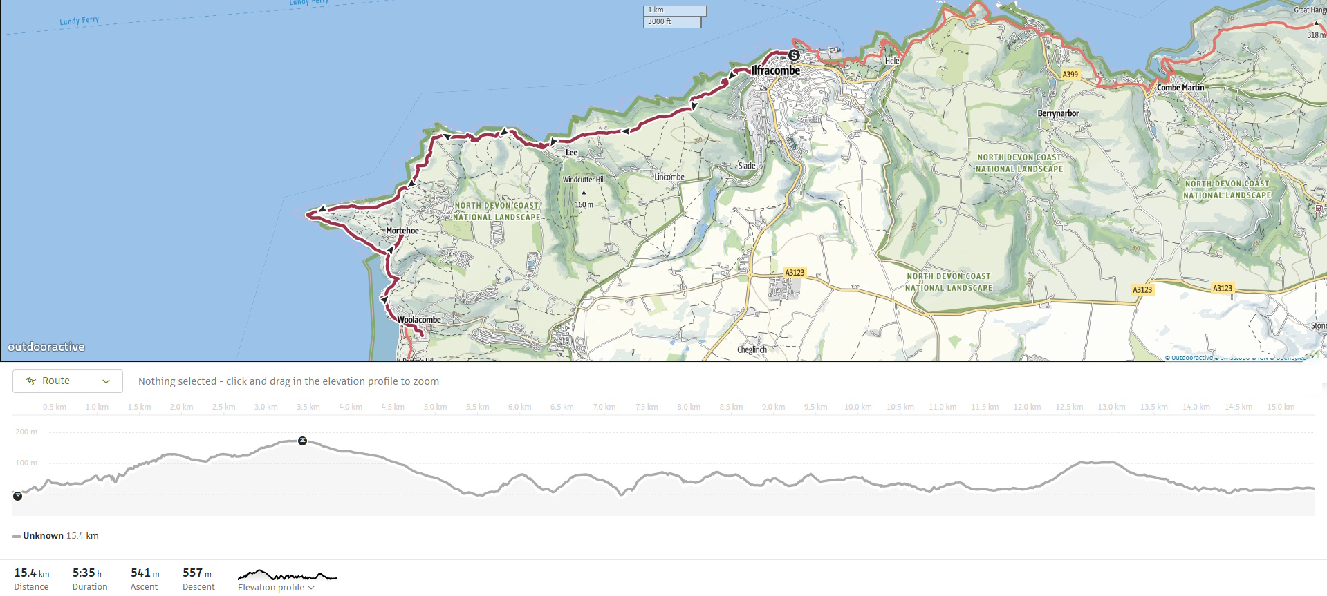
The South West Coast Path from Ilfracombe to Woolacombe is a spectacular and moderately challenging hike along the rugged North Devon coast. Stretching for around 7 miles (11 km), this section offers a diverse mix of dramatic cliff-top walking, hidden coves, sweeping sea views, and fascinating glimpses into both natural history and human industry.
Though not as mountainous as earlier Exmoor sections, the path still has multiple ascents and descents that can surprise the legs. What makes this stretch shine is its rich coastal scenery and ecological variety, with several Sites of Special Scientific Interest (SSSIs) along the way.
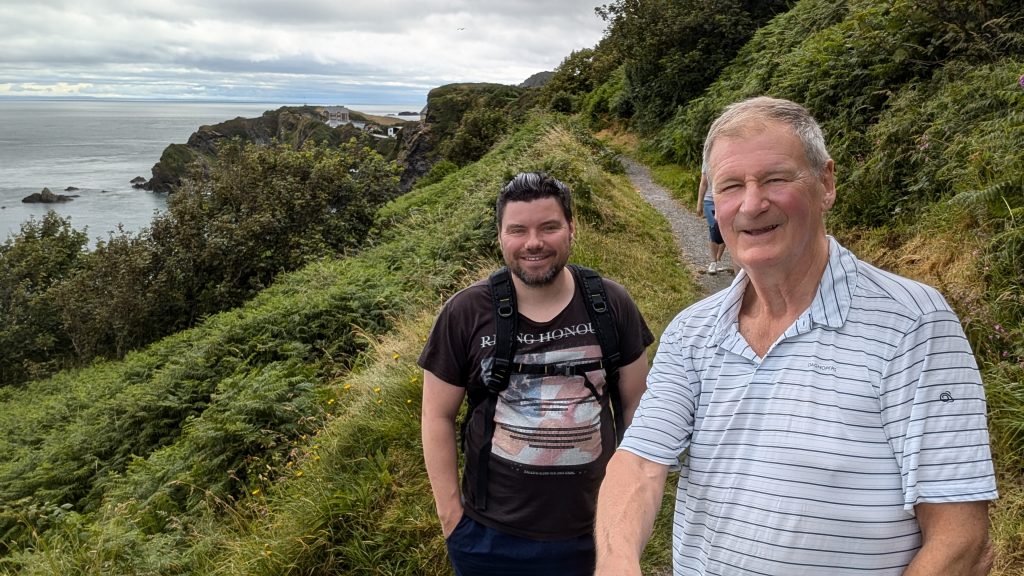
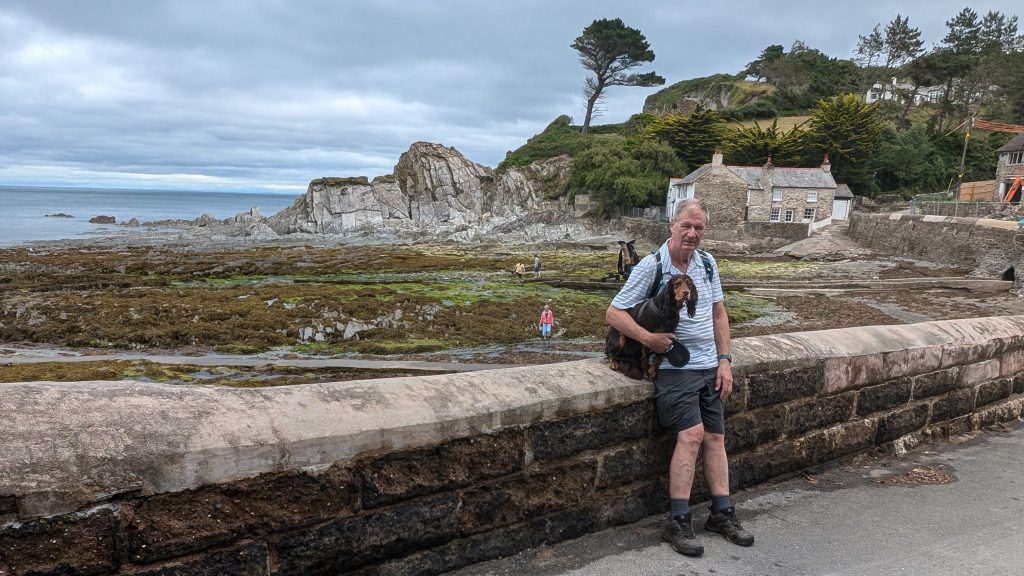
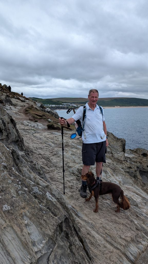
During a family holiday in Woolacombe, it made sense to do a couple of walks. This was the first which I did with Ben. While there are buses, they are operated by a private coach company, and it didn’t look like they were dog-friendly, so we got a taxi from Woolacombe to Ilfracombe.
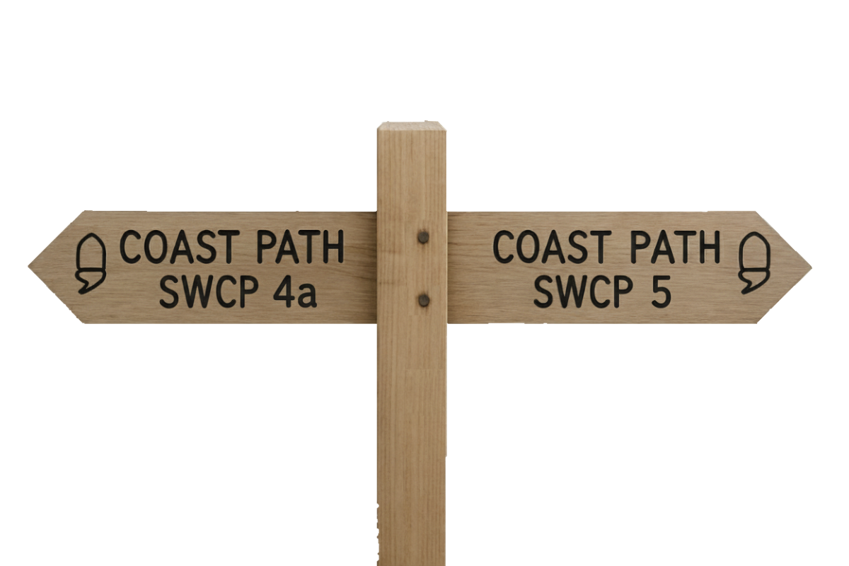
SWCP 4b: The Walk
Challenging – Moderate to strenuous
09 July 2024
Torrs Walk & the First Climb
The path leaves Ilfracombe by climbing steadily out of the town’s western end, joining the Torrs Walk — a well-engineered Victorian cliff path that was created as a scenic promenade in the 1880s. This section offers panoramic views back toward Ilfracombe and over the Bristol Channel.
There are outcroppings of slate and volcanic rocks, shaped into twisted formations by millions of years of geological stress. This stretch rises to around 140m (460 feet) above sea level, with dramatic drops to the sea on one side and wooded slopes on the other.
Into Lee Bay
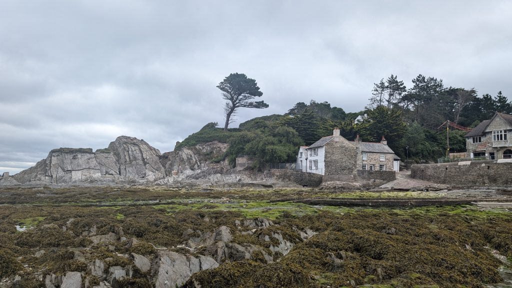
After reaching the high point of Torrs, we descended gradually into the wooded valley of Lee Bay.
Lee is a peaceful, timeless hamlet known locally as “Fuchsia Valley” for the abundance of flowering hedgerows in summer. The beach here is rocky but picturesque, backed by a mixture of cottages and greenery. It’s a good resting point or picnic spot.
Historical note: The area around Lee was once a hotbed of smuggling, thanks to its secluded location and tidal caves.
Damage Cliffs to Bull Point
From Lee, we climbed up the road for a while before heading back onto the cliffs again. We threaded through coastal scrubland and windswept pasture toward Damage Cliffs and then onward to Bull Point.
This is a wild and open section, with wide views to the west, inland toward Exmoor, and occasionally across to Lundy Island.
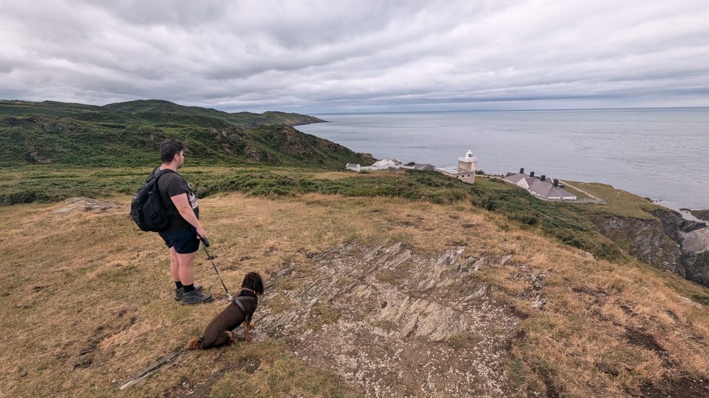
Bull Point itself is home to a working lighthouse, first built in 1879 to warn shipping away from the notoriously dangerous Morte Bay rocks. The original structure was damaged by a landslip in 1972 and rebuilt a few metres inland.
The surrounding clifftop is rich in maritime grassland and is a haven for ground-nesting birds and rare plants such as golden samphire.
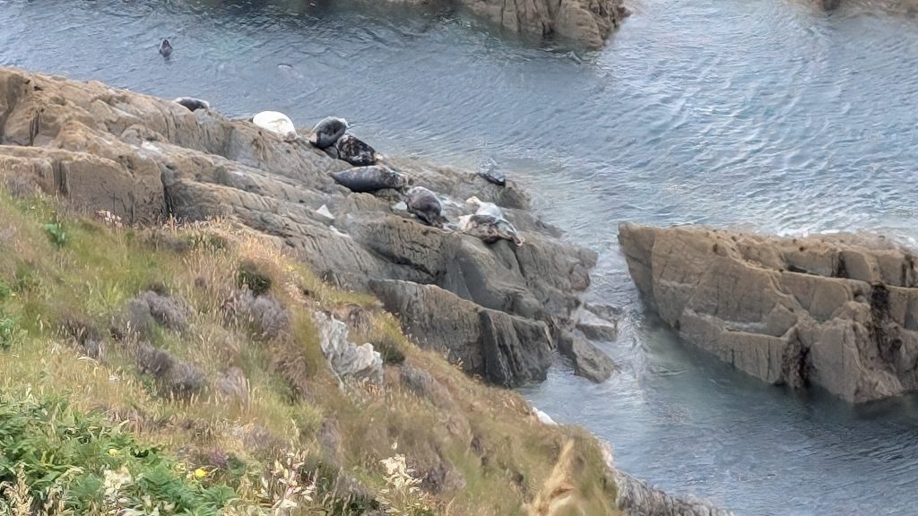
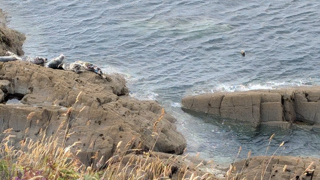
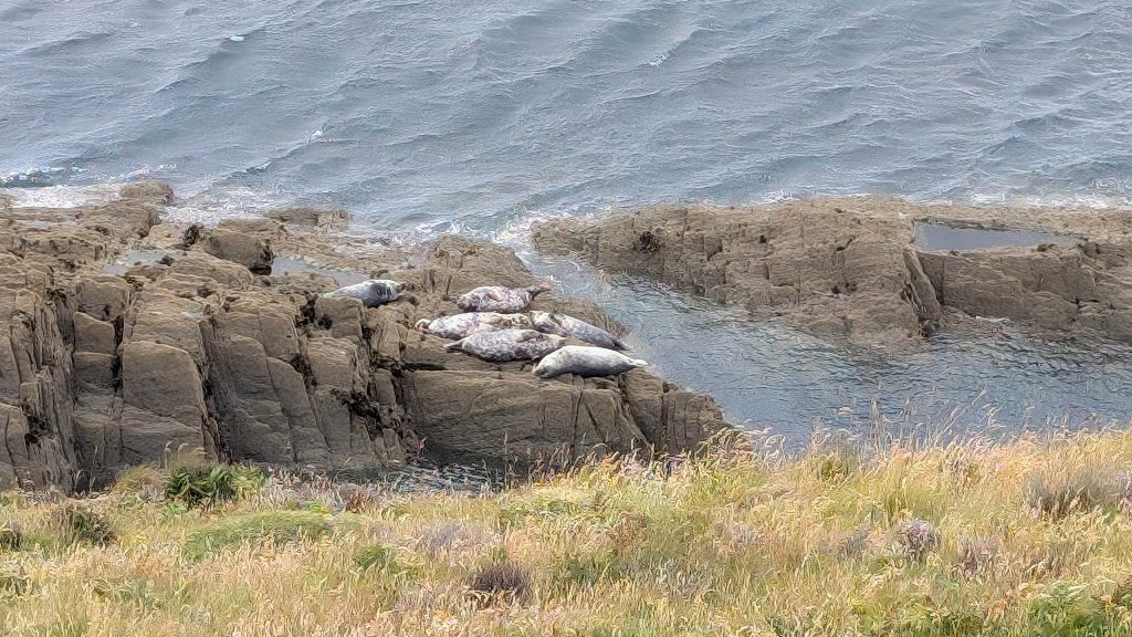
Morte Point – Seals & Shipwrecks
We continued through the Mortehoe area, climbing up to the Morte Point headland, whose name derives from the Latin “mors” (death) — a reference to the treacherous reefs just offshore that have claimed many ships. After the relative seclusion of previous sections, this section was quite busy.
This area has a distinctly windswept and exposed feel, with jagged rocks reaching out into the sea like giant petrified fingers. The rock formations here are part of the Morte Slates, ancient metamorphic rocks dating back over 400 million years.
Below, we saw seals basking on the rocks. Apparently, you may also see porpoises or even dolphins offshore.
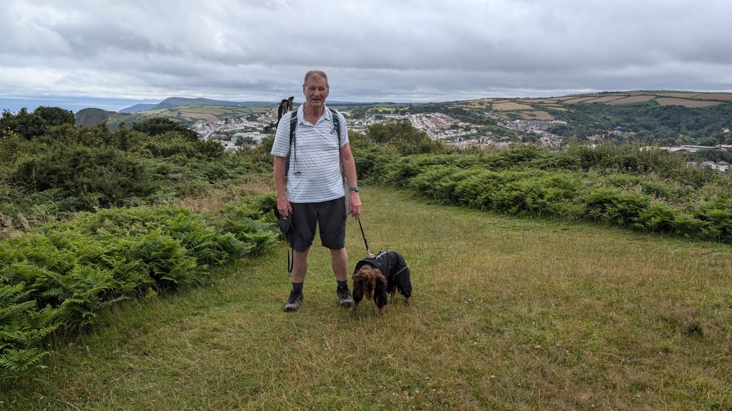
Mortehoe & Woolacombe Bay
From Morte Point, there is a rough section before the path turns gently downhill toward Woolacombe, with sweeping views over the three-mile stretch of golden sand.
We diverted up the road into Mortehoe village for welcome refreshments at the Chichester Arms before retracing our steps and rejoining the Path for the walk back into Woolacombe.
At nearly 5 km or three miles long, the golden beach stretched out ahead — one of the most impressive finishes on the North Devon coast.
Walk Summary: Ilfracombe to Woolacombe
- Distance: 14.3 km (8.9 miles)
- Elevation gained: 661 m (2168 ft)
- Difficulty: Moderate to Strenuous – steady climbs, rugged headlands, exposed sections
- Moving Time: 4:11 hrs | Elapsed Time: 6:13 hrs
- Highlights:
- Torrs Walk – Victorian cliff promenade with sweeping views
- Slate Outcrops – folded volcanic rocks rising 140 m above the sea
- Lee Bay – flower-filled hamlet and smuggling past
- Damage Cliffs – windswept ridge with wide western views
- Bull Point Lighthouse – active light, rare flora and nesting seabirds
- Morte Point – jagged reefs, seals, porpoises and dolphin sightings
- Mortehoe – hilltop village with a welcome pub stop
- Woolacombe Bay – stunning three-mile beach and classic stage finish