Lynton to Combe Martin is a physically demanding walk with multiple sharp ascents and descents, particularly where the path cuts through Exmoor’s signature deep, wooded combes (valleys), before climbing back onto dramatic cliff tops. The landscape oscillates between sheltered, ancient woodland and open, panoramic moorland.
We based ourselves once again at the Valley of the Rocks Hotel in Lynton for a two-night stay. With limited out-of-season buses, we relied on Andy’s Taxis from Combe Martin. On the morning of the walk, we drove to Combe Martin, left the car, and Andy shuttled us back to the start in Lynton. It was here, stepping out of the taxi, that I dropped my wallet — a story that came full circle later in the day!
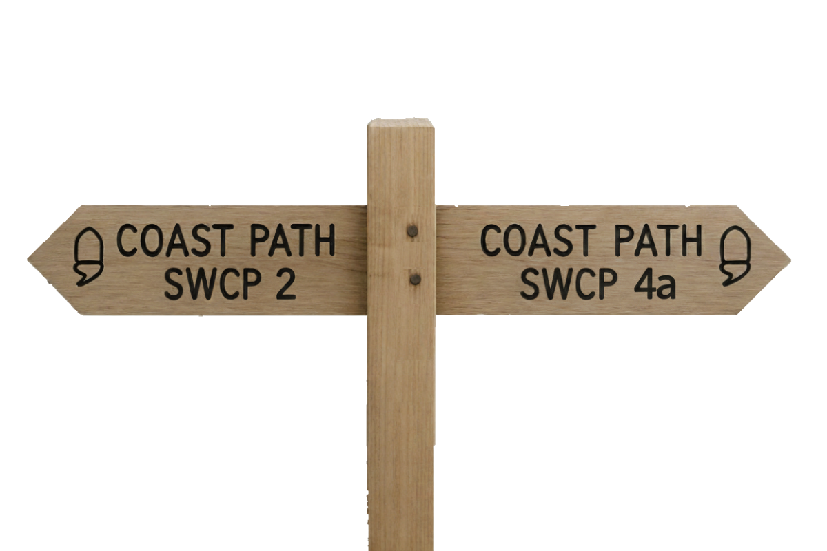
SWCP 3: The Walk
Challenging – Strenuous
20 May 2024
The Valley of Rocks
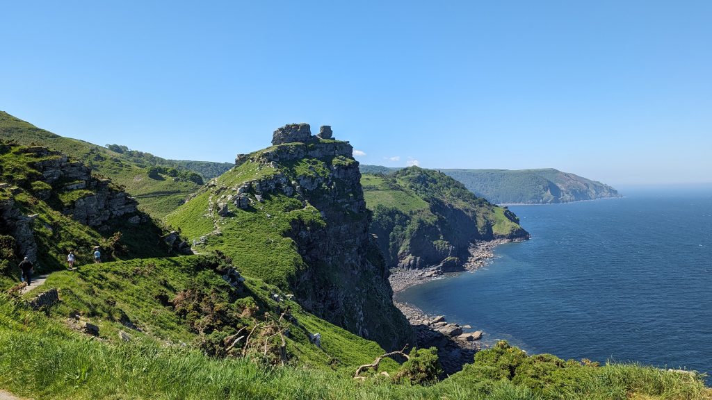
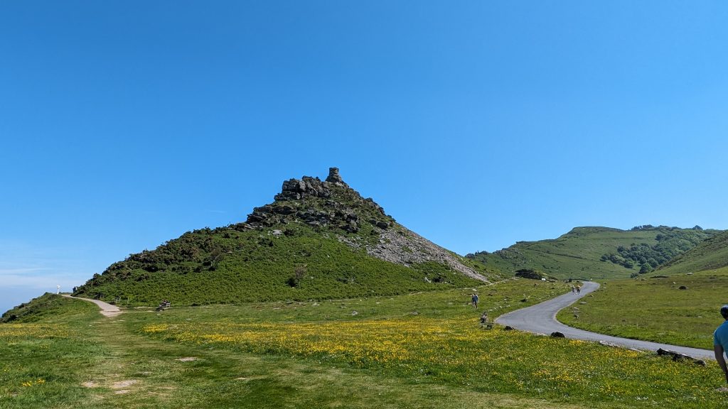
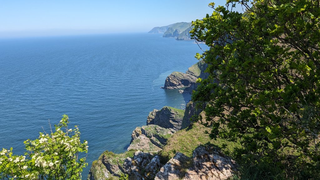
We left Lynton, on a gradual climb west out of Lynton along the cliff path into the Valley of Rocks, a dramatic dry valley carved by periglacial activity during the last Ice Age. The Valley is famous for its rugged rock formations and feral goats, which scale the cliff edges with ease. Many of the craggy outcrops have names like Mother Meldrum’s Cave and Devil’s Cheesewring.
The valley was a popular haunt of Romantic poets — notably Wordsworth and Coleridge.
Wringcliff to Woody Bay
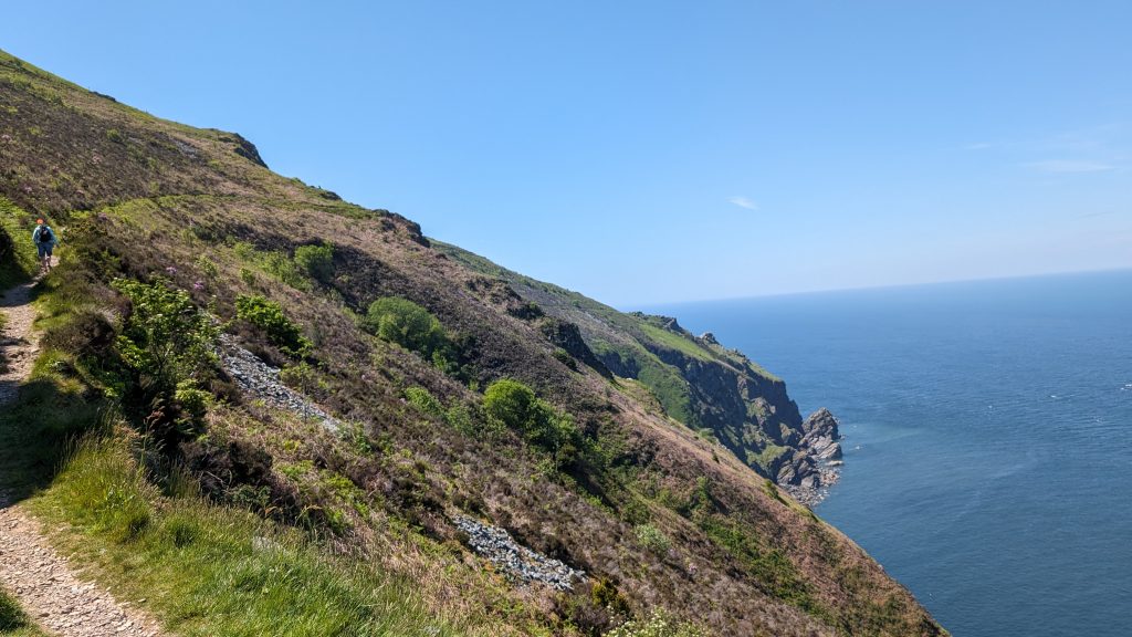
After the Valley of Rocks, we walked high above the sea, with the path contouring steeply around several headlands: Wringcliff, Lee Bay, and Duty Point. Above Wringcliff Bay, the path turns inland and passes around Lee Abbey and down a Toll Road. The terrain is undulating and narrow in places, passing above wooded slopes with occasional open glades. Eventually, we descended through dense woodland into the lovely and secluded Woody Bay, once planned as a Victorian resort that never materialised.
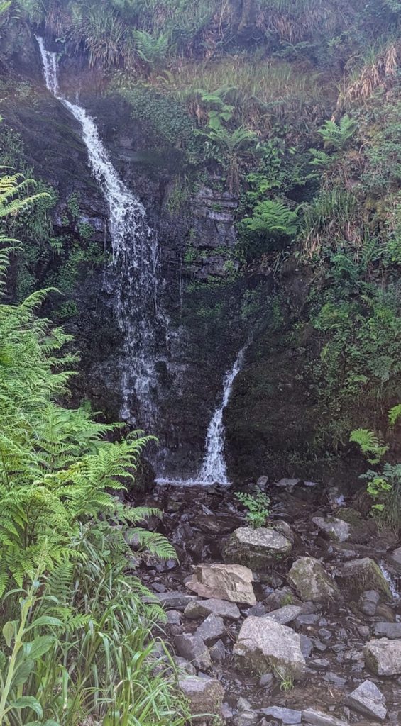
Hollow Brook & the Approach to Heddon’s Mouth
Leaving Woody Bay, the path climbs sharply again, crossing the waterfall at Hollow Brook Combe before rising through oak woods. Emerging higher, the trail contours along the hillside, with vast views back towards the Valley of Rocks and Foreland Point lighthouse.
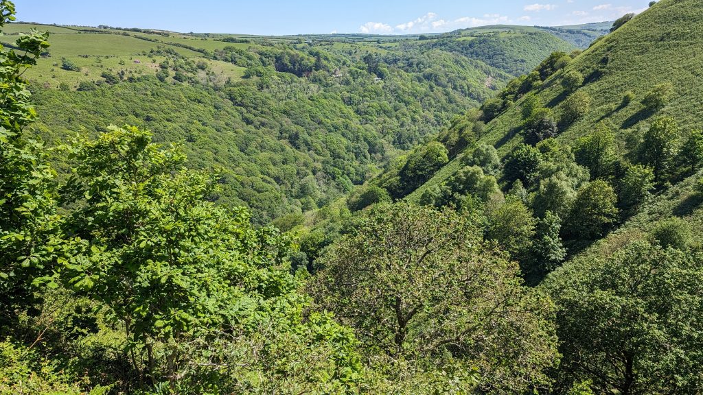
Soon, the Path turned inland and began the descent into Heddon’s Mouth Cleave, a deep gorge carved by the River Heddon.
Heddon Valley is a narrow, gorge‑like valley on the North Devon coast where the River Heddon runs from upland moor into a small, hidden cove at Heddon’s Mouth, a short walk from the South West Coast Path. The valley’s steep wooded slopes, rocky ravines and coastal scenery create a strong sense of wilderness that has attracted visitors for two centuries.
Historically the valley was popular with early walking tourists — notable visitors include the poets Samuel Taylor Coleridge and William Wordsworth — and its secluded cove and winding approaches made Heddon’s Mouth a known haunt for smugglers. The area became especially popular with Victorian sightseers and is now largely owned and managed by the National Trust; parts of the valley are the focus of local conservation work to protect habitats and species, and it lies within the boundaries of Exmoor National Park.
The path drops steeply into the valley, crosses the river, and then climbs the opposite side.
We made a detour at the bridge up to the Hunters’ Inn for a refreshment break. Although the sign suggests it’s an extra half mile, the actual distance is significantly shorter since the Path continues up the valley on the opposite bank of the river for quite a distance.
While we waited to be served, I noticed that a woman with 3 small dachshunds was busy ordering a taxi and thought nothing of it.
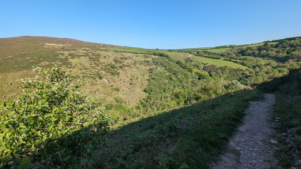
Climbing to Trentishoe Down
Back on the Path, the climb out of the Heddon Valley was tough: steep, stony, and passing over loose scree. It rose past Peter Rock before continuing up onto Trentishoe Down, where Exmoor’s wooded valleys gave way to open moorland.
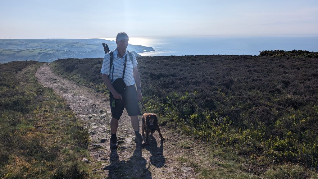
It had also turned out to be a very hot day. As we got near the top, Roxie decided she’d had enough and darted into the shade of some bushes! We had a rest, took on some water and continued, but it was hard going. It was tough: we were crossing the exposed moor with little or no shelter.
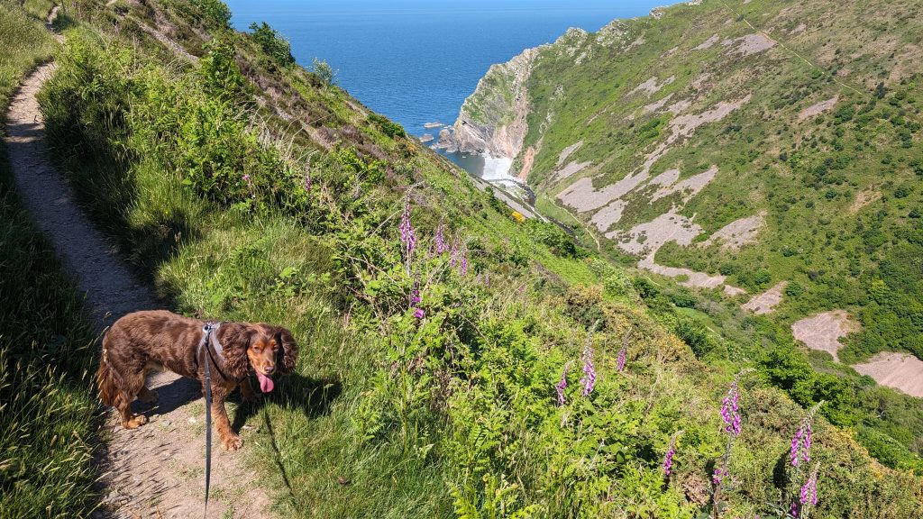
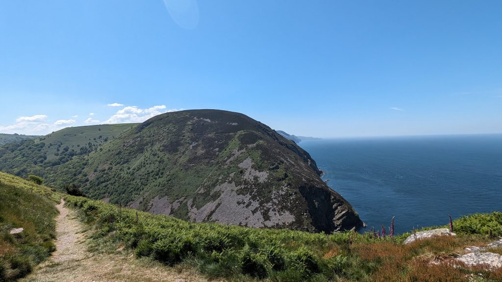
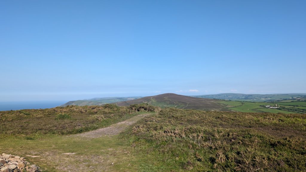
Across Holdstone Down to The Great Hangman
The climb to Holdstone Down (around 350 m / 1,150 feet) is demanding but rewarding — offering 360° views inland to Exmoor and seaward toward Wales and Lundy Island.
The moorland stretched on, lonely and vast. Apart from the odd walker near the car parks, we had much of it to ourselves — until, unexpectedly, we encountered a naked walker returning from a local nudist beach below the cliffs. Michael Portillo even mentioned it in his Coast Path programme! Luckily, he covered himself as he approached—we chatted for a moment and then continued.
We continued, still struggling with the heat and wondering if we should call it a day and return to the nearby car park and call a taxi. The Great Hangman loomed in the distance. The sense of isolation continued. Were we the only ones mad enough to be walking here today? Then, in the distance, climbing up the side of the valley towards the Great Hangman, we saw a group of hikers. This spurred us on.
We were quite high up, and I must have cursed when I spotted that there was a big drop down into a valley, into Sherrycombe, before the eventual climb back up to the Great Hangman. Roxie thought otherwise, sensing that where there is a valley, there is often a stream! And she was right. We got to the bottom, and she spent several minutes splashing up and down and eventually lying in the stream.
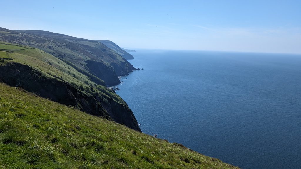
From Holdstone Down, we had descended steeply before beginning the long, steep climb up to Great Hangman. At 318 m (1,043 ft), Great Hangman is the highest sea cliff in England — it rises 250 m (820 ft) directly from the sea. It also marks the highest point on the South West Coast Path.
At the top, we met the other hikers- a group of German walkers.
The summit is marked by a cairn, and, even on a slightly misty day, the views were astonishing — north across the Bristol Channel, east toward Exmoor, and west into North Devon. The name “Hangman” may derive from a Celtic word for “slope,” but it’s also steeped in dark local folklore involving a hanged sheep thief.
Descent to Combe Martin
We descended towards The Little Hangman. It should have been an easy walk, but the muddy track was badly rutted. The area had been badly flooded and then trampled by some escaped cows who churned the mud into a chaotic mess that the sun had dried into a badly rutted obstacle course — ideal for testing both ankles and balance.
From Little Hangman, the Path drops rapidly down toward the village of Combe Martin, nestled along a deep coastal combe. The descent was steep and stony but rewarded with a final look back up at the mighty Hangman cliffs.
Combe Martin was once known for silver mining in the 13th century — the local ore helped finance Edward I’s wars in Wales. Today, it’s a friendly seaside village with a long, narrow high street and a small beach.
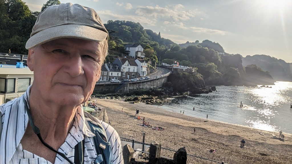
We had a drink and fish and chips in the Focsle Inn, overlooking the beach. We also bumped into the German walkers and chatted for a while. It turns out they were on a seven day walk to Westward Ho!
That’s when I realised my wallet was missing. Luckily, I’d put a tracking tag in it — and oddly enough, it was showing as being in Combe Martin. Which was bizarre, because I’d definitely taken it to Lynton! A little later, I got a call from Andy. He’d found it while giving a lift to a woman with three small dachshunds from the Hunters’ Inn. Unbelievably, my wallet had been just 20 metres away from me the whole time I was relaxing with a drink at the Hunters’ Inn!
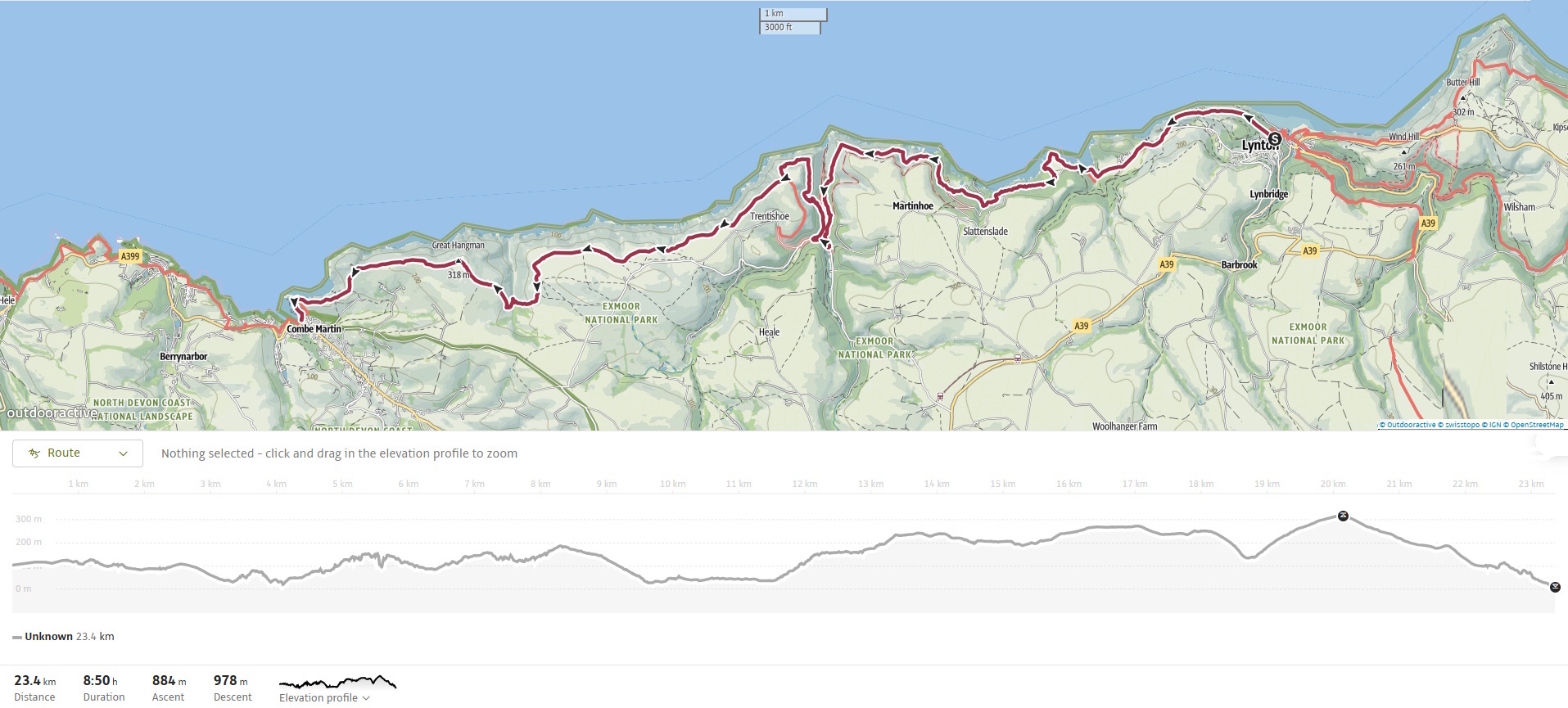
Walk Summary: Lynton to Combe Martin
- Distance: 23.3 km (14.5 miles)
- Elevation gained: 807 m (2646 ft)
- Difficulty: Strenuous – frequent steep climbs and descents, exposed moorland
- Moving Time: 5:48 hrs | Elapsed Time: 7:52 hrs
- Highlights:
- Lynton & Lynmouth – twin villages, cliff railway link, steep gorge setting
- Valley of Rocks – jagged crags, wild goats, Atlantic views
- Woody Bay & Lee Bay – quiet coves hidden below wooded slopes
- Heddon’s Mouth – deep gorge, stone bridge, smugglers’ haunt
- Great Hangman – 318 m, highest sea cliff in England
- Little Hangman – final ridge before the descent
- Combe Martin – seaside village, pubs, and silver-mining past