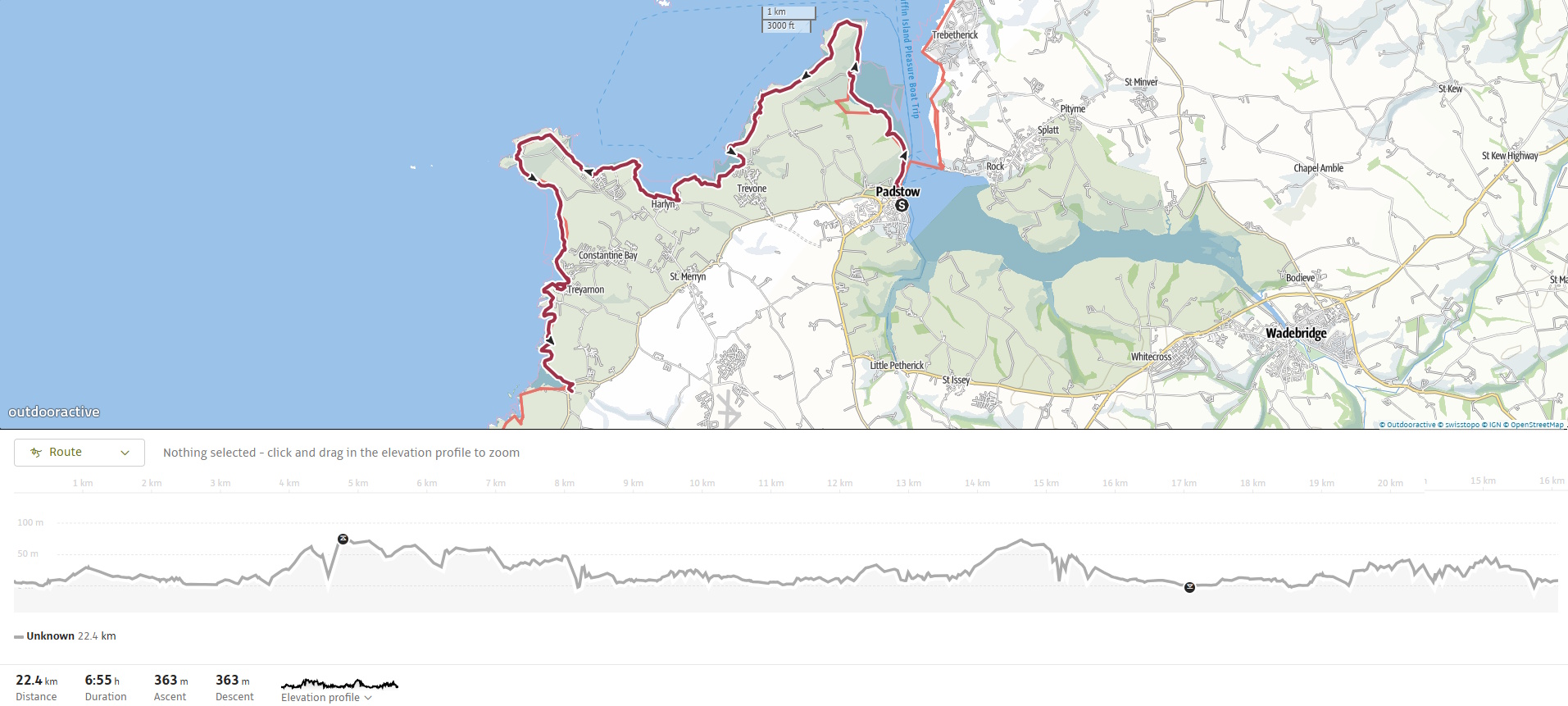
The walk from Padstow to Porthcothan is often called The Seven Bays. It covers approximately 21 km (13 miles) along the South West Coast Path, is a journey of shifting landscapes, rich heritage, and constantly changing terrain. Starting from the gentle estuarine trails of the Camel, it soon opens up into bold Atlantic cliffs, secluded coves, sandy bays, and wild headlands. It’s a walk that blends natural drama with historic echoes — from lifeboats and saints to blowholes and shipwrecks.
The walk is generally easy, although the sandy bays are punctuated by rugged headlands with some steeper climbs and descents.
This is an area I know well as I’ve visited many times.
As usual, we travelled down the day before. We were booked into the Farmers Arms in St Merryn. This is a pub I first visited nearly 50 years ago so I suppose I’m a regular—I visit every 50 years!
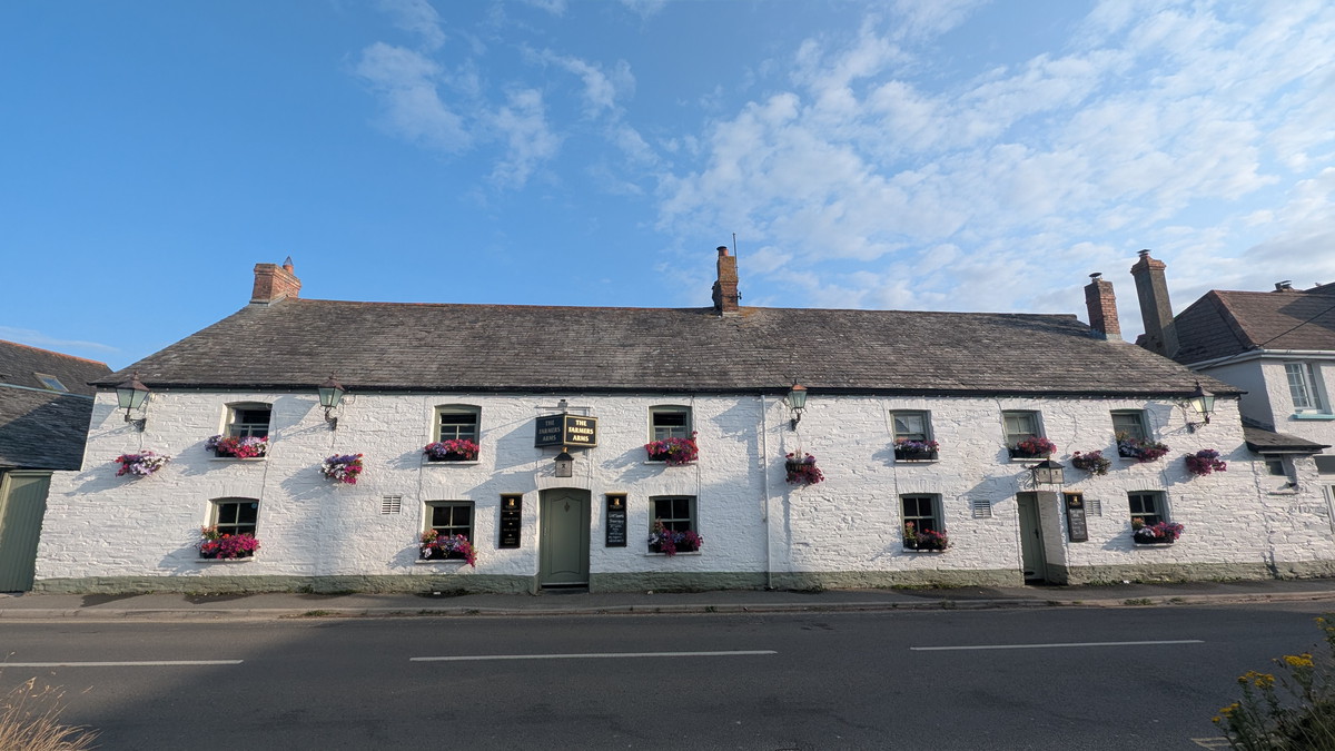
St Merryn is a bustling village situated just outside Padstow, offering two pubs and a variety of dining options. It is also conveniently situated for the first walk of the trip, being only 1 to 4 km from all the key locations we plan to explore.
SWCP 15: The Walk
Easy—Easy
14 July 2025
Logistics were easy. We drove the 3 km (2 miles) to Portcothan Car Park and caught the bus back to Padstow. After getting off the bus, we walked to the Harbour and crossed the bridge at the inner harbour entrance.
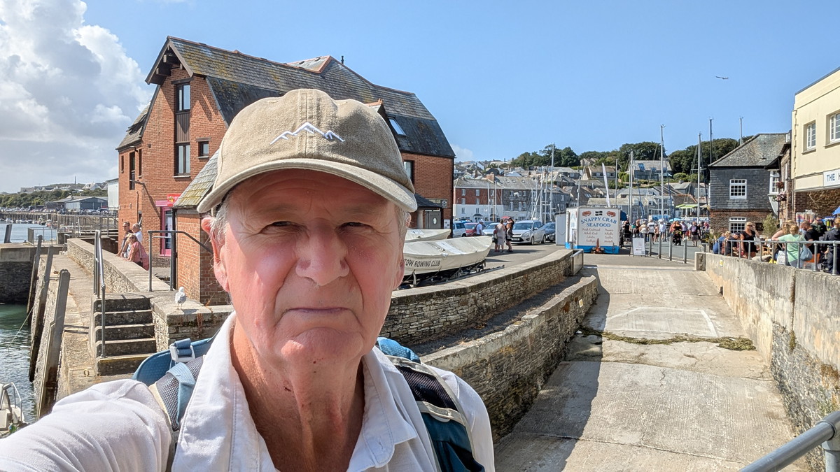
Padstow, Chapel Stile Field & War Memorial Views
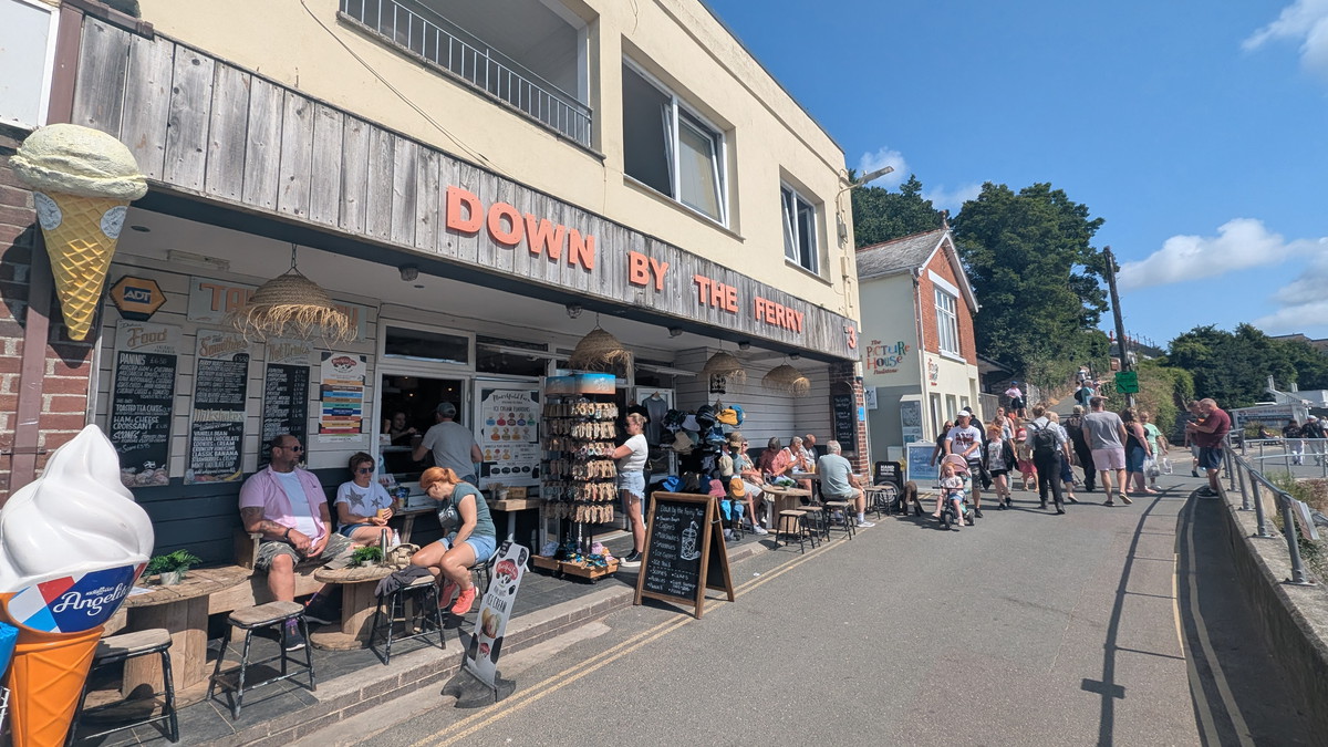
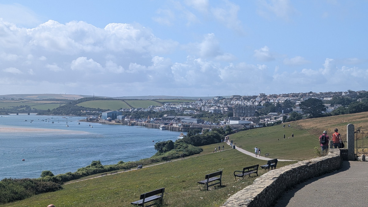
We followed the road along the side of the harbour past the ‘Down by the Ferry’ Cafe (but didn’t stop as we’d already had the full Farmers’ Breakfast earlier!) and walked up the gentle slope leading to Chapel Stile Field. Following the path (and the crowds), we walked up to the War Memorial, where there were amazing views up, down and across the estuary.
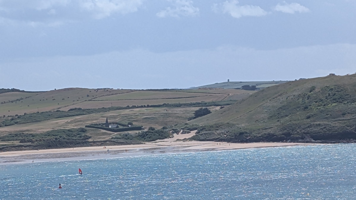
As we walked along the path just above the beach, we passed St Georges Cove, named after the well located at its rear, and then started the lengthy trail around Harbour Cove. With the tide receding, we opted to stroll along the beach, allowing Roxie the opportunity to run and splash in the water.
Looking across the estuary over the infamous Doom Bar, we could see Daymer Bay and Polzeath.
Harbour Cove to Hawker Cove: Pilot Gigs & Wetlands
Across the bay, we spotted the small hamlet of Hawker Bay, with a row of six cottages built for the crews of the pilot gig boats, who navigated shipping through the treacherous sandbars in the Camel Estuary to Padstow.
The official Path skirts around the wide bay, crossing a boardwalk across a wetland area, but we cut across the beach and rejoined the Path there. Carrying on, we passed the hamlet at Hawker Cove and continued along the Path, which was beginning to rise gradually. Across the Camel we could see Daymer Bay and St Enodoc’s Church behind it.
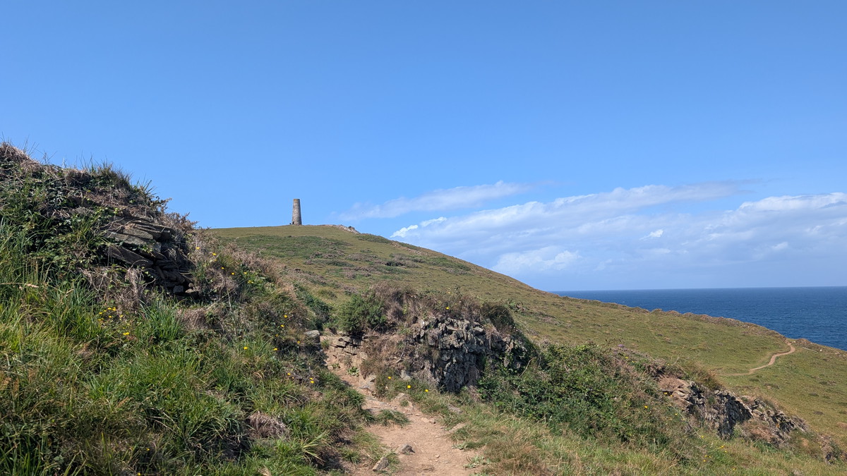
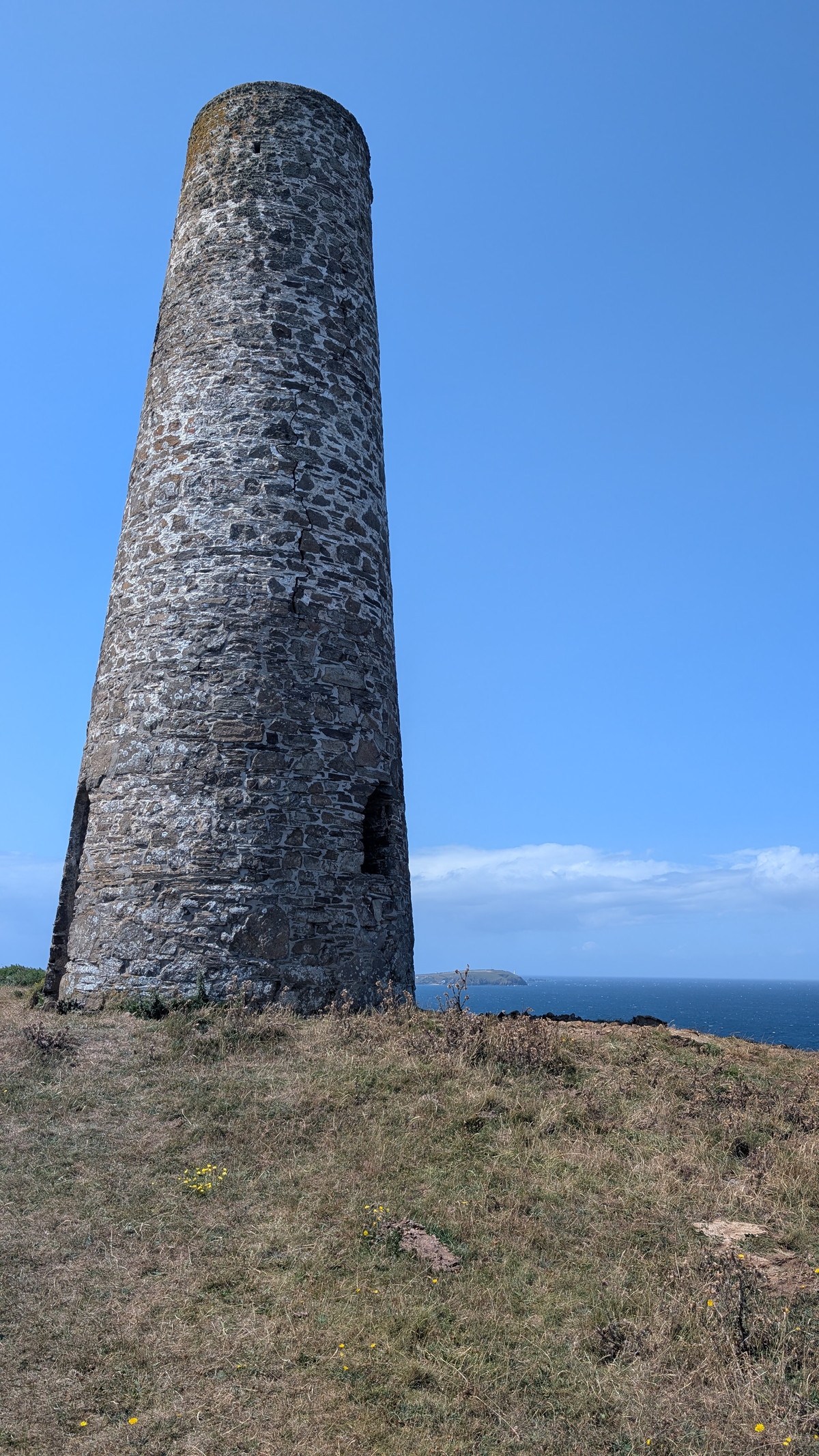
As we gradually climbed, the Daymark Tower at Stepper Point came into view. There is an easy path up past the Coastguard Lookout, but we followed the official Path, which drops down the side of the hill. The path here was quite rocky and narrow on a steep hillside and probably not for the faint-hearted. We circled around the headland and then climbed up a very steep, rough track to the tower.
From here, we had views across the head of the estuary to Pentire Head and across the bay in the other direction to the sandy bays and Trevose Head.
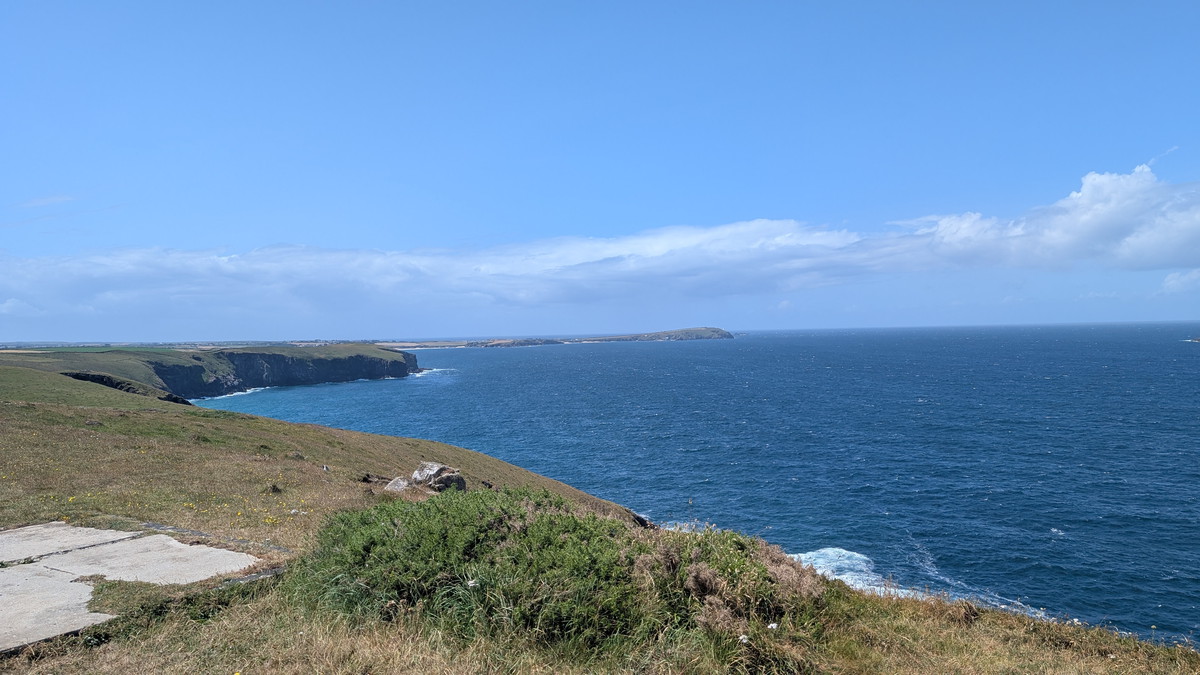
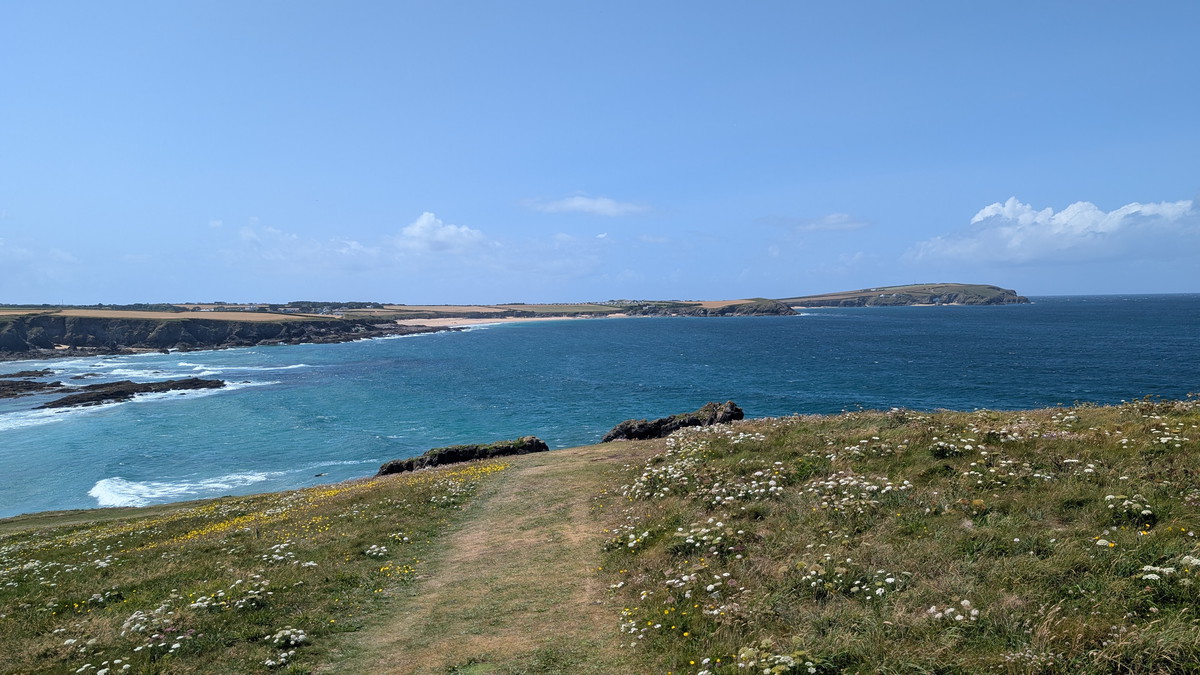
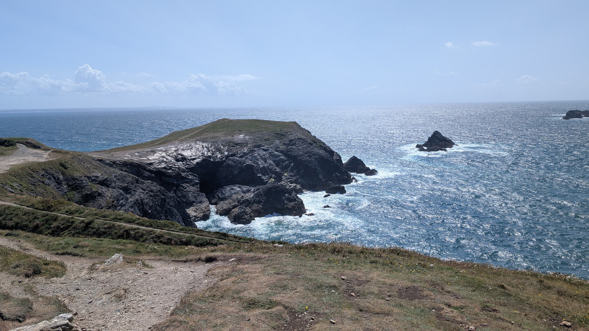
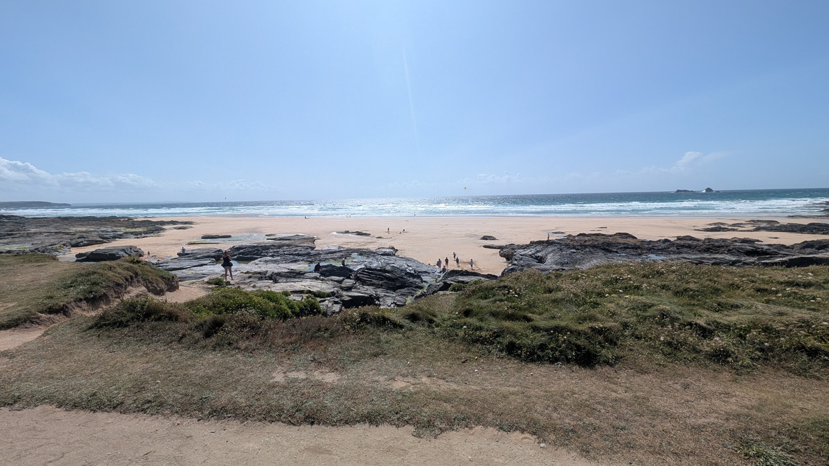
Gunver Head to Trevone: Quarries, Blowholes & First Bay
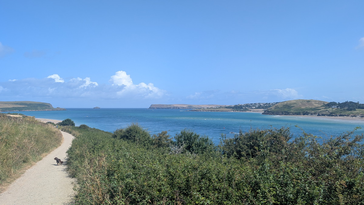
From here, it was a fairly easy, level, grassy path. Undercut headlands, collapsed sea caves, and old quarry faces line this run. The coast kinks and dips, then eases into Trevone Bay—our first of the seven. It’s a natural pause before the rhythm of bays and points begin in earnest.
Harlyn Bay & The Fish Cellars → Mother Ivey’s
We followed the Path around past the rocky area and soon after dropped down to the car park at Harlyn Bay- our second bay. Here, after crossing the stream on the road, we walked along the back of the beach before climbing up some steps behind it. We then walked along a fairly level path with the West end of the beach below us.
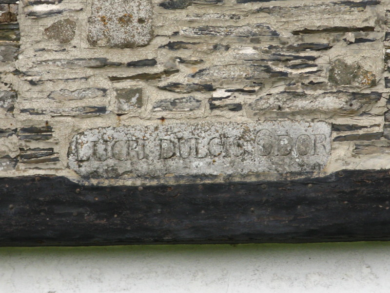
We passed The Fish Cellars- a former pilchard processing building with the inscription ‘Dulcis Lucri Odor’, meaning ‘Profit Smells Sweet’. (See The Curse of Mother Ivey later).
Continuing along the Path, passing small sandy coves below us, to Cataclews Point. Cataclews Point has been the scene of intensive quarrying in the past, which has removed a large chunk of the headland!
Here we turned westward and approached the third sandy bay, Mother Ivy’s Bay, also known as Polventon Bay (Cornish Poll Fenton, meaning pool of a spring). The Bay gets its name from the legend of Mother Ivy (Ivey), a renowned Cornish wise woman who placed a curse on the land at Harlyn Bay in response to the cruelty of a wealthy fish merchant. This curse is said to have caused shipwrecks, deaths and contributed to the decline of the pilchard trade.
On one side of the path was a tranquil, sandy beach, while on the other side lay a massive construction site—what would Mother Ivy have thought of that? The once sizable holiday park, which was already somewhat of an eyesore, was apparently doubling in size!
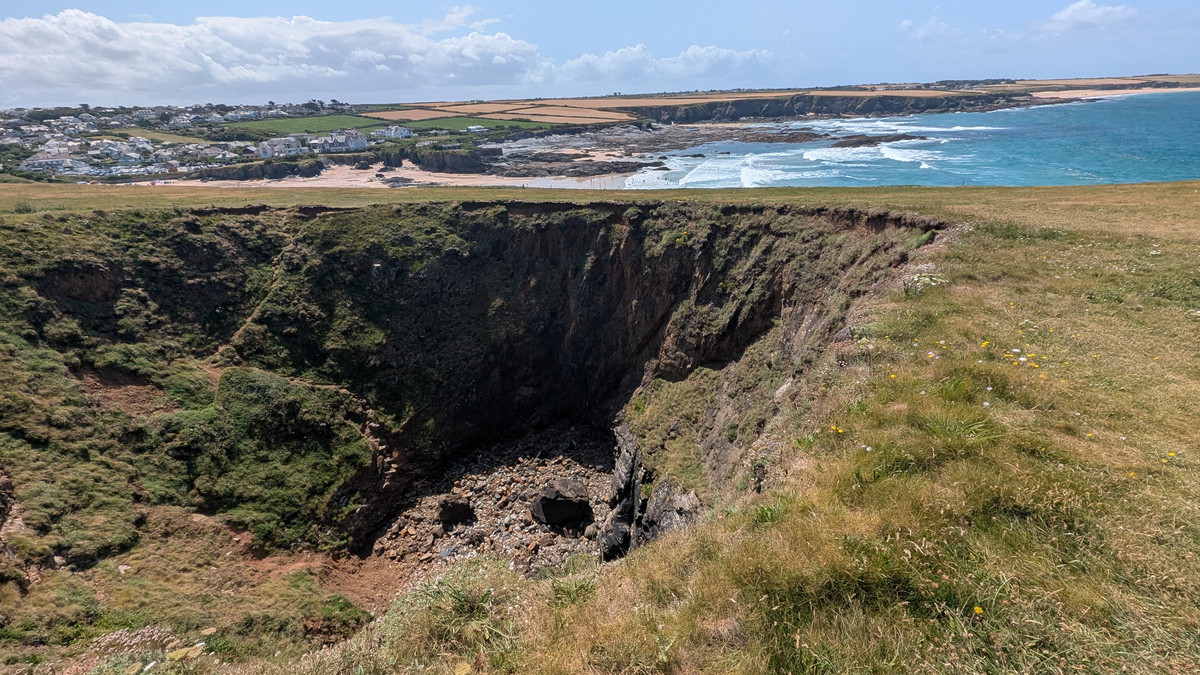
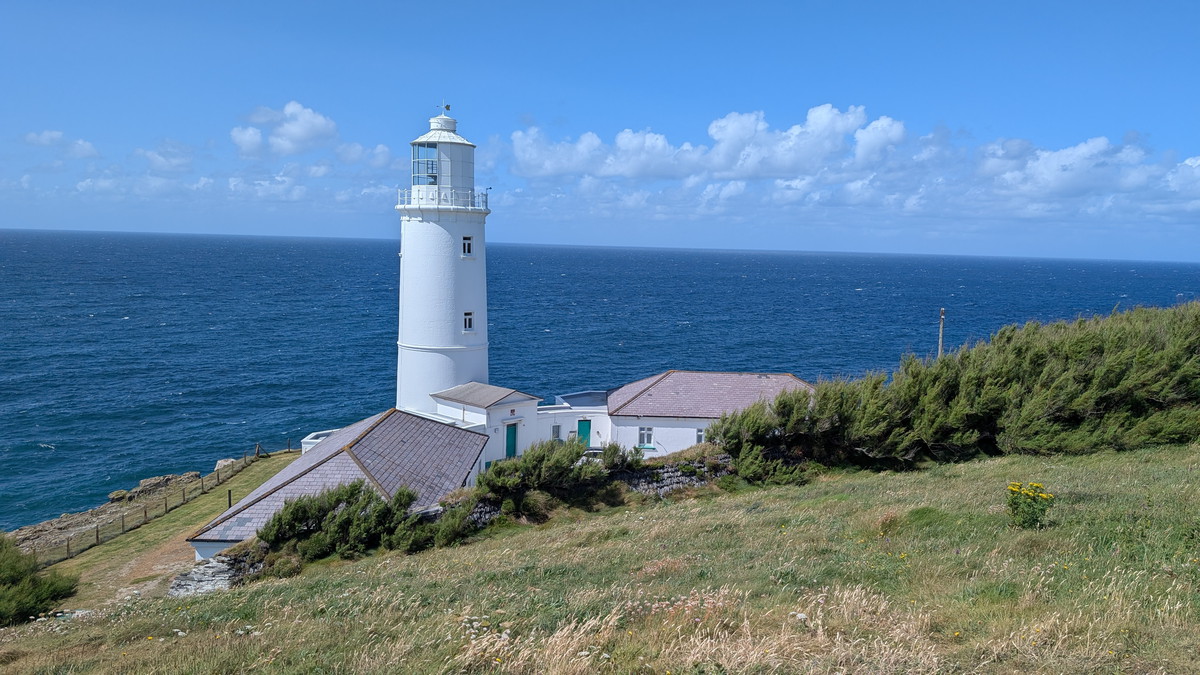
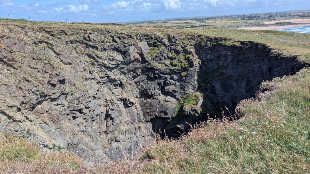
Trevose Head: Lighthouse, Stinking Cove & Round Hole
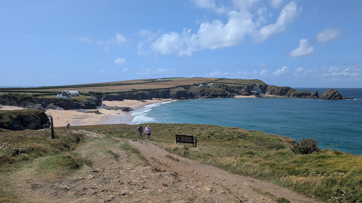
The path led us up to a road and inland for a short distance as we passed the entrance to the Lifeboat Station. The lifeboat was relocated here from Hawker Bay in 1967 to allow for launches into deep water at any tide. We then began a steady ascent toward Trevose Head, moving inland past the lighthouse.
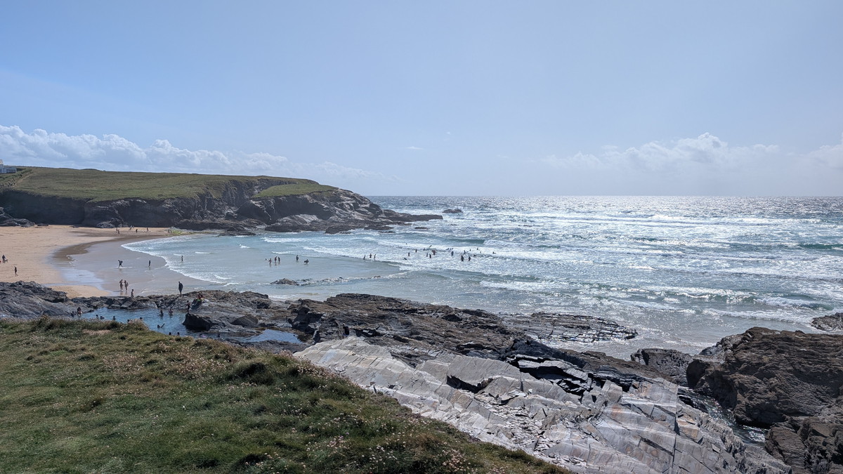
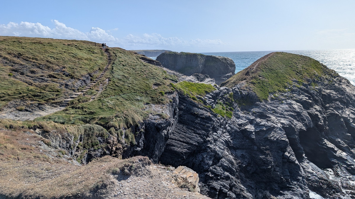
We crossed the lighthouse access road then dropped down some steps, with Stinking Cove below us. We followed the Path across the headland, missing out Dinas Head and headed round the headland past Round Hole- a 40m deep blow hole.
Booby’s & Constantine: Wide-Open Sands
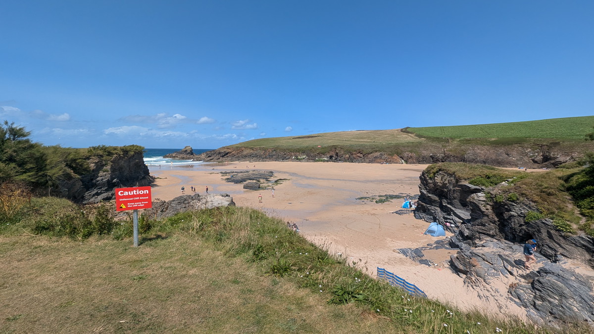
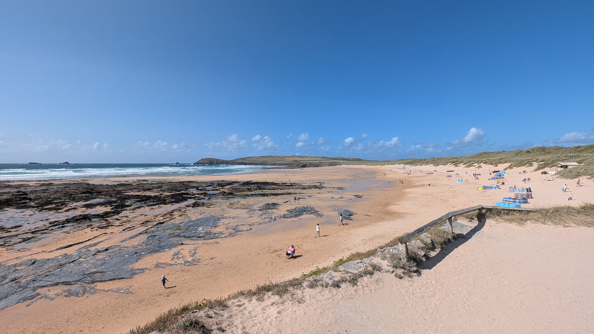
We walked along the path reaching our fourth bay, Boobys Bay.
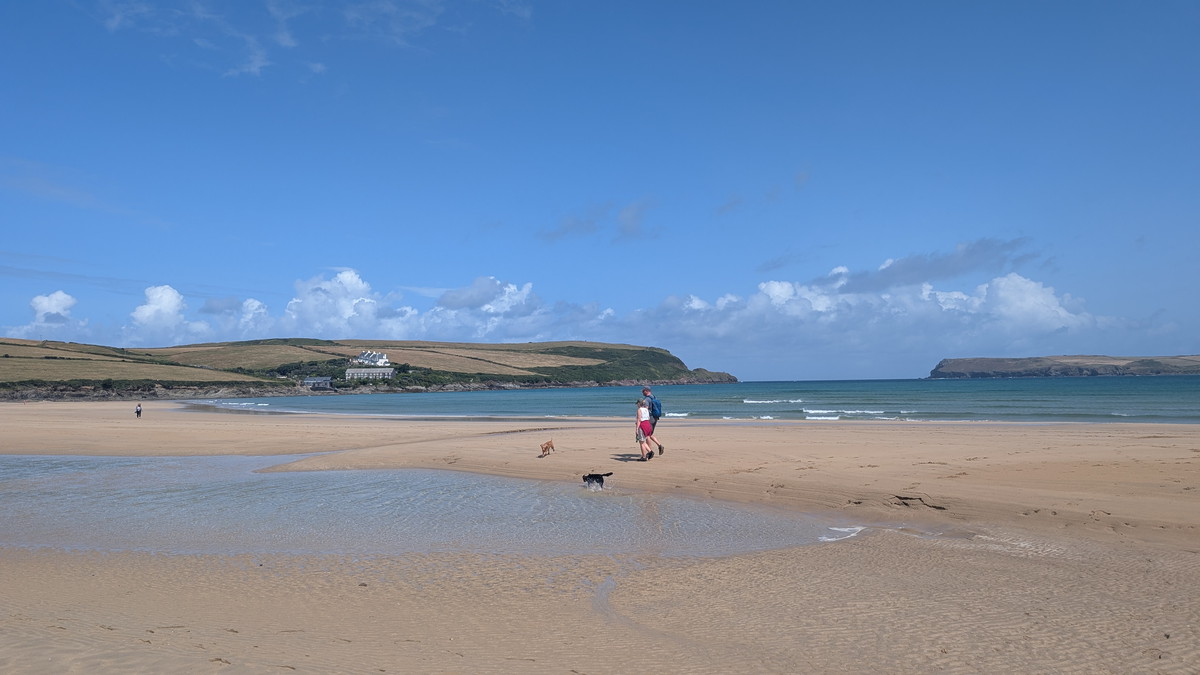
We followed the Path behind it before dropping down on to the beach at Constantine Bay, our fifth and another opportunity for Roxie to have a spell off the lead. The bay is named after Saint Constantine, a 6th-century Cornish saint and reputed king who is said to have converted to Christianity near here.
Treyarnon to Porthcothan: Smugglers’ Coves & A Gentle Finish
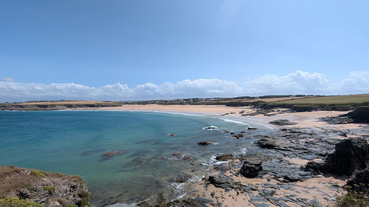
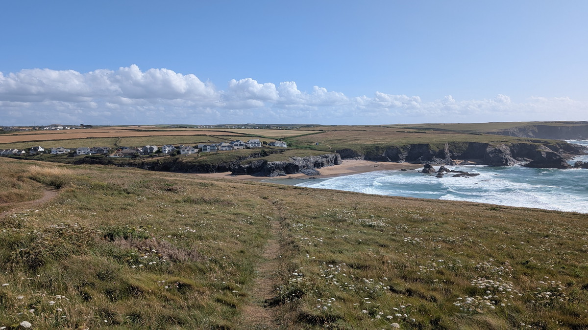
Leaving the beach by the ramp, we followed the path around Treyarnon Point to Treyarnon Bay- our sixth bay. We dropped down to the beach, and Roxie had another run and paddle.
It would have been easy to think that the walk was pretty much done now, but there was still plenty of walking ahead.
As we crossed the cliff towards Porthcothan, we weaved in and out of small headlands overlooking six quaint coves. Wine Cove and Pepper Cove were intriguingly named after smuggling activities that took place in the area between 1700 and 1850. Additionally, remnants of an Iron Age fort can be seen above Wine Cove and along the cliff top above Pepper Cove- coastal erosion has split the site in two. We also passed Warren Cove, Fox Cove, Rowan Cove, and Long Cove.
Continuing, the Path suddenly turned left, and we were descending down beside Porthcothan Bay, our seventh bay. We followed the path down alongside the beach and a stream, then turned onto the road and into the car park.
While it wasn’t a particularly challenging walk, it was quite lengthy, with enough ups and downs to make you feel like you had accomplished something. This walk is a quintessential North Cornwall experience, showcasing a diverse array of coastal scenery, rich geological features, local legends, and natural beauty.
Unfortunately, there wasn’t a pub nearby to celebrate our arrival, so we headed to the nearest, which turned out to be the Farmers Arms in St Merryn for our celebratory drink!
Walk Summary: Newquay to Perranporth
- Distance: 24.2 km (15.1 miles)
- Elevation gained: 419m (1376 ft)
- Difficulty: Moderate – some long sandy sections and short climbs
- Moving Time: 4:37 hours Elapsed Time: 6:38 hours
- Highlights:
- Padstow & Doom Bar: Big estuary views from the War Memorial.
- Harbour & Hawker Coves: Pilot-gig cottages, boardwalk and broad sands.
- Stepper Point Daymark: Iconic tower with an airy rocky traverse.
- Gunver Head → Trevone: Blowholes and quarry scars meet the first bay.
- Harlyn Fish Cellars: Dulcis Lucri Odor—pilchard history in stone.
- Mother Ivey’s Bay: Folklore, RNLI station and calm sands.
- Trevose Lighthouse: Classic headland panorama.
- Round Hole: 40 m deep, collapsed sea cave.
- Booby’s & Constantine: Long beaches, reefy interest and saintly names.
- Treyarnon → Porthcothan: Smugglers’ coves; Iron Age cliff-fort remains.