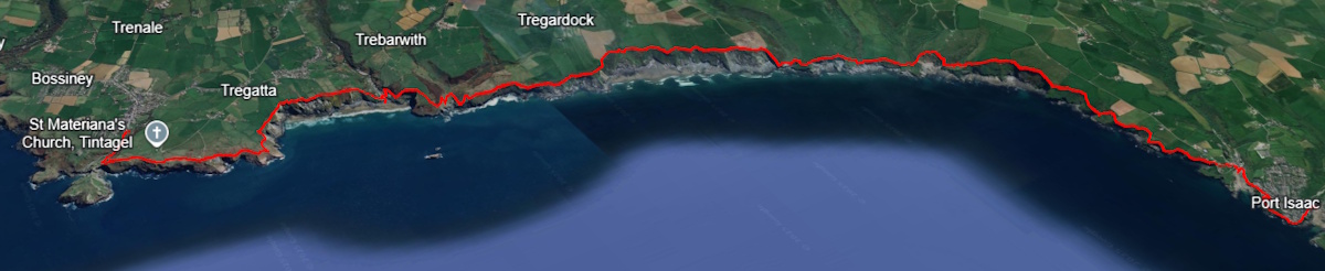
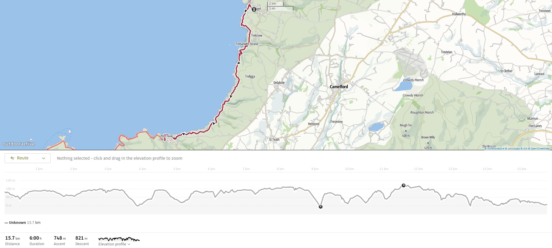
The walk from Tintagel to Port Isaac is a challenging and exhilarating 15 km (9.5-mile) stretch of the South West Coast Path that offers some of the most dramatic and varied cliff scenery in Cornwall. It is categorised as Severe. With countless steep ascents and descents, narrow paths, and sweeping views, this route is both physically demanding and richly rewarding. Along the way, you’ll encounter remnants of Cornwall’s slate mining past, seabird-rich headlands, hidden coves, and echoes of smugglers and saints.
SWCP 13- The Walk
Challenging —Severe
14 May 2025
 Click to explore in Google Earth 3D
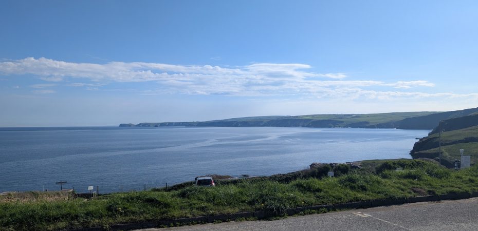
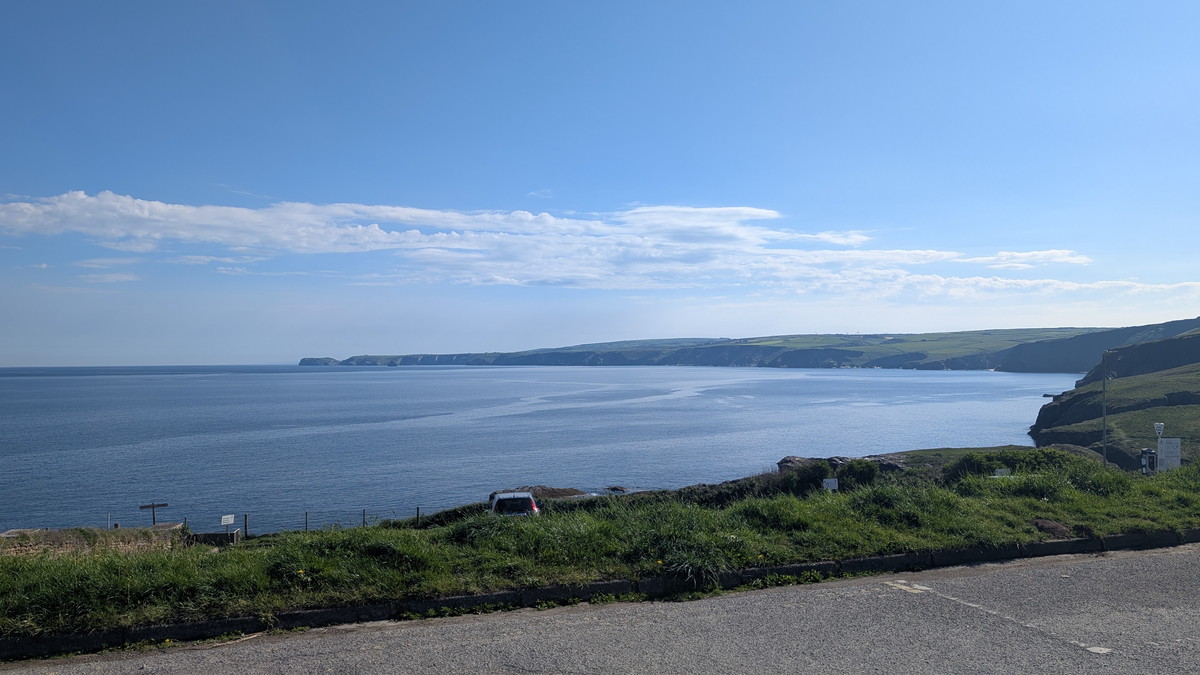
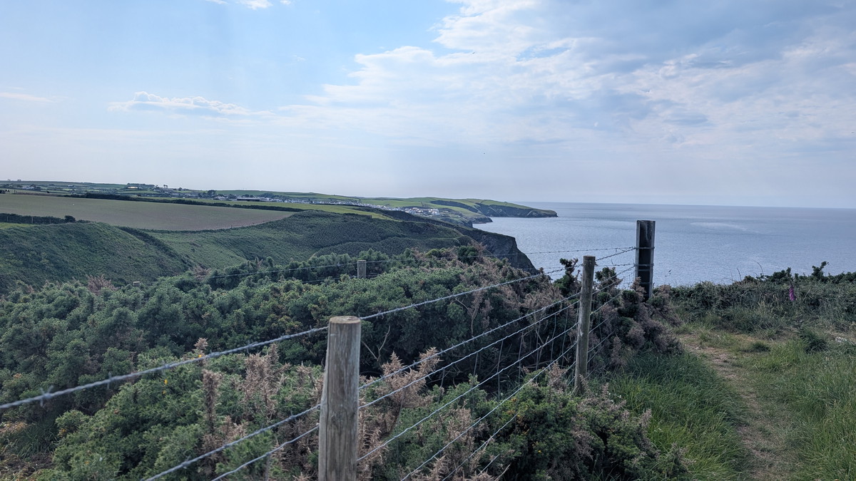
We stayed overnight at the Old Mill House before parking in Port Isaac’s New Road Car Park. From here, the view back toward Tintagel was both inspiring and daunting — our route stretched out across the cliffs beyond.
The return logistics weren’t straightforward, so we took a taxi to Tintagel. Our taxi had a flat tyre on the way to us and nearly derailed the plan, but fortune smiled: we shared a ride with another couple heading the same way, making for a later but cheaper start.
SWCP 13: The Walk
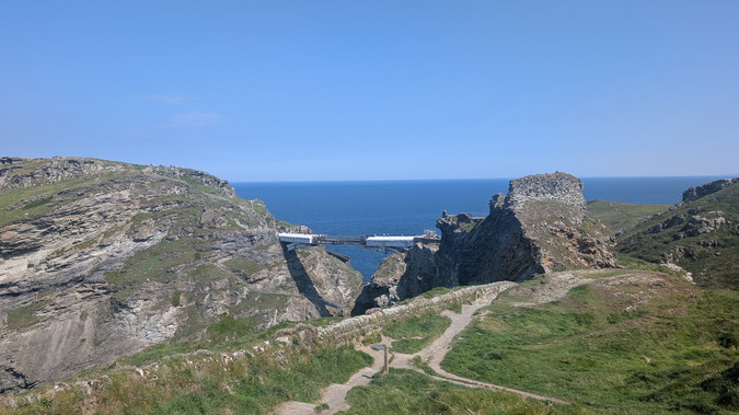
Tintagel & Slate Quarries
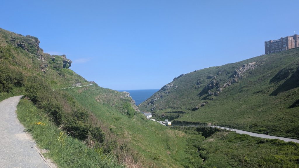
We were dropped off in Tintagel on the corner opposite the path down to the Castle. We said our goodbyes to our taxi companions. They headed off to stock up on supplies including Pengenna Pasties—a good move—while we headed off to start the walk. We walked down, Castle Road, the path towards the Castle’s Upper Entrance where we turned left up the path, climbing away from the valley.
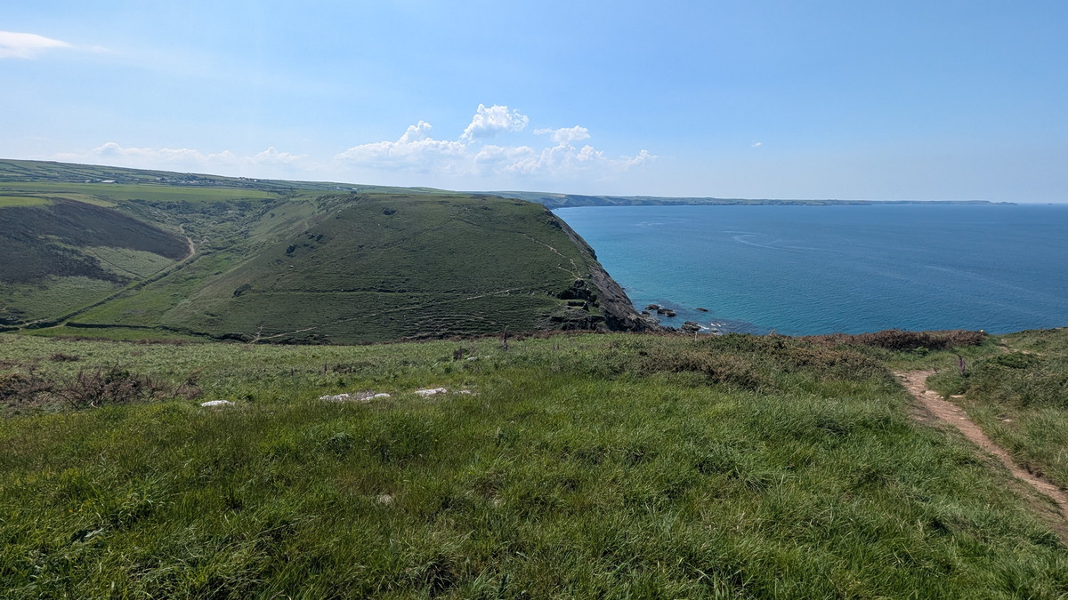
We were soon treated with views over Tintagel Head with the Castle.
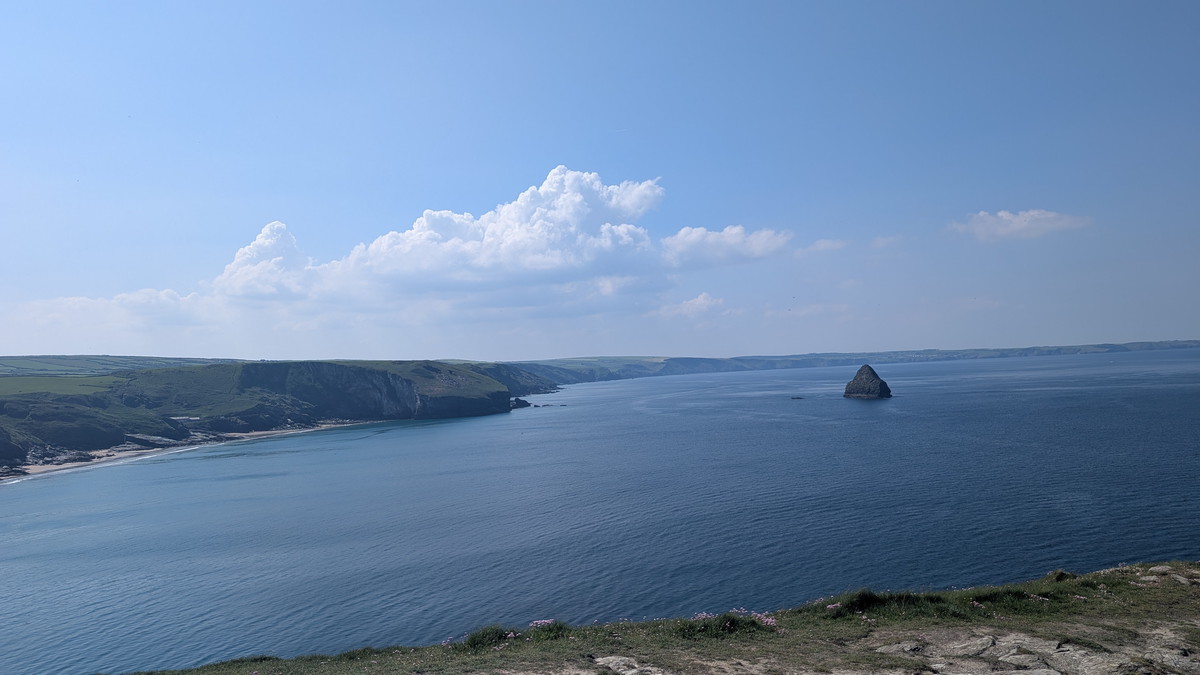
Ahead, we could see Gull Rock rising from the sea, opposite Trebarwith, the place we’d been staying overnight and also our first major descent and climb of the day.
We soon passed St Materiana’s Church.
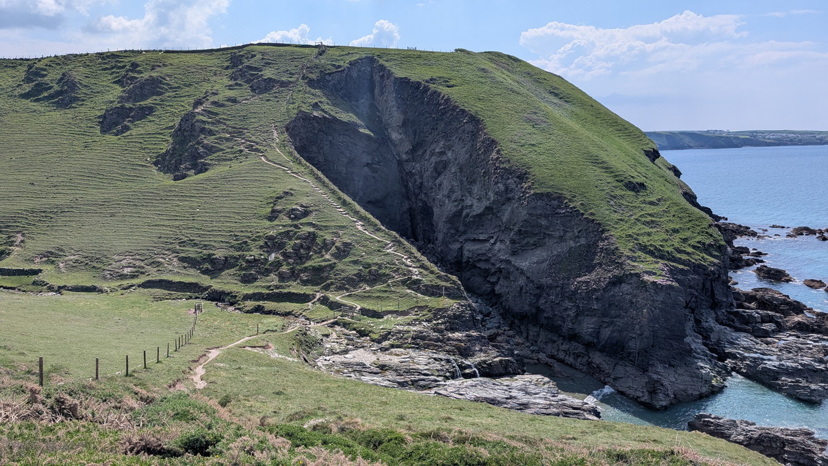
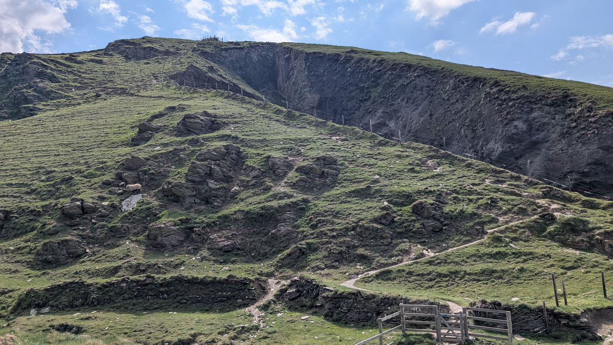
As we walked along the cliff top, we could see extensive signs of old slate quarrying. Shortly after, we were above the YHA Hostel, housed in the former Long Grass Quarry buildings.

Before long, we found ourselves walking along the National Trust’s Glebe Cliff, where a large, abandoned quarry came into view. A sizable stack of what must have been low-quality slate stood within it, seemingly left untouched.
Trebarwith Strand
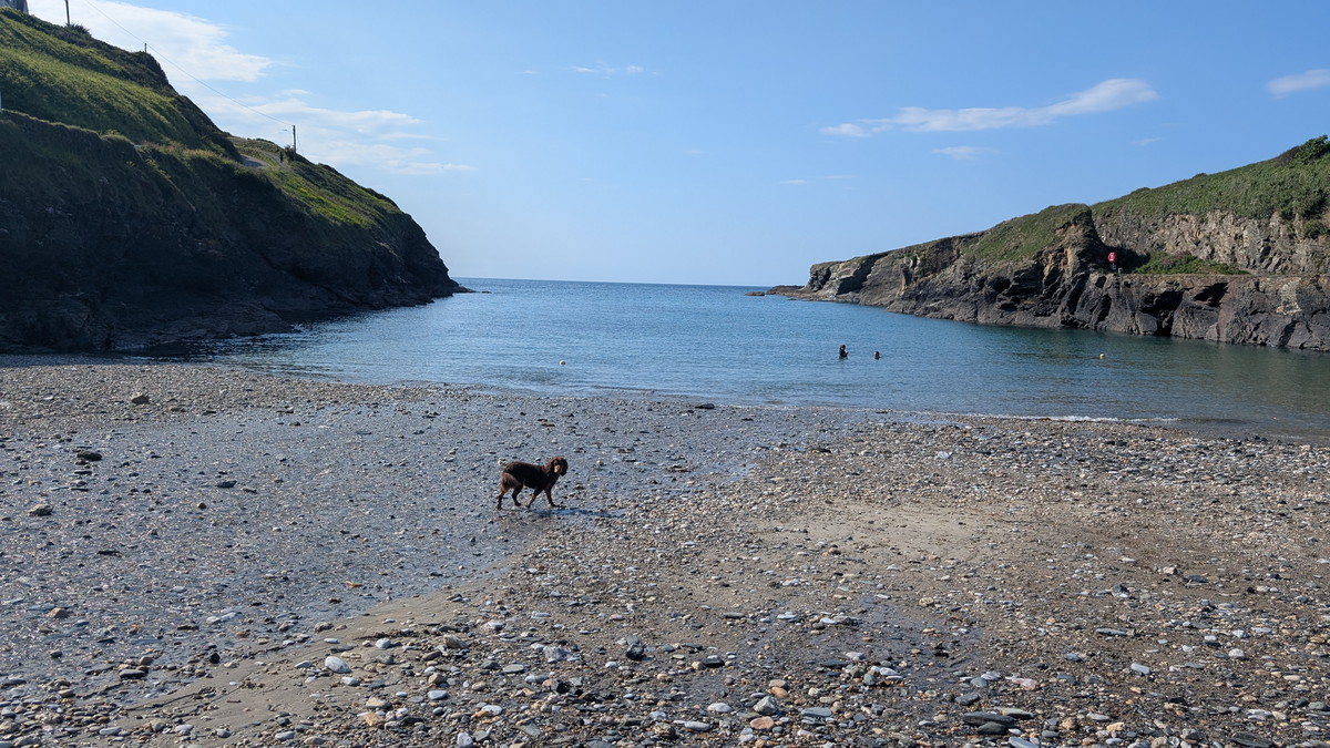
Eventually, we descended a twisty path which wound down towards Trebarwith Strand.
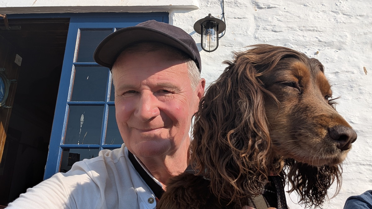
Having stayed just up the valley during this visit as well as on our previous trip, we took a moment to appreciate the view again and allow Roxie to have a paddle. Previously, when we’ve walked down to the beach, we’ve found the tide in, leaving no sand, so this was a special treat!
Our taxi companions caught us up here, and we exchanged brief comments about the walk so far and what was to come. This was the first of a number of times our paths crossed on the journey.
The Port William pub dominates the area. The structure that now forms the heart of the Port William was originally a slate store and workshop, used for processing and storing slate before shipment, and it takes its name from the port at the cove below, where ships used to carry slate away.
We left Trebarwith, walking up past and above the pub, climbing up a steep flight of 200 steps up towards Dennis Point. The path soon rose onto narrow cliff-top trails, hugging slate and sandstone cliffs.
Backways Cove & Treligga Cliffs
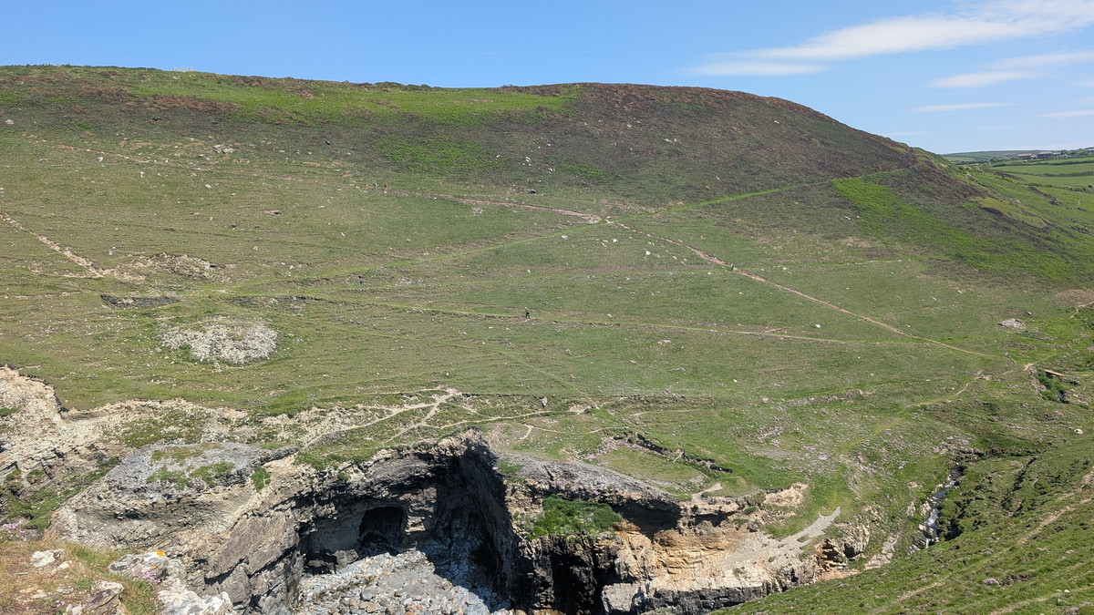
Almost immediately, we began descending again, zigzagging into the valley behind Backways Cove. After crossing a couple of bridges, we continued with a zigzag ascent up the other side. Below us were the ruins of an old farm. This area is said to be haunted, although there is no clear account of the details, and most of the claims appear to originate from modern sources.
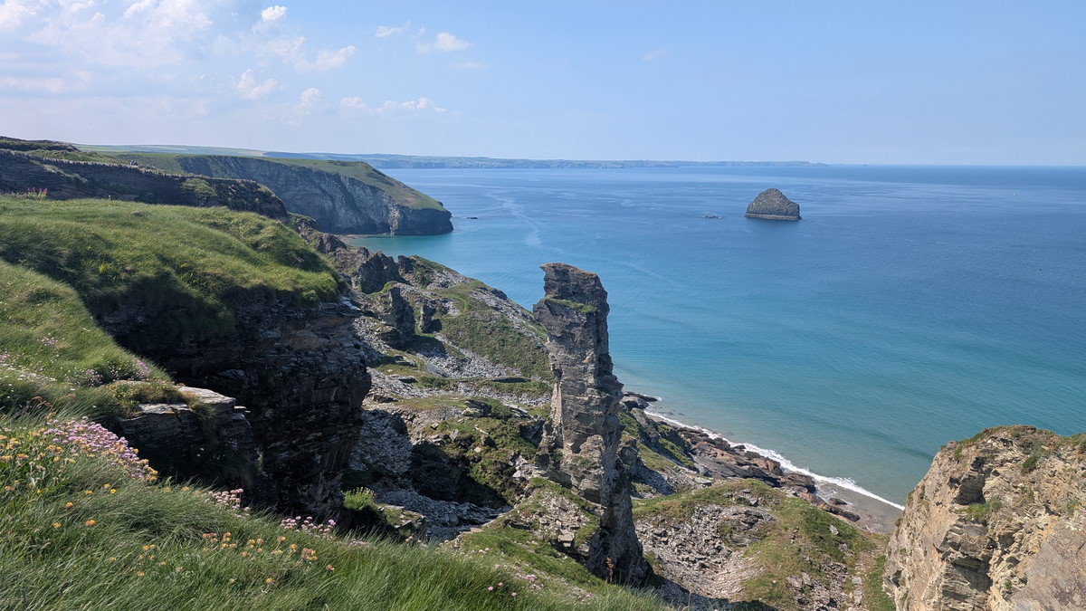
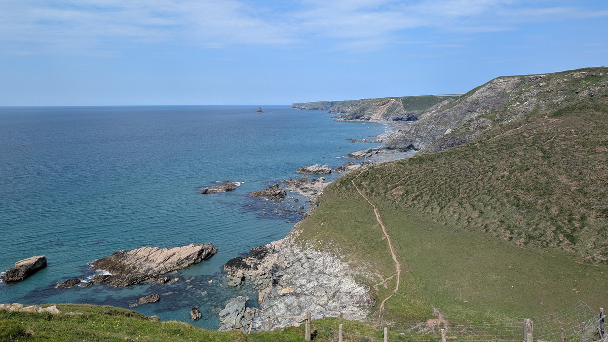
Once back at the top, the walk was much easier along Treligga Cliff to Tregonnick Tail before we descended down to Tregardock Beach.
We had to walk up the valley a little way before crossing a stream, and then climbed up behind the pyramid-shaped ‘Mountain’ to Tregardock Cliff.
A relatively flat walk followed before a series of tough descents and ascents.
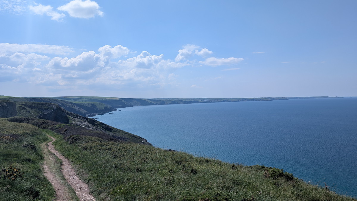
Jacket’s Ridge & Endless Valleys
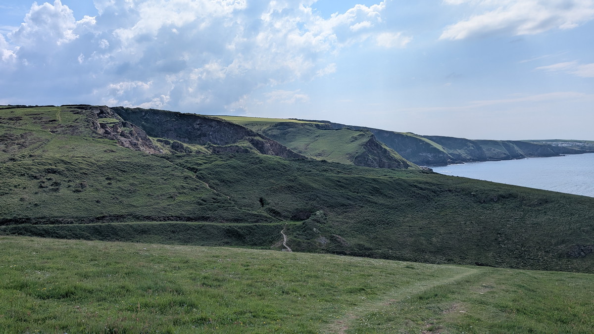
We wondered where the stony path along the ridge of Jacket’s Point was taking us. It seemingly headed over the cliff into the sea but, fortunately, it eventually turned inland, descending into Tregragon Valley to a footbridge overlooking a waterfall. We then had a steep climb, alongside a ‘zawn1‘ or chasm in the headland, that seemed to get steeper and steeper.
Next came Dinnabroad Valley, possibly not as challenging as Tregragon but energy-sapping nonetheless.
The roller coaster continued with the valley at Delabole Point. Down almost to sea level, across a stream, then back up.
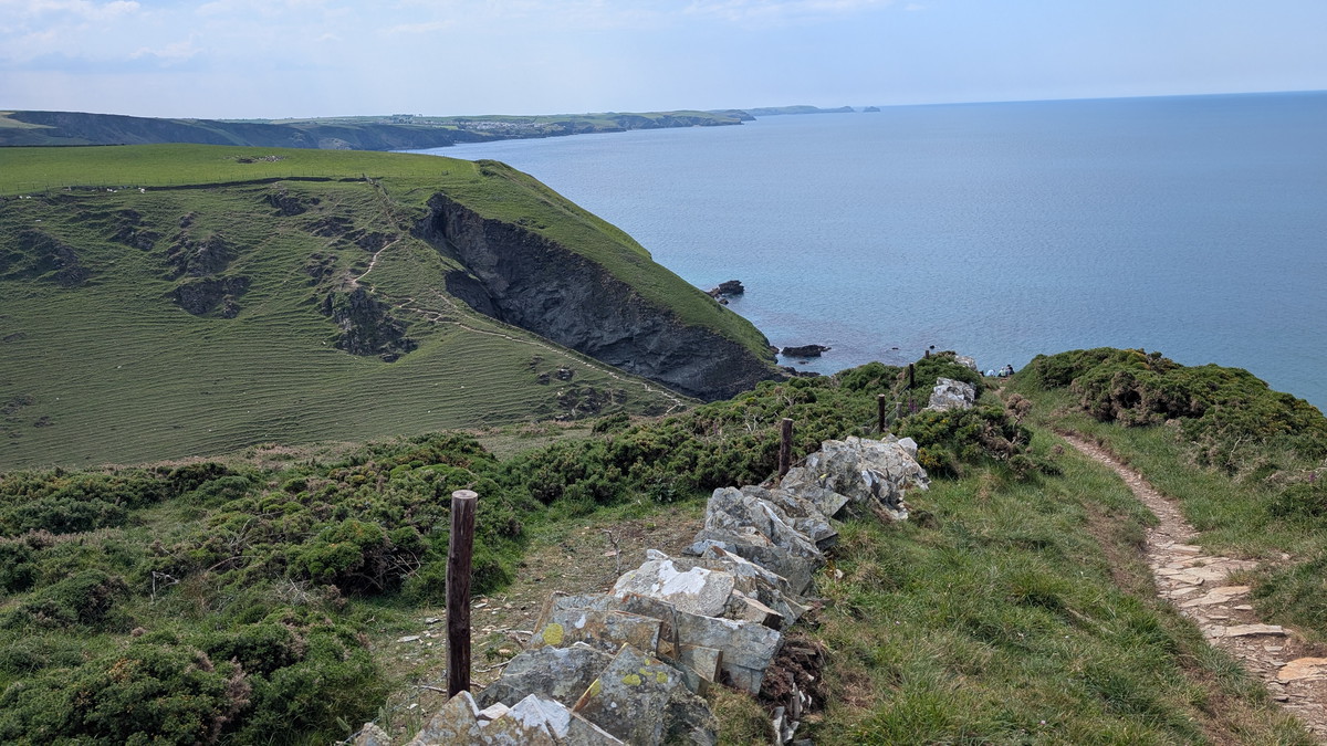
You’ve probably worked out what happened next- after walking a short distance above Barret’s Zawn Beach, we were heading back down another valley at Ranie point, down to sea level, then back up, this time climbing to nearly 120 metres /400 feet above sea level.
We were quite high up now and we could see Port Isaac in the distance but then came another, slightly lesser descent and climb at St Illickswell Gug.
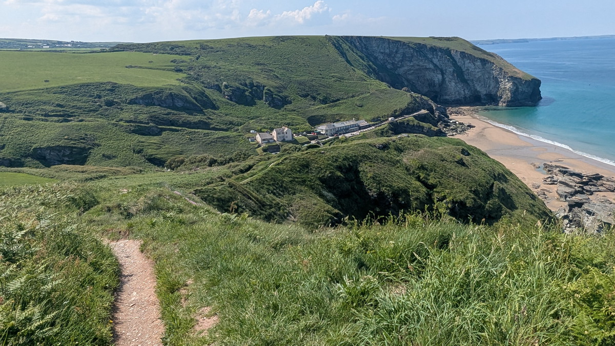
Port Gaverne
The eighth valley of the walk didn’t seem so bad. Following a cliff path for a while, we could even see our car in the car park in the distance. We eventually crossed a road, followed a steep lane down behind some cottages, passed the Port Gaverne Restaurant & Hotel and emerged opposite Port Gaverne Beach.
The name “Port Gaverne” (sometimes spelt “Port Gavern”) likely comes from the Cornish Porth (harbour) and possibly Karn (rocky outcrop), reflecting the rugged coastal geography. Unlike Port Isaac, which developed as a bustling fishing port, Port Gaverne served a more industrial role in the 18th and 19th centuries.
Its sheltered cove was once a slate shipping point, particularly for slate quarried inland at Delabole. The stone was transported by cart to the beach, loaded onto small sailing vessels, and exported by sea. Later, lime and coal also passed through here. Remnants of old buildings and platforms still hint at its working heritage.

We were greeted by our taxi companions who had parked close by and had arrived some time before us. After chatting for a while, we continued up the hill- this was effectively our last big valley, passing our car in the car park since we weren’t quite done yet.
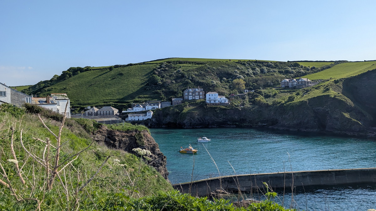
Port Isaac
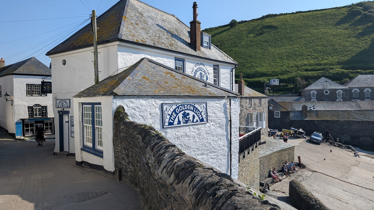
We walked around the headland and descended into Port Isaac village, where we enjoyed a celebratory drink at the Golden Lion.
Port Isaac dates back to at least the 14th century, when it grew as a busy fishing port and trading hub. Its name likely comes from the Cornish Porth Izzick, meaning “the port of the corn” or “the port of Isaac.”
Throughout the 18th and 19th centuries, it thrived as a centre for pilchard fishing and coastal shipping, importing coal and timber and exporting slate from nearby Delabole, as well as agricultural goods. You can still see evidence of this history in the old fish cellars, stone slipways, and narrow lanes once used by donkeys and carts.
Port Isaac rose to fame as Portwenn in ITV’s Doc Martin, with key filming locations like the doctor’s house and village pub still attracting fans. It’s also featured in Poldark and Fisherman’s Friends, based on the local sea shanty group who still perform here.

Having visited Port Isaac numerous times, I’ve enjoyed a crab sandwich almost every visit. However, we finished our walk quite late, and the usual spots for crab sandwiches had already closed.
At The Mote Restaurant by the harbour, known for its focus on local produce, I spotted Crab Sandwiches on the menu board! I went in to order one, only to find out they were available only at lunchtime. As I left, I had a brief chat with some customers—Roxie’s friendly waggy greetings often spark a conversation or two. During our conversation, I mentioned that my crab sandwich dreams had been dashed. We said our goodbyes and began the uphill walk back to the car. After a few steps, I heard someone calling me. A chef from the restaurant had overheard our conversation, chased after me and offered to prepare the crab sandwich for me after all. What a result!
We drove back to the Midlands feeling pleased that we had successfully completed a very challenging yet enjoyable walk, and delighted that my crab sandwich cravings had been fulfilled!
Walk Summary: Tintagel to Port Isaac
- Distance: 16.2 km (10 miles)
- Elevation Gained: 692 m (2,272 ft)
- Difficulty: Severe – relentless climbs and descents through slate valleys and rugged cliffs
- Moving Time: 4:58 hrs | Elapsed Time: 6:55 hrs
- Highlights:
- Tintagel Head & St Materiana’s Church – views of castle ruins, ancient church, quarry remains
- Lanterdan Slate Quarry – towering slate stacks and industrial heritage
- Trebarwith Strand – sandy cove, pub with slate-porting history
- Dennis Point & Backways Cove – steep steps, hidden ruins, zigzag climbs
- Treligga Cliffs & Tregardock – open clifftops with wide coastal views
- Jacket’s Ridge & Tregragon Valley – dramatic ridge descent, waterfall and chasm climb
- Delabole & Ranie Valleys – remote, energy-sapping rollercoaster terrain
- Port Gaverne – slate shipping cove with remnants of industry
- Port Isaac – historic fishing port and filming location, perfect finale
- A geo or zawn refers to a narrow inlet or a steep-sided cove found in coastal areas, particularly along rugged coastlines. These geological features are typically formed by the erosion of softer rock, which creates a deep, often vertical-sided chasm or ravine that extends inland from the sea. ↩︎