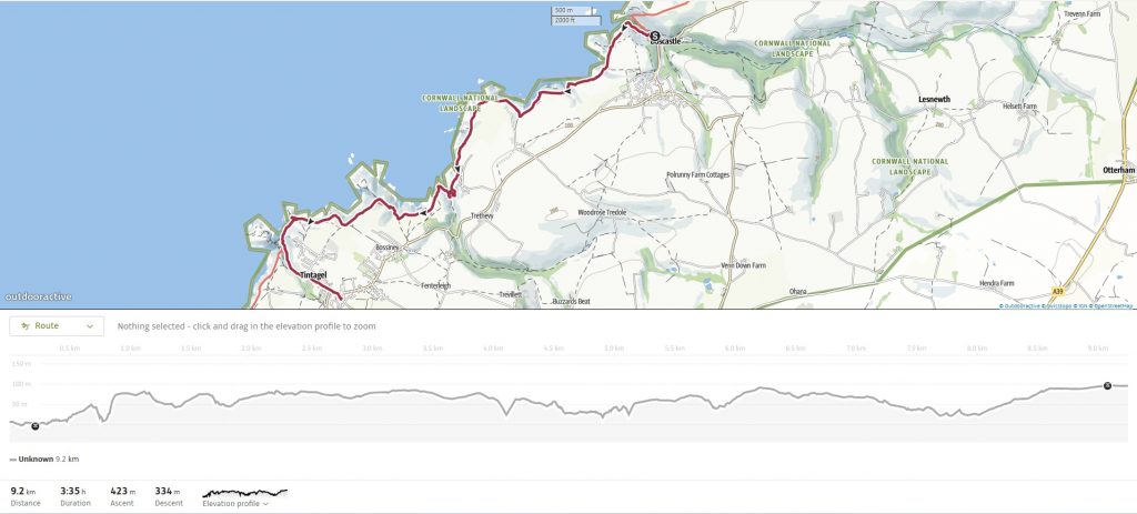
The walk from Boscastle to Tintagel is a short but stunning and relatively challenging 9 km (5.5-mile) stretch of the South West Coast Path, winding through wild, elemental landscapes shaped by ancient geology and steeped in myth. With its soaring cliffs, steep-sided valleys, and frequent ups and downs, it’s often described as the perfect introduction to the path — offering a bit of everything Cornwall’s coast has to offer.
Thomas Hardy provides a literary link to this dramatic stretch of the coast. In 1870, he came to nearby St Juliot to work on the church restoration, where he met his future wife Emma. The surrounding cliffs inspired his novel A Pair of Blue Eyes, which introduced English literature’s first “cliffhanger,” set on the very landscape between Boscastle and Tintagel.
On this occasion, the walk served as a continuation of the previous day, after heat forced us to stop at Boscastle. With a drive back to the Midlands ahead, this shorter stretch proved ideal.
We checked out of the Old Millhouse and drove up to the Tintagel Visitor Centre Carpark ready to catch the bus from across the road back to Boscastle.
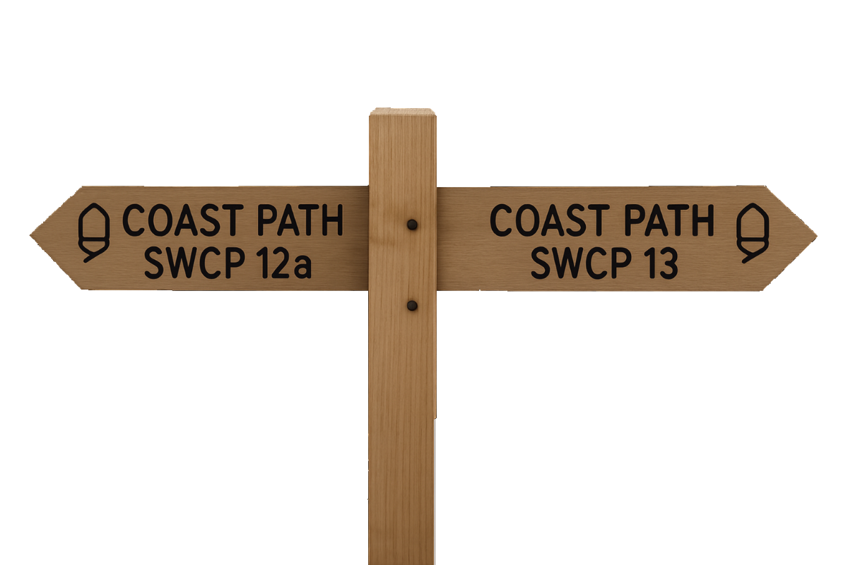
SWCP 12b: The Walk
Moderate to Strenuous
1 May 2025
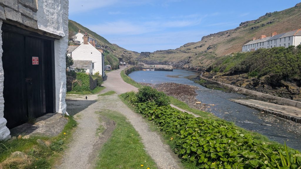
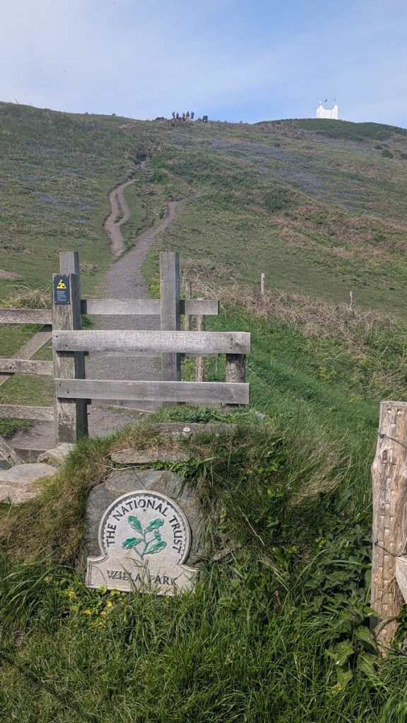
Boscastle Harbour & Willapark
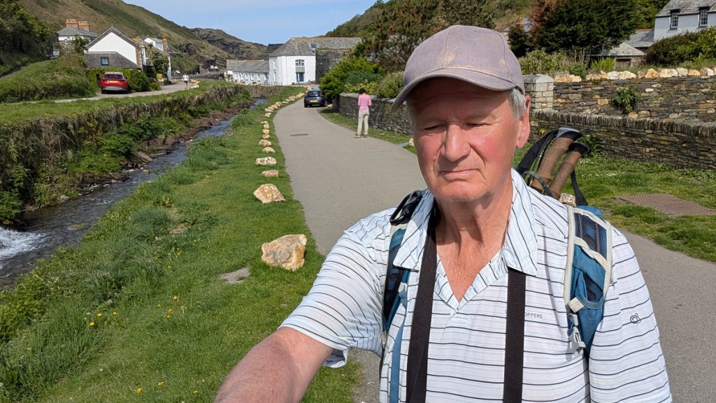
We began at the bus stop by the bridge in Boscastle and followed the path along the right-hand bank before crossing over to the opposite side.
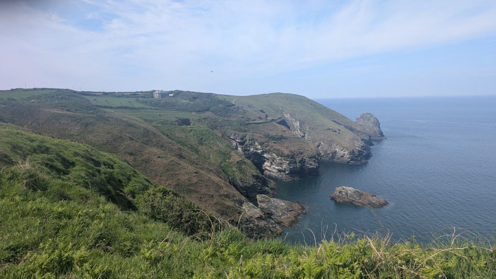
From there, we started the long, steep climb up toward Willapark, with the dramatic inlet of Boscastle Harbour visible below us.
Atop Willapark Headland, just beyond a gate, stands the distinctive white Boscastle Coastguard Lookout — a castellated Victorian tower originally built as a pleasure house, now used to spot vessels in distress. It’s also the site of an ancient Iron Age cliff castle, adding another layer of history to the view.
Trevalga & Cliff-top Walking
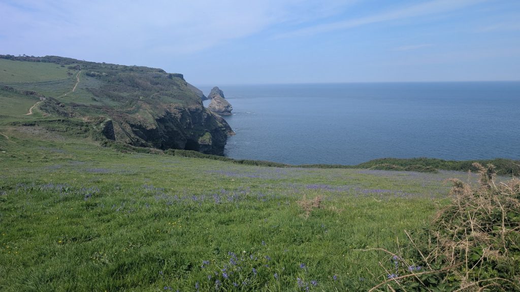
Once past Willapark, while not as dramatic as it has been, the coast path settled into its classic rhythm: deep valleys and high clifftop stretches, with each descent into a valley followed by an ascent to the sweeping headlands..
After a dip and a climb, we skirted the edge of Trevalga, a peaceful, unspoilt hamlet that has been protected by a charitable trust although might now be facing a more uncertain future. Inland, we caught sight of Trevalga Church, a small medieval building sitting quietly among the fields.
Not far ahead lay Lady’s Window, a natural rock arch carved through the cliff face by centuries of pounding surf. Sadly, we missed it — a reminder of how easy it is to overlook things when walking this awe-inspiring coast.
As we continued, we passed the overgrown remains of once busy slate workings, now reclaimed by nature. Today, they provide nesting spots for birds like choughs, and in spring, the cliffs here are dotted with sea campion and thrift.
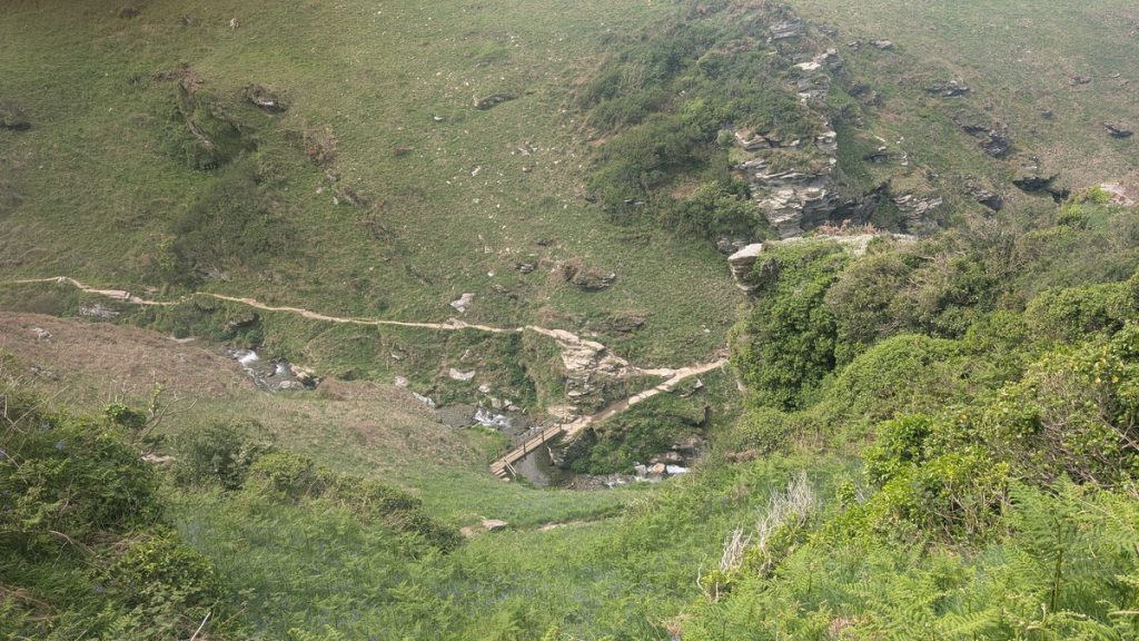
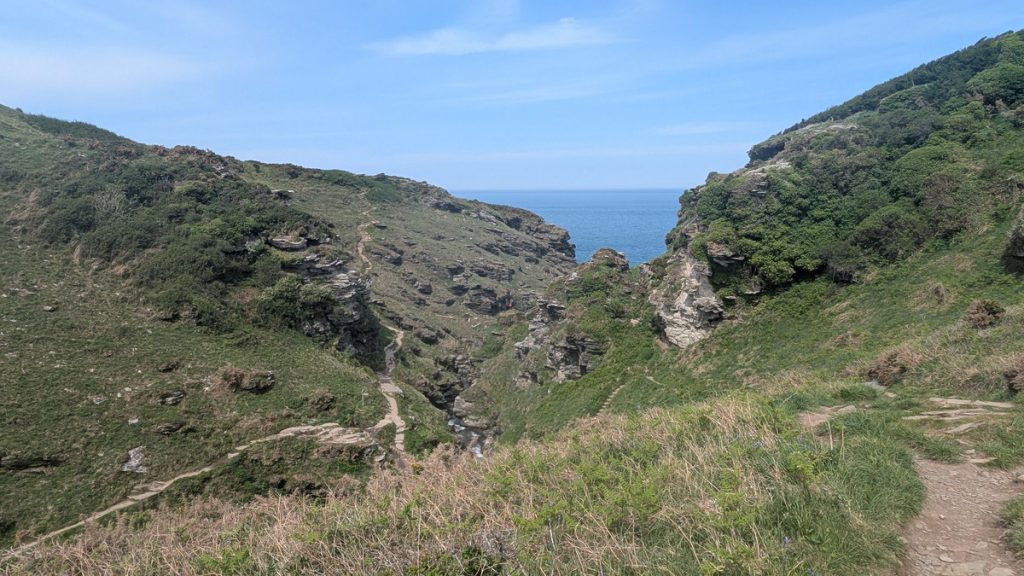
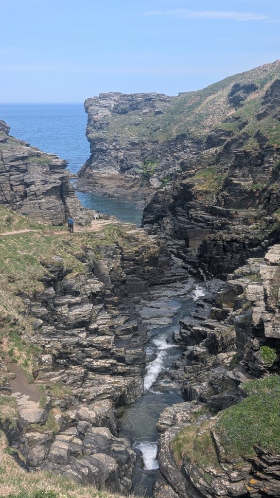
Rocky Valley
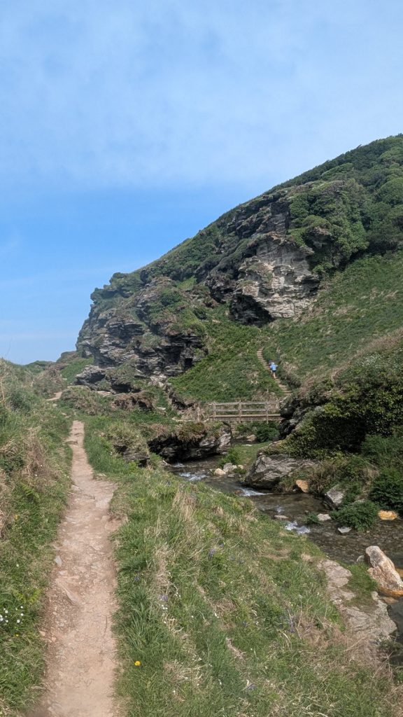
We passed a caravan site just before arriving at the rim of Rocky Valley. The descent down steps into this steep gorge is one of the most atmospheric moments of the walk. The Trevillet River tumbles through the ravine toward the sea, and after crossing a small bridge, Roxie enjoyed a well-earned paddle in the cool water.
Just upstream are the ivy-covered remains of Trewethet Mill, and beside them lie intriguing labyrinth carvings. Their origin is disputed — they may be Bronze Age, scratched into the rock thousands of years ago, or the work of a more recent mill worker with time and imagination to spare.
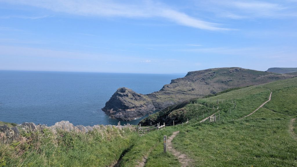
Lye Rock & Bossiney
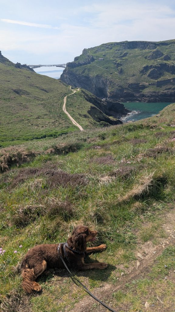
Climbing steeply out of the valley, we rejoined the cliff tops with Lye Rock ahead — a dramatic sea stack with a history of shipwrecks and daring rescues. Far below were the tidal beaches of Benoath Cove and Bossiney Beach. We went down a few steps and crossed the path leading to Bossiney Beach, then climbed again, followed by a descent to cross a stream before ascending to a second Willapark. — another headland and the site of yet another Iron Age settlement. (Apparently, Cornwall was full of cliff fort builders!)
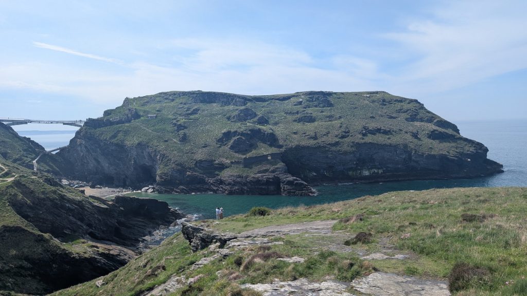
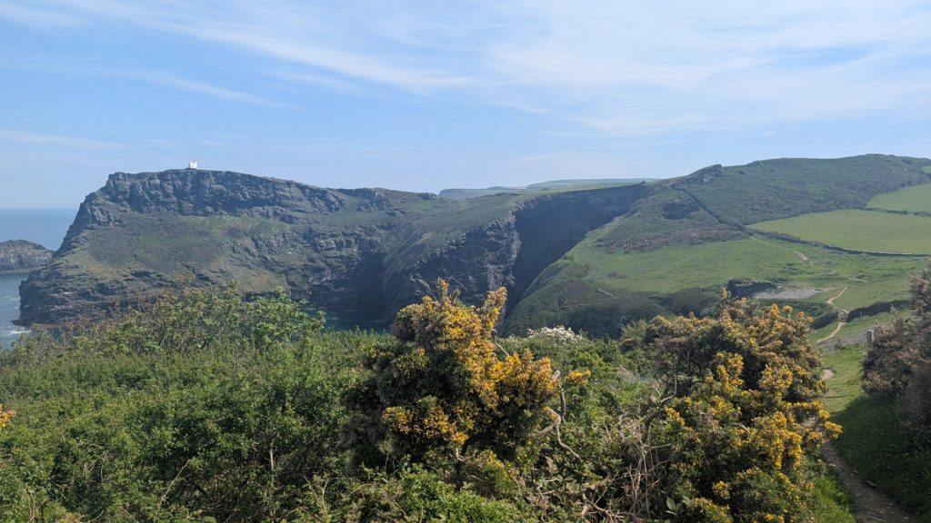
Barras Nose & Tintagel Castle
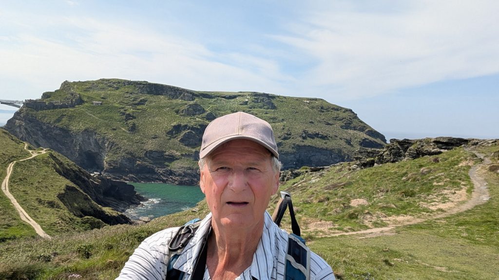
The views became even more impressive as we neared Barras Nose, a narrow finger of land owned by the National Trust to protect its unspoiled beauty. Just beyond, Tintagel Castle came into view — clinging dramatically to a craggy promontory, part legend, part ruin.
We stopped to take in the view and record the moment with some photos, and then descended the slope before climbing up a short way and then down again to the Visitor Facilities for the castle.
Far below, the sea has carved out Merlin’s Cave, accessible at low tide and forever linked with Arthurian folklore.
The castle ruins — partly medieval and partly mythical — cling to the cliffs. Archaeological evidence reveals 5th–7th century buildings, suggesting this was once a powerful post-Roman stronghold. The site was later transformed into a medieval castle in the 1200s by Richard, Earl of Cornwall, who leaned heavily on the King Arthur legend to bolster its mystique.
Far below, the sea has carved out Merlin’s Cave, accessible at low tide and forever linked with Arthurian folklore.
From here, the coast path continues onward, but that was a story for another day. Instead, we turned inland, climbing up into Tintagel village, where we rewarded ourselves with a Pengenna pasty and a drink at the Ye Olde Malthouse Inn.
After a well-earned rest, we made our way up to the car park, which lies about 1.5 km (just under a mile) from the coast path — a final gentle walk to end a short but satisfying walk.
Walk Summary: Boscastle to Tintagel
- Distance: 7.7 km (4.8 miles)
- Elevation gained: 377 m (1237 ft)
- Difficulty: Moderate to Strenuous – short but with steep valleys and climbs
- Moving Time: 2:42 hrs | Elapsed Time: 3:41 hrs
- Highlights:
- Boscastle Harbour & Willapark – harbour views, cliff castle and Coastguard Lookout
- Trevalga & Lady’s Window – tranquil hamlet and a natural cliff arch
- Slate Workings & Cliff Flowers – reclaimed quarries, wildflowers, nesting choughs
- Rocky Valley – tumbling river, ancient carvings, ivy-draped ruins
- Lye Rock & Bossiney – dramatic sea stack and tidal coves
- Second Willapark – another Iron Age cliff fort with wide views
- Barras Nose – narrow headland protected by the National Trust
- Tintagel Castle – legendary fortress linked to King Arthur
- Tintagel Village – pasties, pubs and a gentle finish inland