Crackington Haven to Boscastle is one of the most demanding sections of the South West Coast Path. In just 12 km (7.5 miles) it packs in a relentless sequence of steep ascents and plunging descents over some of Cornwall’s highest and wildest cliffs. From the beak-shaped headland of Cambeak to the sheer face of High Cliff and the hidden waterfall at Pentargon, this is coastal walking at its most dramatic — a day that tests stamina but rewards every step with breathtaking views and rich natural history.
SWCP 12a: The Walk
Challenging—Strenuous
30 April 2025
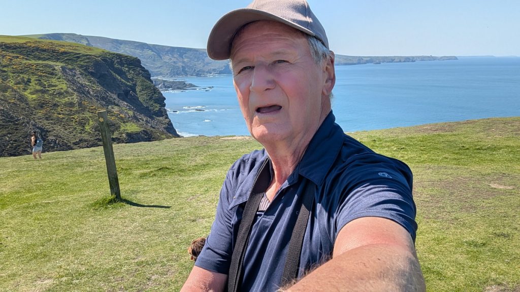
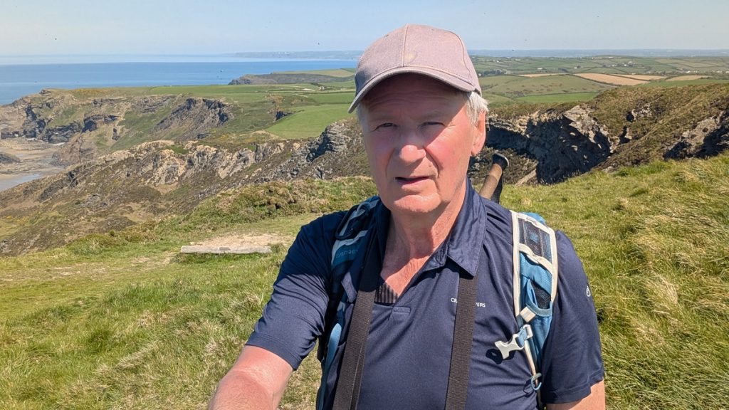
After another night at The Old Mill House, we drove to Tintagel Visitors Centre Car Park and then caught the 95 bus to Crackington Haven. The intention was to walk the 11 miles or so back to Tintagel.
Setting Out from Crackington
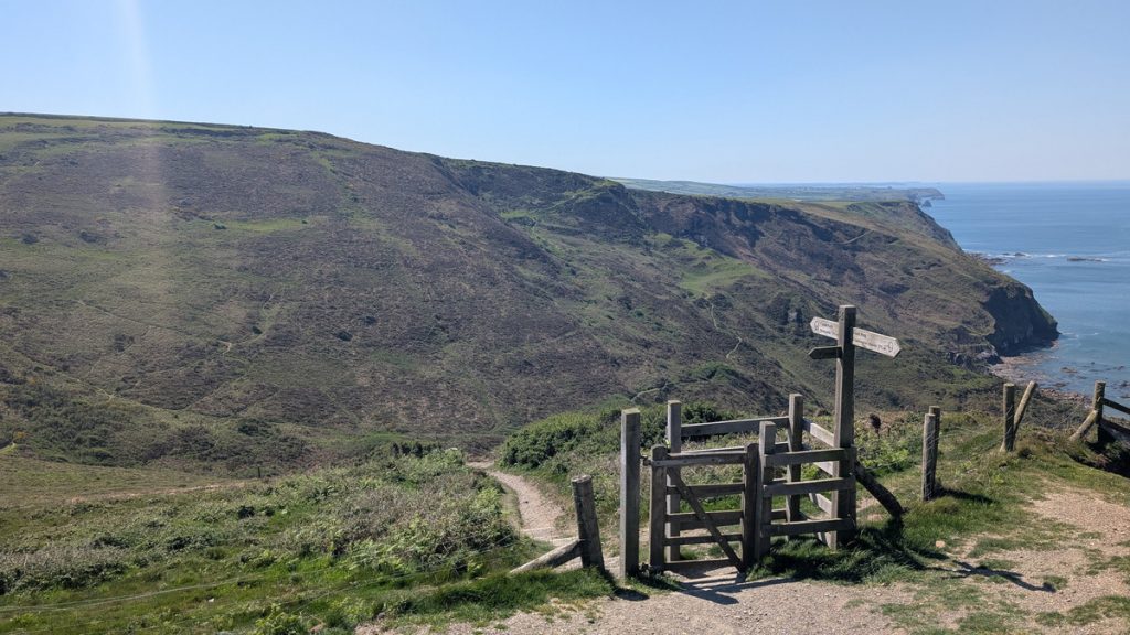
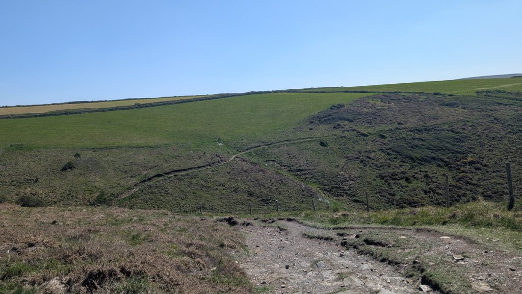
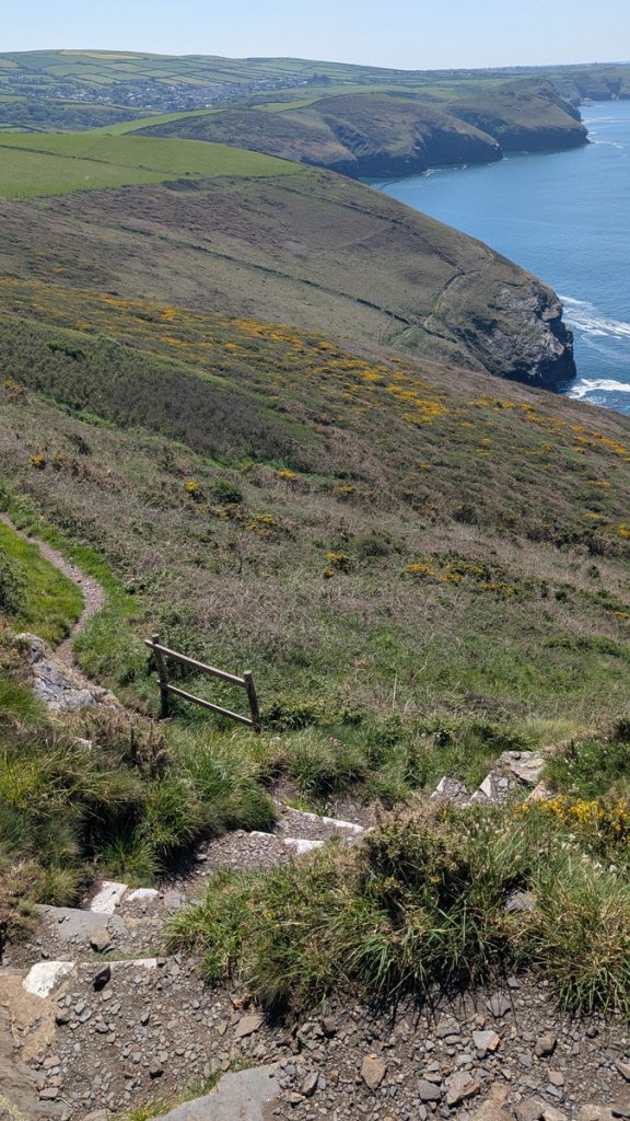
We began the day with a bus ride from Tintagel to Crackington Haven, stepping off by the bridge and heading along the stream by the bridge before climbing steeply away from the beach. The path soon dropped again around Tremoutha Haven, crossed by small footbridges, before the first big challenge came into view: Cambeak.
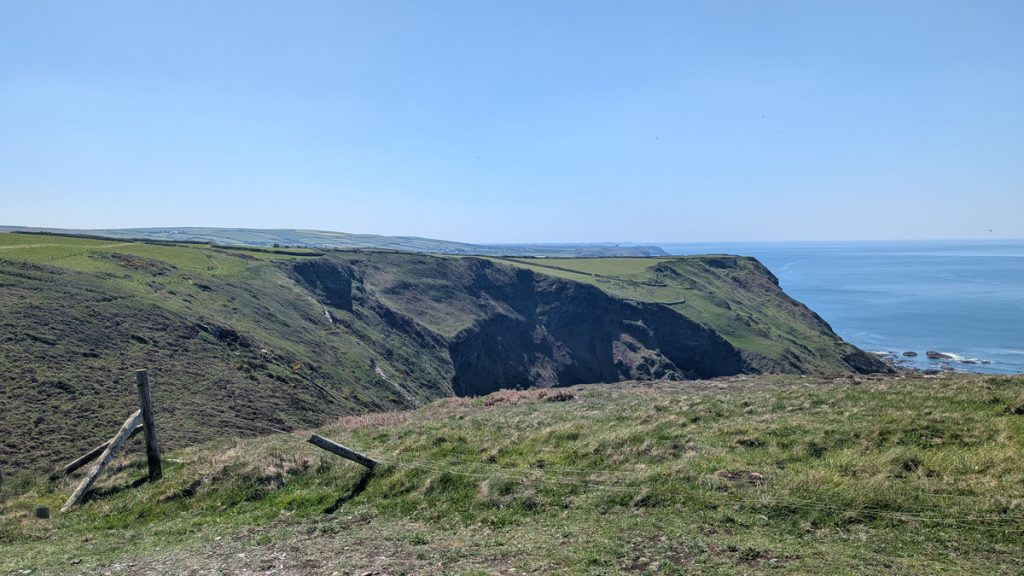
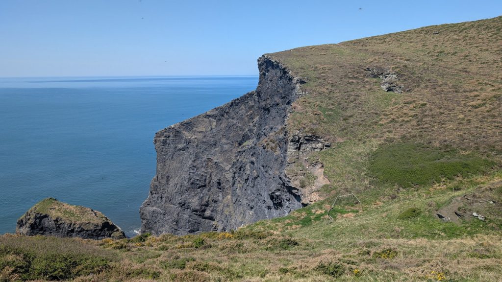
Cambeak and High Cliff
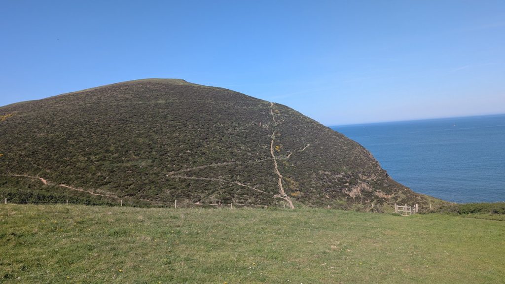
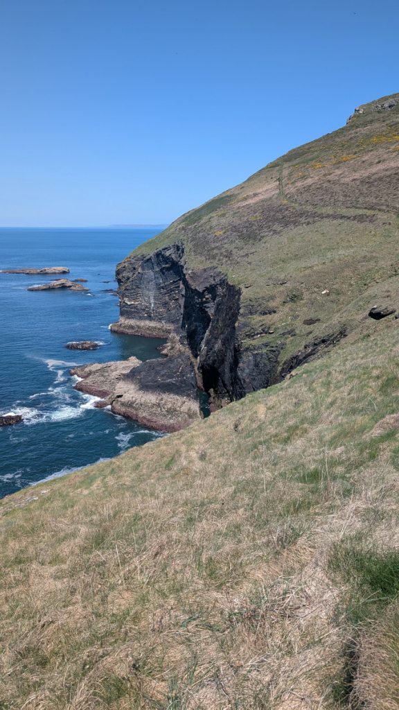
Ahead loomed our first challenge of the day: the striking headland of Cambeak, shaped like a beak—its name derived from the Cornish word “kamm,” meaning crooked, and “bek,” from Old Norse for beak. (The beak bit is on the other side!)
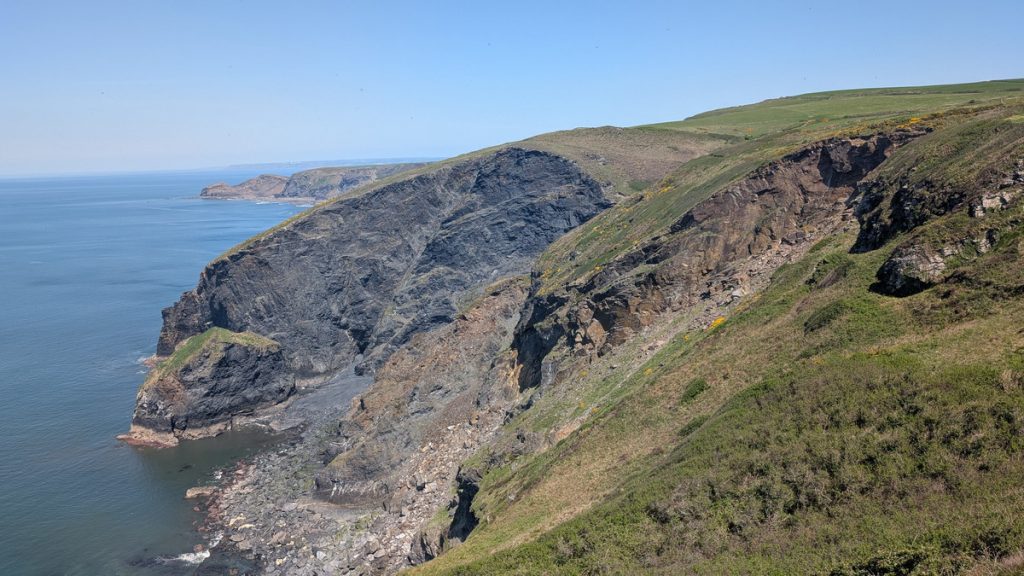
Cambeak is part of the Crackington Formation, a fascinating band of highly folded Carboniferous rock that characterises this coast. The sedimentary layers twisted like toffee, telling a vivid geological story of the ancient Variscan mountain-building event that occurred over 300 million years ago.
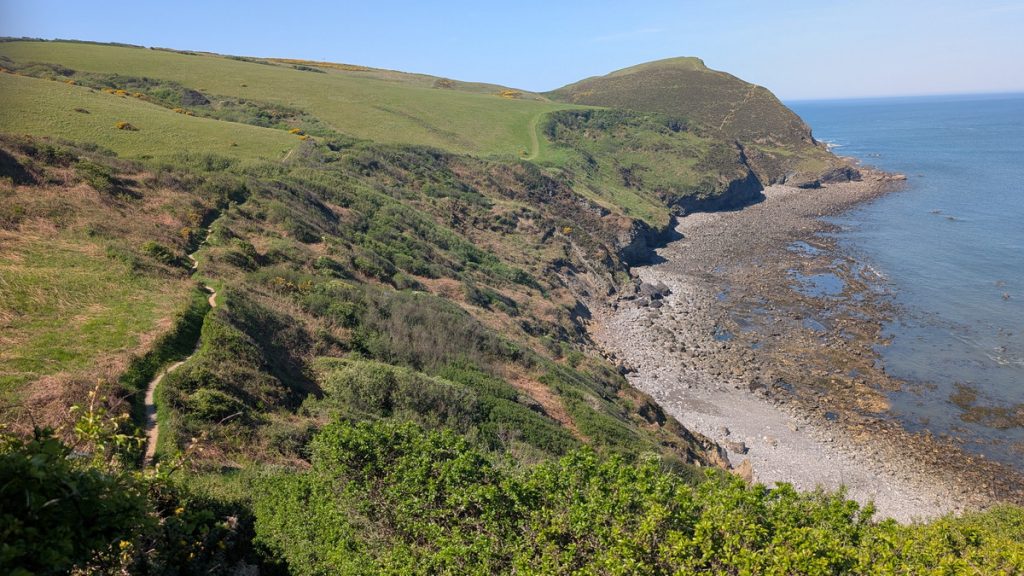
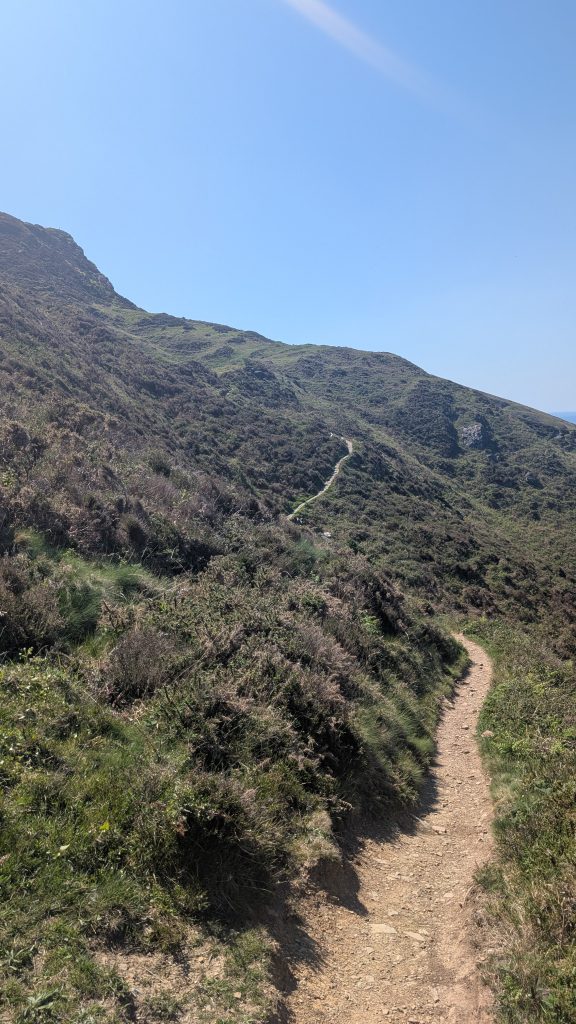
The zigzag climb up Cambeak was tough, but the views from the top were spectacular. After soaking in the scenery, we began our descent from Cambeak, crossing a steep combe before climbing again. The path dipped once more as we navigated a scrubby slope, leading us to the long, steady grassy climb up to High Cliff, Cornwall’s highest sea cliff at 735 feet (224 m).
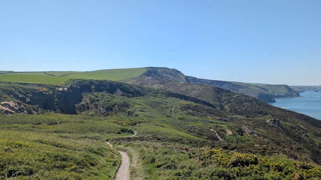
Rusey Beach and Rusey Cliff
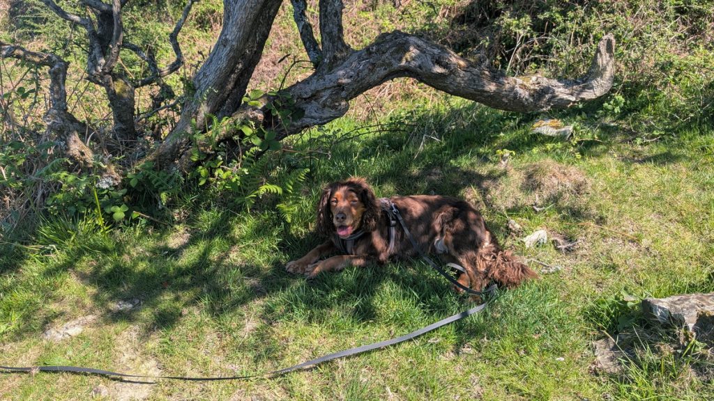
The exhilaration didn’t last long. From High Cliff, we descended 160 steps to the combe at Rusey Beach, then began a long, punishing climb up to Rusey Cliff, another prominent headland. The heat made it harder still, and Roxie eventually flopped under one of the few trees for a much-needed rest and water.
We paused there, too. Out at sea, we kept an eye out for gannets diving or, if we were going to be lucky, dolphins. Unfortunately, luck wasn’t on our side today!
Buckator and Beeny Cliff
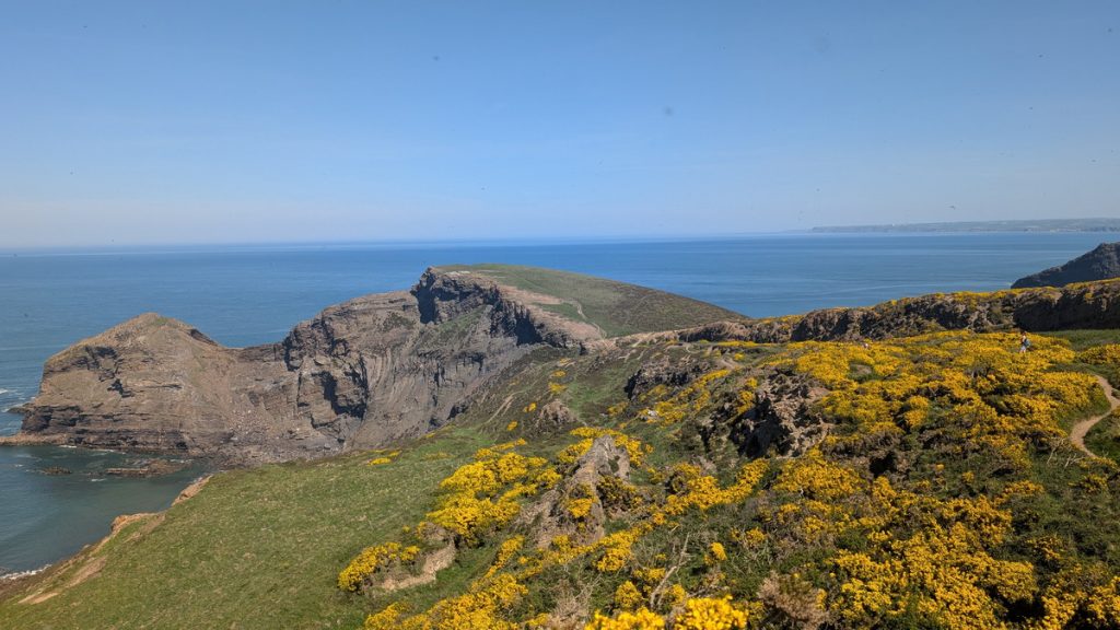
Beyond Rusey, the coast feels remote and wild. The cliffs around Buckator are designated a Site of Special Scientific Interest, rich in flora, butterflies and seabirds. The warm day brought out plenty of butterflies, but we were a bit early for the elusive grayling, a rare butterfly that can be seen in these parts.
After Buckator Cliff, we descended again towards Buckator Beach. Further on, the path levelled briefly along Beeny Cliff and up to Firebeacon Hill, which was once part of a chain of warning beacons lit to signal an invasion. The surrounding gorse and heather moorland is home to lizards, slow-worms, and an abundance of insects in summer.
“Still in all its chasmal beauty bulks old Beeny to the sky.”
— Thomas Hardy, Beeny Cliff
“O the opal and the sapphire of that wandering western sea.”
— Thomas Hardy, Beeny Cliff
“What if still in chasmal beauty looms that wild weird western shore.”
— Thomas Hardy, Beeny Cliff
“Beeny did not quiver, / Juliot grew not gray, / Thin Valency’s river / Held its wonted way.”
— Thomas Hardy, A Death-Day Recalled
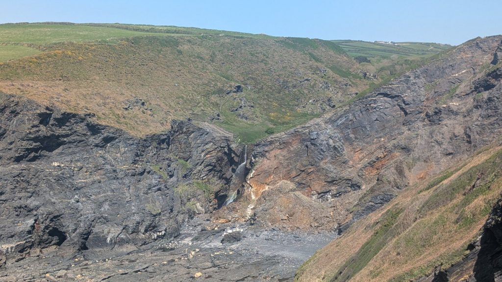
Pentargon Waterfall and the Approach to Boscastle
Here we descended some steep steps before contouring round the slope into the valley at Pentargon. We descended some more steps before crossing a footbridge above the 37-metre (120 ft) Pentagon Waterfall and then climbed up many more steps to the top of the hill by the Boscastle Farm Shop.
Here the sea has eroded the cliffs faster than the river could cut its valley, creating another striking hanging valley. From the Boscastle Farm Shop the trail eased, curving round Penally Point to reveal the dramatic inlet of Boscastle Harbour.
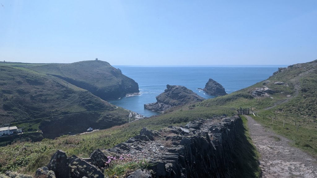
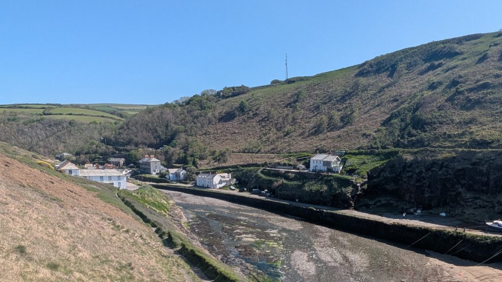
Arrival in Boscastle
The path then veered inland, and soon the village of Boscastle came into view, tucked between steep, wooded hills. Below us lay the dramatic harbour, its natural inlet reinforced by cliffs and stone jetties that have sheltered ships for centuries. We descended a flight of steps, wound our way behind a cluster of buildings, and entered the village.
By this point, we had covered about 12 km (7.5 miles), and with the heat taking its toll, we decided to call it a day. Conveniently, the Cobweb Inn—opposite the bus stop—provided the perfect place for a refreshing drink before we caught the 16:10 number 95 bus back to Tintagel and our car.
More recently, Boscastle became known for the devastating flood of 2004, when torrential rain swept through the harbour — remarkably with no loss of life. Today, the village is restored and thriving, with tea rooms, galleries, and historic pubs like the Cobweb Inn, where we ended the day before catching the bus back to Tintagel.
Historically, Boscastle was an important fishing village and trading port, reaching its peak in the 19th century. Due to the lack of nearby roads and railways, goods like lime, coal, and slate were shipped in and out via the harbour, often offloaded onto donkeys that carried cargo up the steep hillsides. Today, echoes of its working past survive in harbour warehouses, narrow lanes, and stone buildings with slate roofs.
Boscastle has retained its charm and authenticity. It’s small and compact, with a few independent shops, galleries, tea rooms, and pubs — including the historic Cobweb Inn, which claims to be one of Cornwall’s most haunted pubs. The village is popular with walkers, artists, and anyone seeking a quieter, more contemplative corner of Cornwall.
Boscastle became nationally known after the devastating flood of 16 August 2004, when torrential rain sent a wall of water crashing through the village, sweeping away cars and buildings. Remarkably, no lives were lost, and the rebuilt village now stands strengthened by new flood defences and restoration efforts.
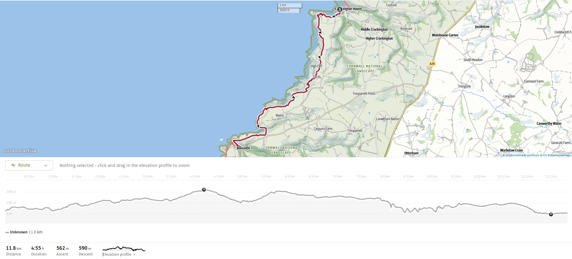
Walk Summary: Crackington Haven to Boscastle
- Distance: 9.4 km (5.8 miles)
- Elevation Gained: 590 m (1934 ft)
- Difficulty: Strenuous – multiple steep climbs, including Cambeak, High Cliff, and Pentargon
- Moving Time: 3:51 · Elapsed Time: 4:51
- Highlights:
- Tremoutha Haven – narrow combe crossed by bridges, marking the first dip after Crackington.
- Cambeak – striking headland with steep zigzag climb and outstanding views.
- High Cliff – Cornwall’s highest sea cliff at 224m (735 ft), followed by long descent to Rusey Beach.
- Rusey Beach & Cliff – remote cove with tough climb to dramatic headland, seabird sightings possible.
- Buckator & Gull Rock – remote SSSI coastline, rare butterflies, and striking sea stacks.
- Beeny Cliff & Firebeacon Hill – open moorland with historic beacon site, linked to Spanish Armada defences.
- Pentargon Waterfall – 120-ft (37m) drop into the sea from a hanging valley, crossed via footbridge.
- Boscastle Harbour Entrance – narrow natural harbour revealed dramatically as the path curves inland.
- Boscastle Village – historic slate-built harbour town, rebuilt after 2004 flood, home to the haunted Cobweb Inn.