Bude to Crackington Haven is a demanding 13 km (8-mile) stage of the South West Coast Path, combining beaches, dramatic geology and a string of challenging climbs. From castle and canal in Bude, the route passes the long sands of Widemouth Bay, the folded cliffs of Millook Haven, and the wooded slopes of Dizzard before tackling several more steep valleys on the approach to Crackington. It’s a day of changing scenery — and plenty of ups and downs — rewarded at the end with one of Cornwall’s most dramatic coves.
Base at Trebarwith
For this section and the following days, we based ourselves at The Mill House pub in Trebarwith, near Tintagel — a cosy spot to return to each evening and handy for an evening stroll down to Trebarwith Strand.
SWCP 11: The Walk
Challenging—Strenuous
29 April 2025
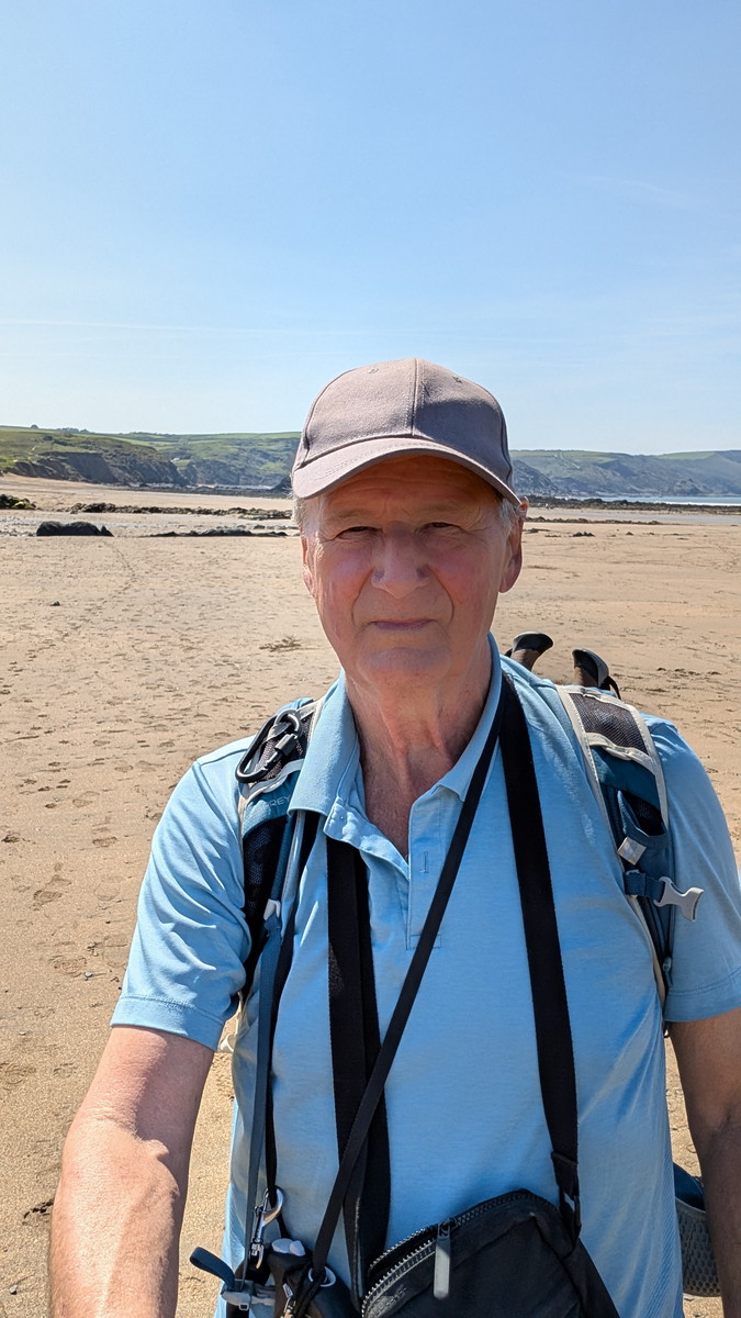
Setting Out from Bude
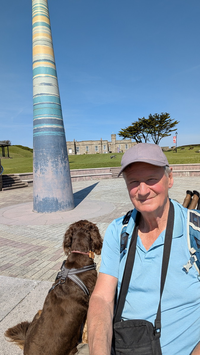
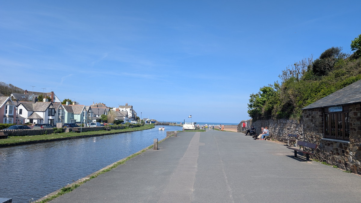
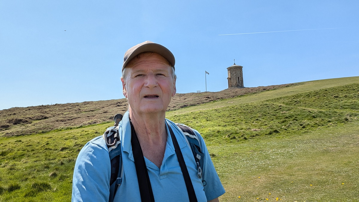
We parked at Crackington Haven and caught the 95 bus back to Bude, starting at the castle. From there, the walk began gently, following the Bude Canal across the lock gates and out towards the beach. The Storm Tower (the “Pepperpot”) stood above us on Efford Down as we began to climb steadily along the cliff.
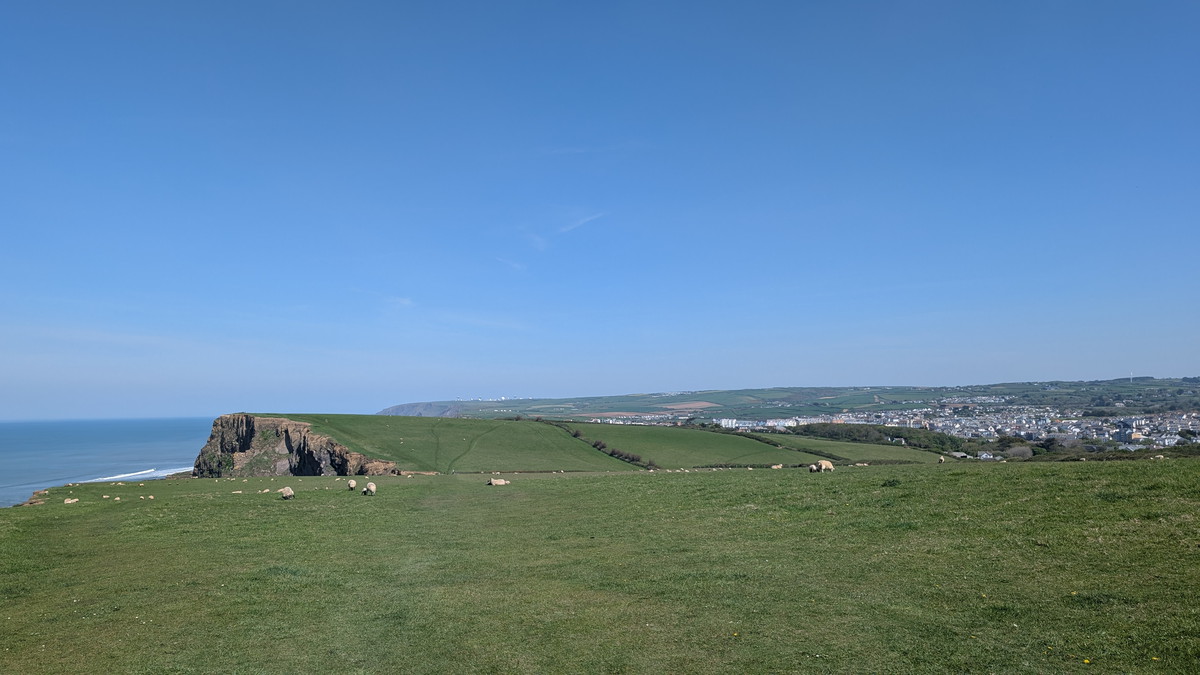
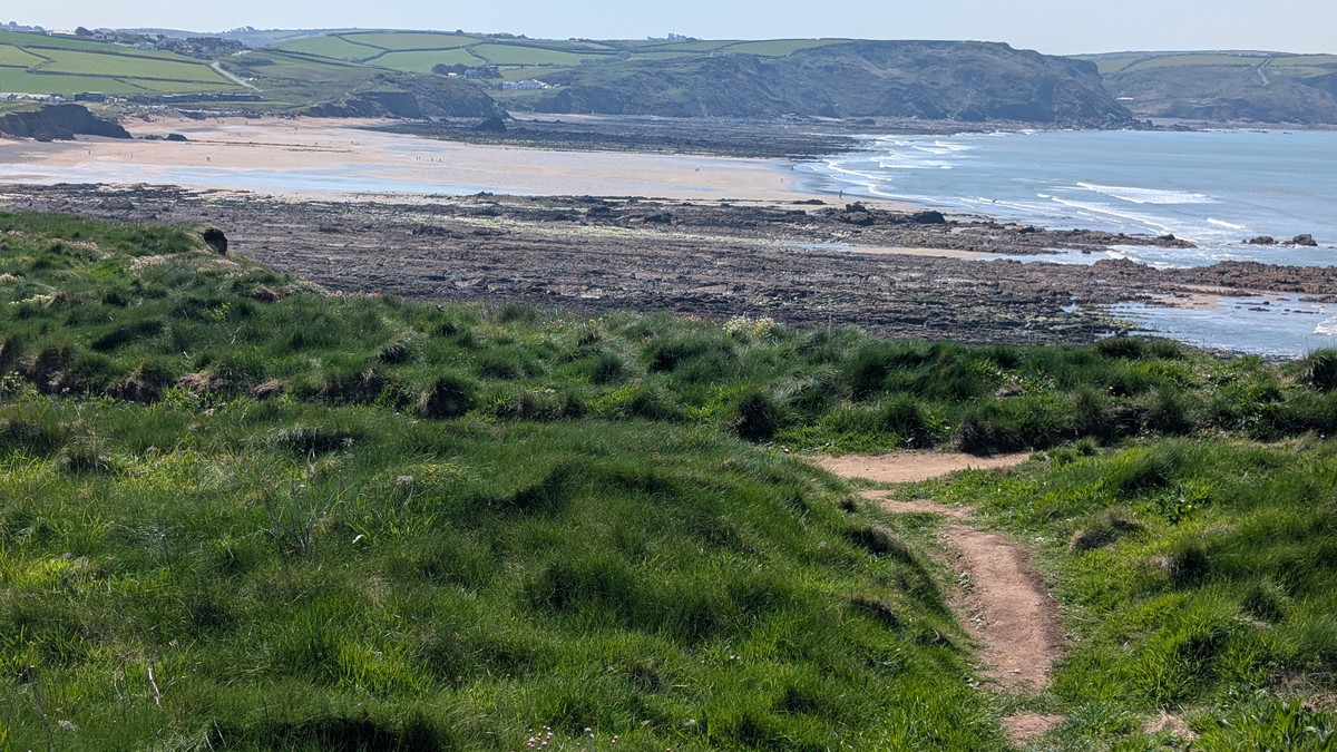
Across Efford Down to Widemouth Bay
The path followed the grassy edge of Efford Down, with wide views over the coast, before dipping to the road at Upton and regaining the cliffs. Rocky coves and jagged outcrops lined the way until the sandy expanse of Widemouth Bay came into sight.
The trail skirted Higher Longbeak and curved around Lower Longbeak before descending to the beach. In April, Roxie was free to enjoy the full stretch, though in summer, dogs are restricted to the southern end near Black Rock.
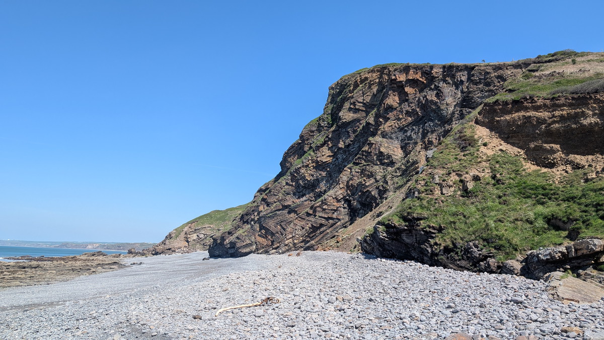
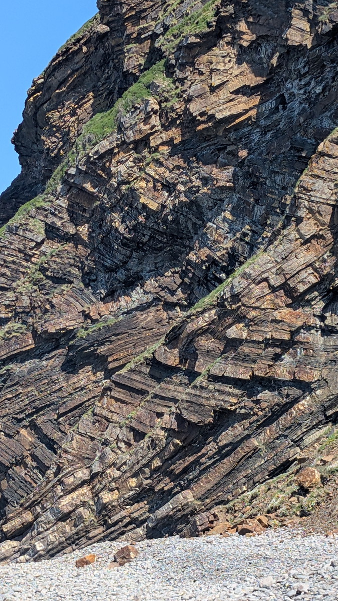
Millook Haven – Zig Zag Folds
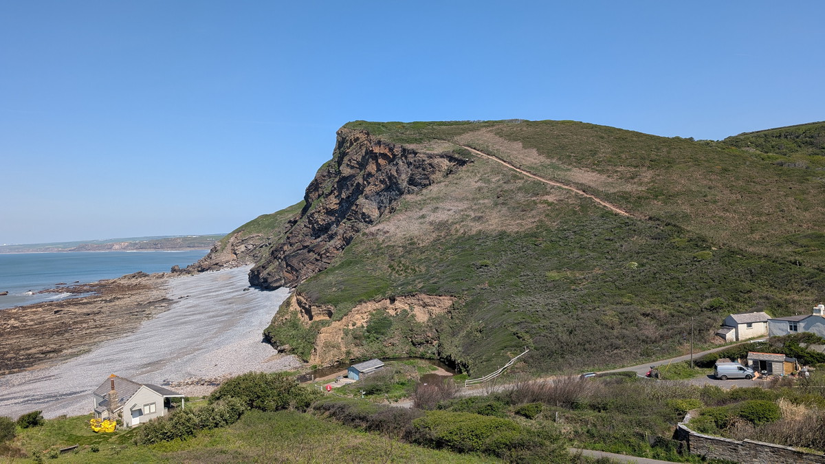
After crossing the beach, we climbed up through the car park and along the road before dipping back down past Wanson Water. After a steep climb out, up to Penhalt Cliff, we dropped down to Millock and the extraordinary geology of Millook Haven. From the beach, the cliffs reveal famous Zig Zag folds — contorted strata of Devonian rock twisted like giant ribbons. It’s one of the most striking geological features on the entire Coast Path.

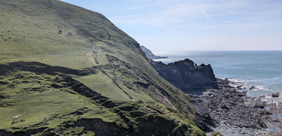
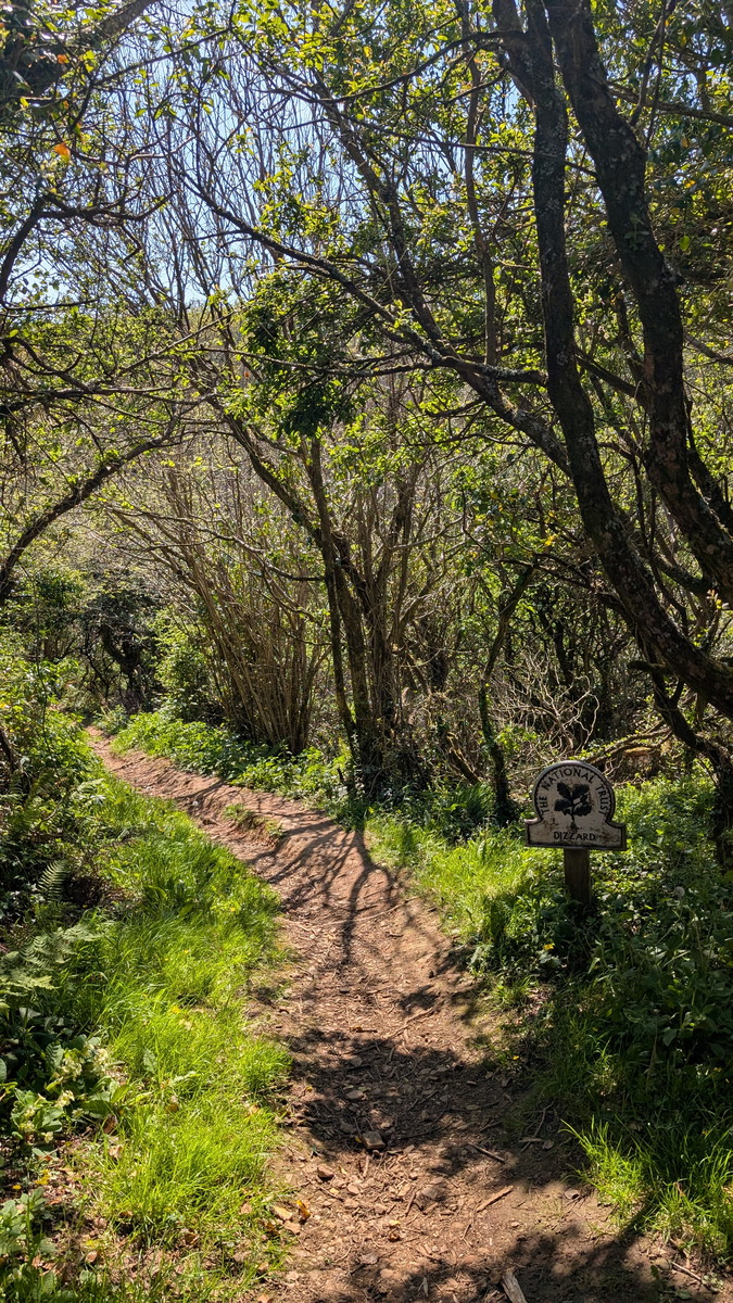
Into the Dizzard
Climbing out again, the route rose past Millook Common before entering the wooded slopes of the Dizzard, an ancient woodland dating from 6500-4000 BC. The path threaded along the woodland edge, shaded and atmospheric, before descending steeply into Cleave Strand by a zig-zag trail. Roxie made the most of the stream at the bottom before we slogged up the opposite slope with its grazing horses. At the top, we followed the cliff top around Penkenna Point.
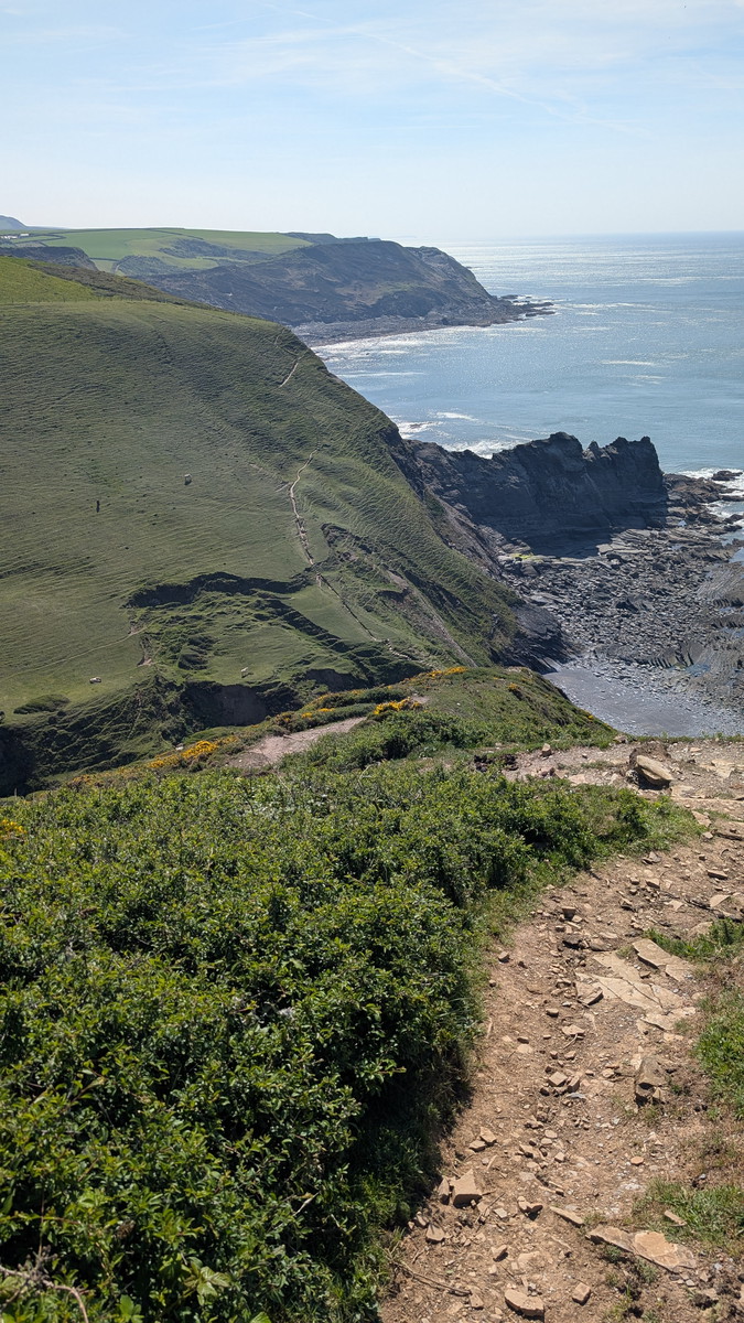
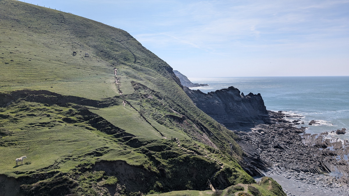
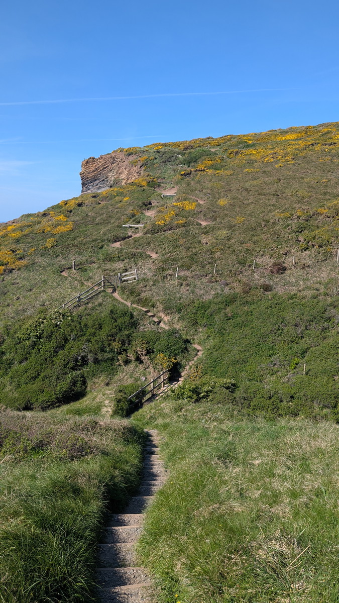
Endless Ups and Downs
The path continued its relentless pattern — with another a dip and a climb, at Little Barton Strand. Each one feeling like it might be the last. Above Pencarrow Point, the trail finally turned inland and descended steadily towards Crackington Haven.
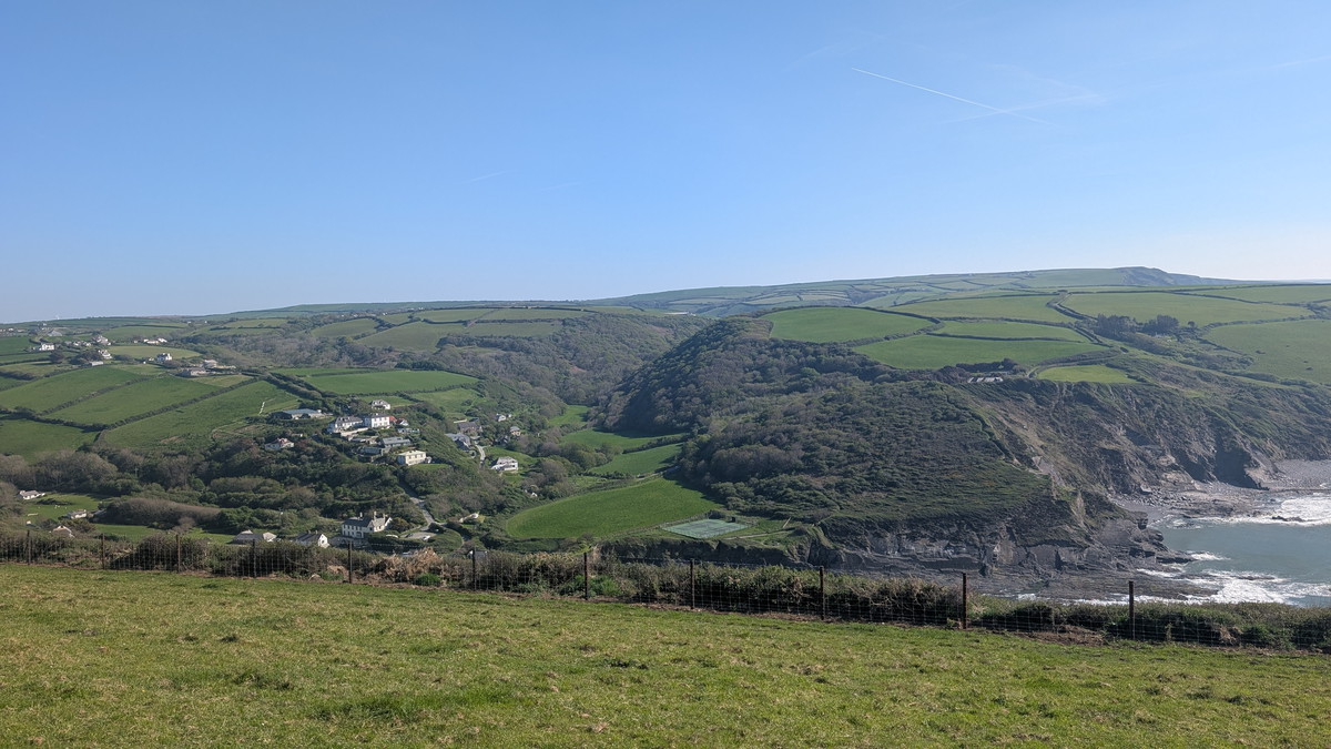
A Welcome Rest
At the end of a long day, we headed straight for the Coombe Barton Inn. Over a drink, we shared stories with another walker, who agreed the final miles seemed to stretch on endlessly. It was a fitting conclusion to a tough but memorable stage — coastal walking at its most rugged and rewarding.
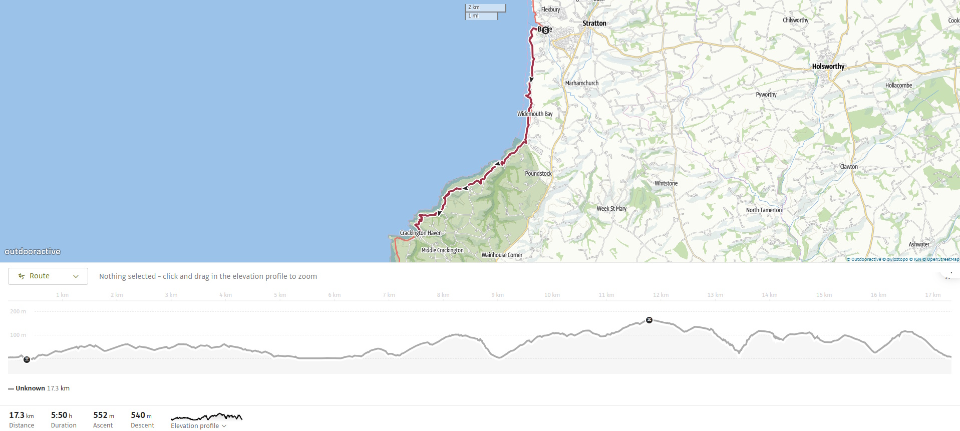
Walk Summary: Bude to Crackington Haven
- Distance: 16.9 km (10.5 miles)
- Elevation Gained: 695 m (2279 ft)
- Difficulty: Challenging – strenuous climbs, especially at Millook and Dizzard
- Moving Time: 5:05 · Elapsed Time: 6:01
- Highlights:
- Bude Castle & Canal – start by the castle and lock gates
- Efford Down & Storm Tower – clifftop views and the Pepperpot lookout
- Widemouth Bay – long sandy beach, dog-friendly south end
- Wanson Water Valley – stream crossing and steep climb to Penhalt
- Millook Haven – famous Chevron-folded cliffs
- Millook Common & Dizzard – steady climb past ancient oak woodland
- Cleave Strand – steep zigzag valley crossing
- Little Barton Strand – short dip before Pencarrow Point
- Crackington Haven – small village with beach and Coombe Barton Inn