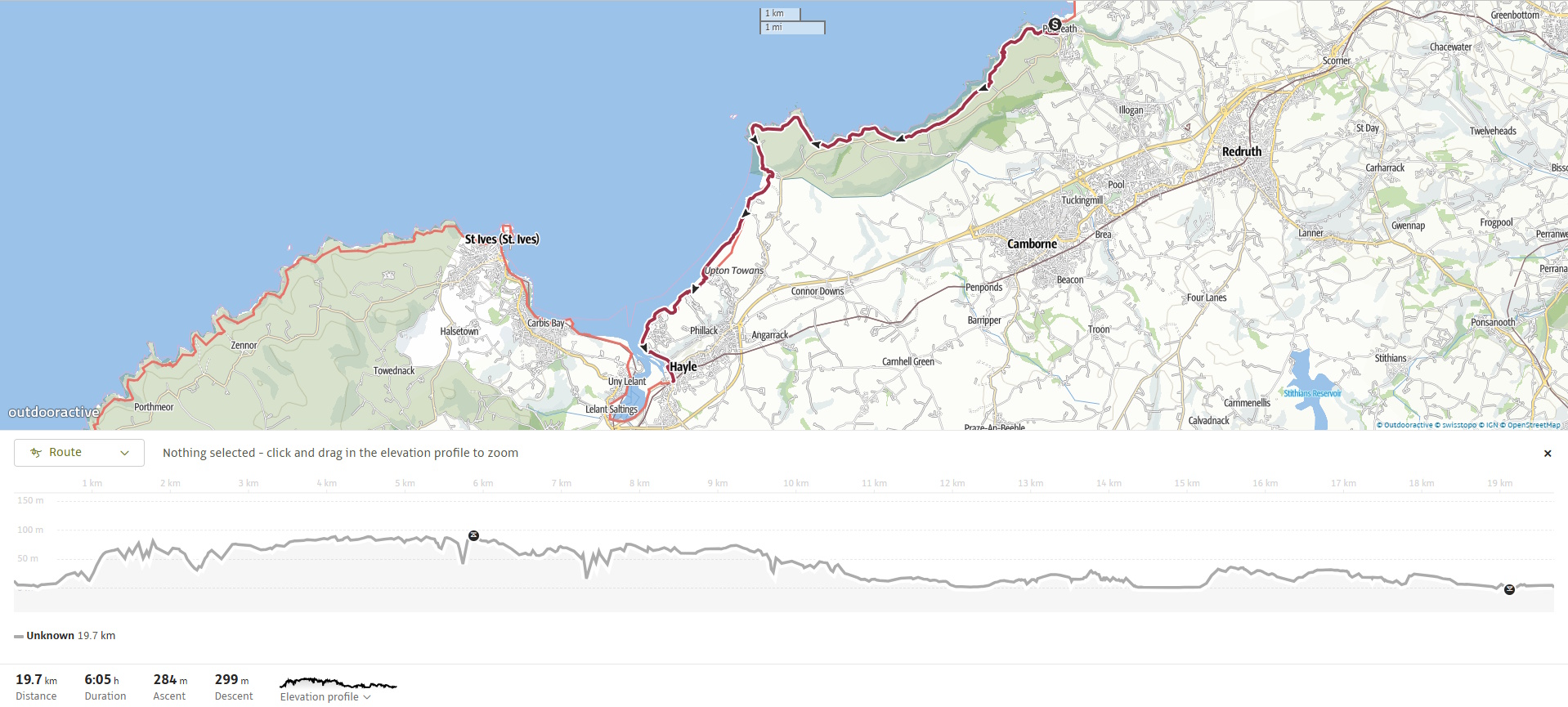
The South West Coast Path from Portreath to Hayle offers a varied 12.5-mile (20 km) journey across some of Cornwall’s most striking scenery. Starting with rugged cliffs and mining heritage around Portreath, the route continues over high headlands, descends to long sandy bays, and finally follows the sweeping dunes and estuary views of St Ives Bay. This stretch combines history, wildlife, and big Atlantic panoramas, making it one of the most rewarding walks on the north coast.
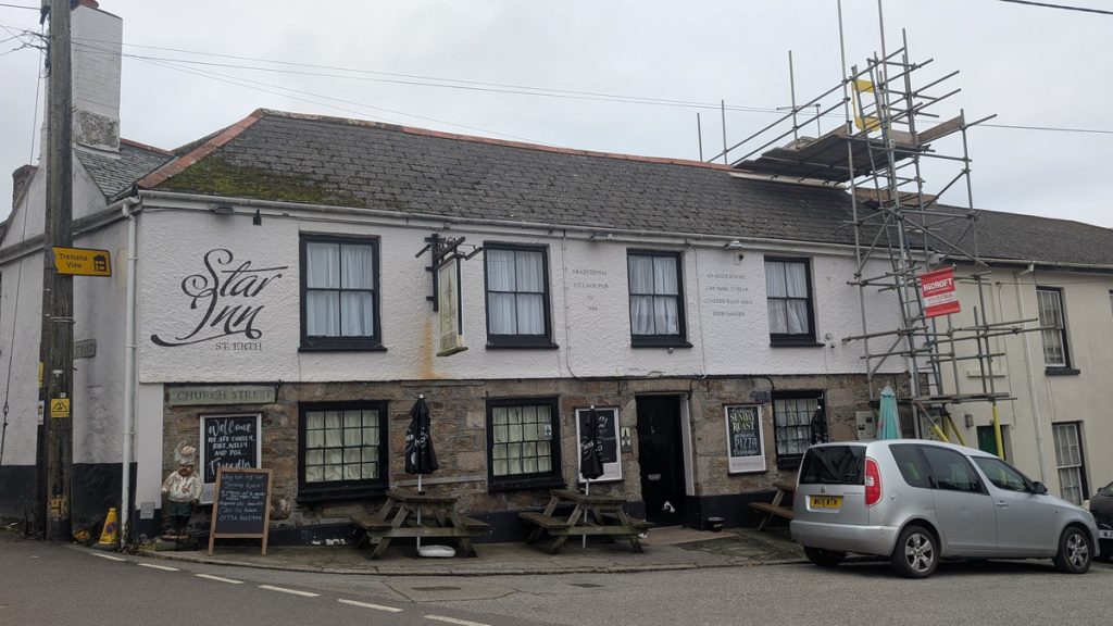
We travelled down the day before and stayed overnight at the Star Inn in St Erth. The following morning, we drove the short distance into Hayle and left the car at the Foundry Car Park. From there, it was only a short walk to the station, where we took the train to Redruth before catching the 49 bus to Portreath from just outside the station.
SWCP 19: The Walk
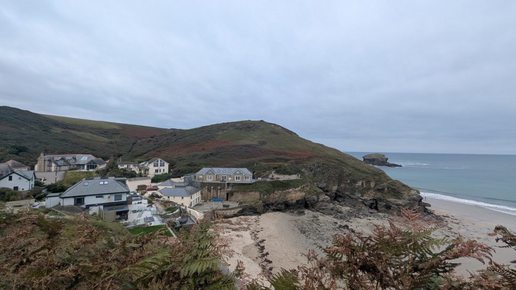
Leaving Portreath
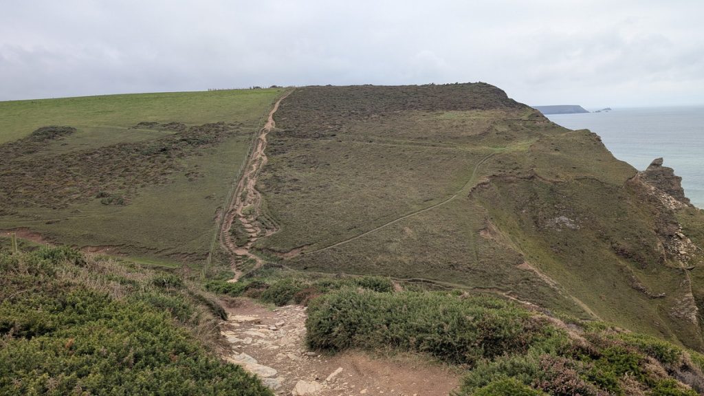
Leaving Portreath Beach, the South West Coast Path follows the road up Battery Hill, climbing steeply before dropping down at the far southern end of the bay. From here, we turned inland up a narrow valley path. The official route diverts sharply right up steep steps onto Western Hill — a turn we missed — but continuing on still brought us out on the clifftop above Western Cove, with fine views back along the coast.
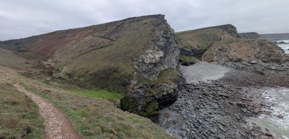
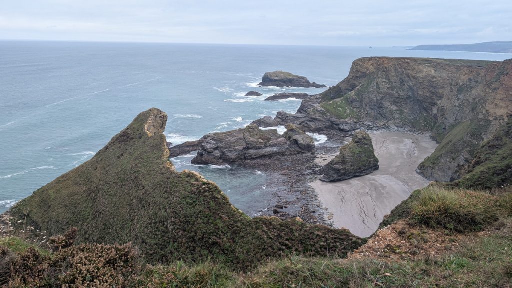
At the far end of Western Cove lies a narrow inlet known as Ralph’s Cupboard, separated from the main cove by a rocky promontory called The Horse. The inlet is the collapsed remains of a sea cave, and its name is steeped in legend. Some say it was once a smugglers’ hideaway, used to stash contraband beyond the reach of customs men. Others tell a more fantastical tale — that it was the lair of a fearsome giant, the so-called Wrath of Portreath (later corrupted to Ralph), who hurled boulders at passing ships, plundered their treasure, and devoured their crews.
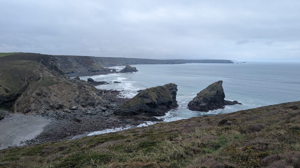
Continuing across the wide heathland of Carvannel Downs, the path drops steeply beside Porth-cadjack Cove before climbing again and descending once more beside Basset’s Cove. From here, the route rises towards the headland above the offshore Crane Islands, where the grassy outline of Crane Castle, an Iron Age promontory fort, still marks the landscape — a reminder that this dramatic coastline has been settled and defended for thousands of years. Heavy erosion has taken its toll over the centuries, with the Crane Islands once forming part of the headland and its castle.
Reskjeage Downs and North Cliffs
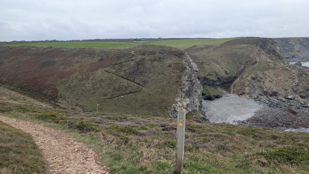
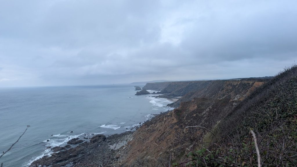
The path soon levelled out as we crossed the broad expanse of Reskajeage Downs, a stretch of open heathland high above the North Cliffs. Here, the walking was easier underfoot, with a well-made and accessible path maintained by the National Trust, which cares for this dramatic section of coastline. The contrast with the earlier ups and downs made it a welcome change of pace.
From the clifftops, we looked down over a series of coves carved into the rugged shoreline — Greenbank Cove and Derrick’s Cove, followed by not one but two separate inlets named Deadman’s Cove, grim reminders of the countless shipwrecks that have taken place along this hazardous stretch of coast.
The drama built as we approached Hell’s Mouth (The Devil’s Mouth), where the cliffs drop almost sheer for nearly 90 metres (300 feet) into the churning sea below. It’s one of the most spectacular viewpoints on the north coast, with sweeping views in both directions and a sobering sense of the power and danger of the Atlantic.
The Knavocks and Godrevy Point
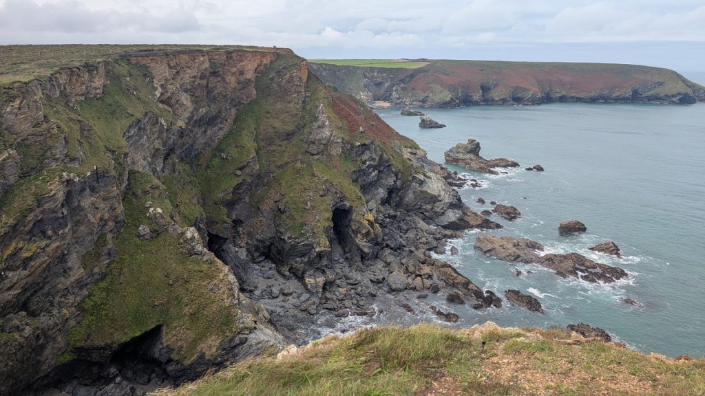
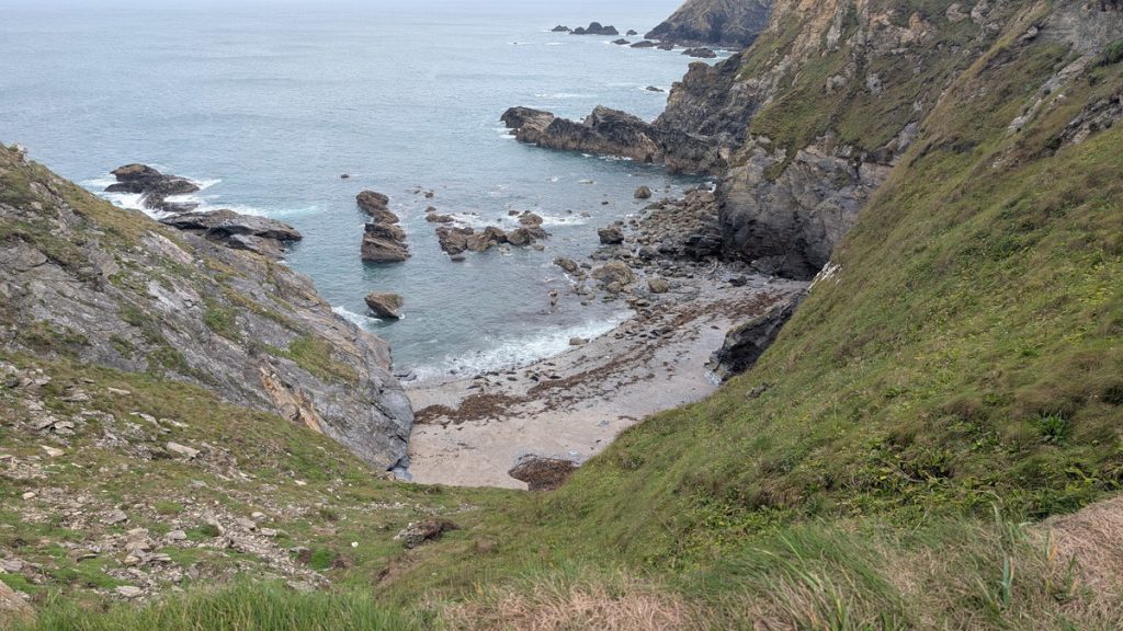
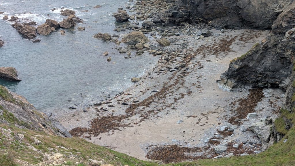
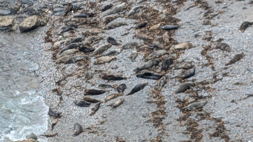
The path carried us across the heathland of The Knavocks, a National Trust reserve rich in wildflowers and birdlife, before curving around the windswept headland of Navax Point. From here, the views opened out across secluded coves and sheer cliffs until we reached Mutton Cove, where a large colony of grey seals was spread across the sand below — a memorable sight best enjoyed quietly from the clifftop.
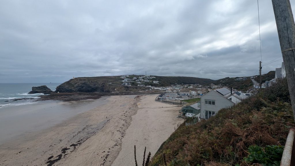
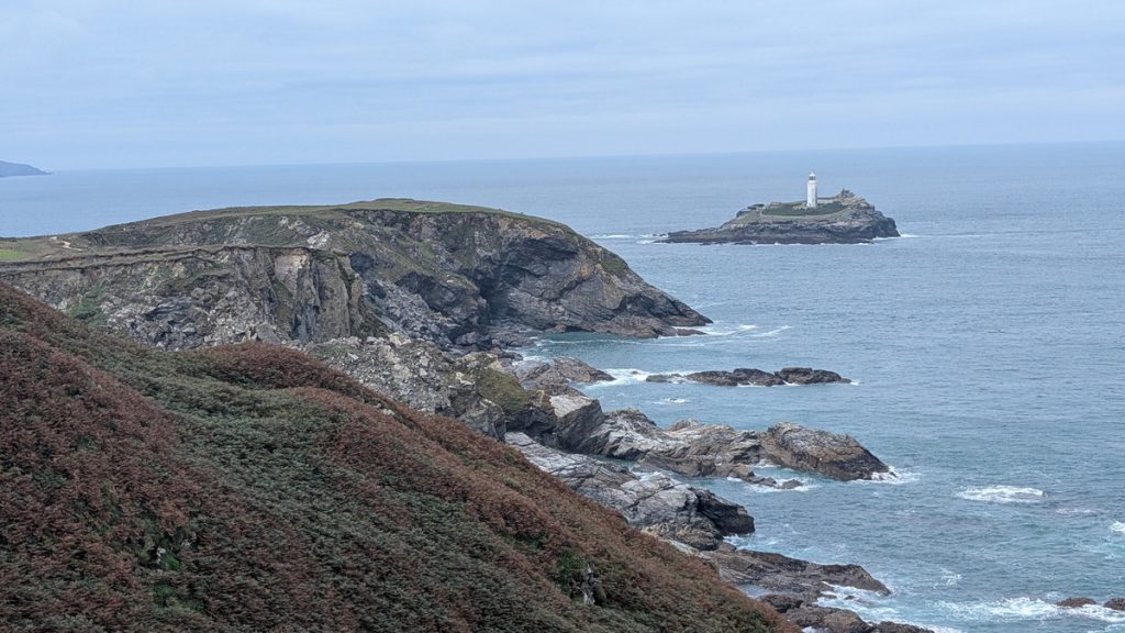
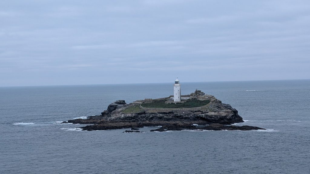
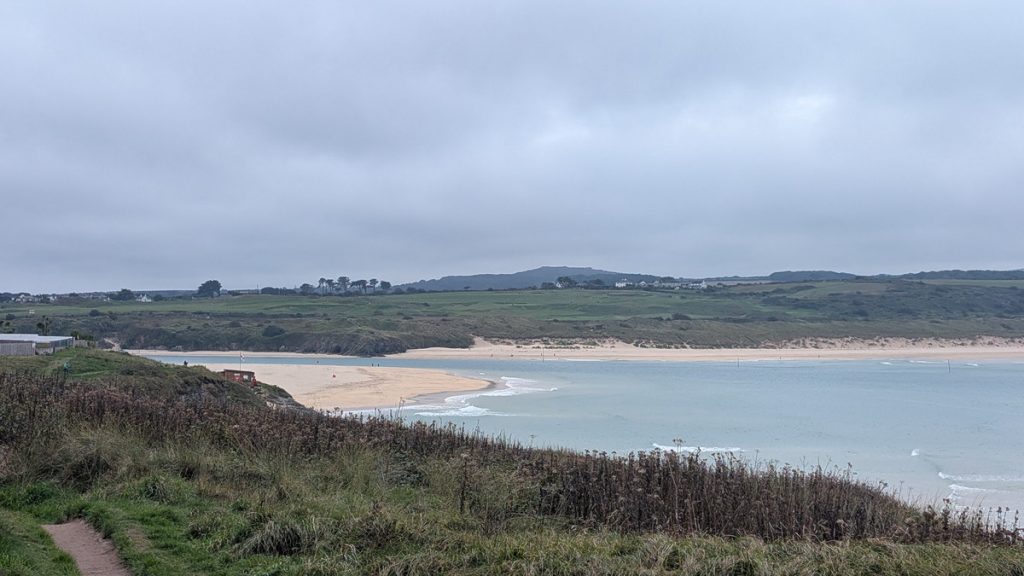
Beyond this, the route followed the coast toward one of Cornwall’s most recognisable landmarks, Godrevy Lighthouse. Perched on a rocky island at the northern tip of St Ives Bay, the 19th-century lighthouse stands as both a striking feature of the seascape and the inspiration for Virginia Woolf’s famous novel To the Lighthouse. From the clifftops, the panoramic views take in the sweep of St Ives Bay, with its vast golden beaches stretching south toward Gwithian and Hayle.
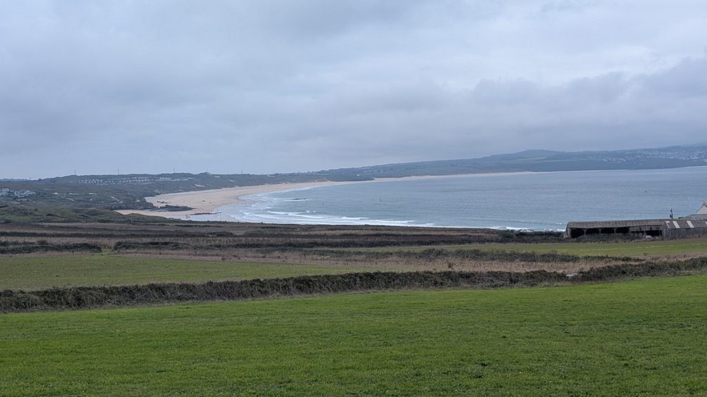
Crossing the Hayle Towans into Hayle
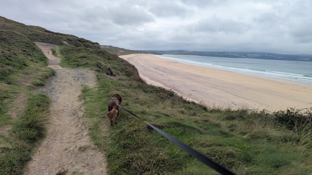
From this point, the walk changes character as the rugged cliffs give way to the sweeping sands of Gwithian Beach. We passed the National Trust car park and facilities, then, following a signed diversion, crossed the Red River and continued through the Gwithian Towans Nature Reserve before entering the dunes.
The final kilometres unfolded across the vast dune system known as the Towans, stretching for nearly 6 km (4 miles) behind the beaches of Gwithian, Upton Towans, Mexico Towans, and Riviere Towans. This area is a haven for birdlife and wildflowers, with rolling dunes offering sheltered paths and shifting views of the Atlantic. The area also has a rich history: the dunes conceal wartime training sites and the remains of earlier mining and industrial activity.
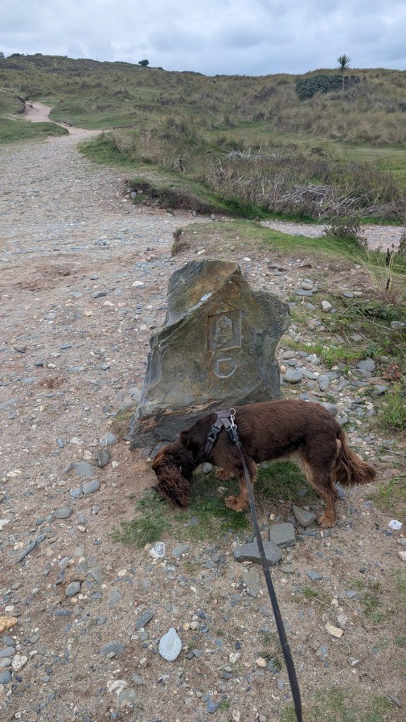
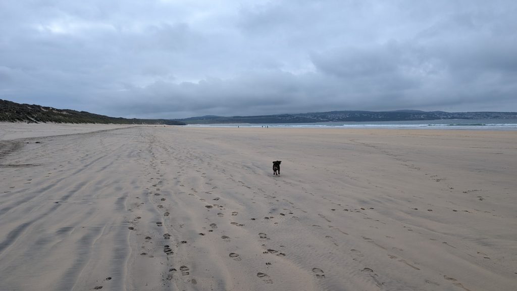
Here, a maze of sandy tracks and grassy paths make route-finding a little confusing, though the Official Coast Path is marked by large granite waymarkers. It was the perfect spot for Roxie to roam off the lead, dashing from dune to dune and exploring every hollow. We followed a path running close to the cliff edge, with Roxie back on the lead for safety, until it eventually brought us down onto the beach itself. After walking along the shoreline, we left by a set of steps beside the Beachside Holiday Park, then rejoined the Coast Path past more holiday chalets and a car park before entering the new North Quay development in Hayle.
Crossing the Swing Bridge, we couldn’t resist a diversion to Philps Bakery, famed for its Cornish pasties, where we enjoyed a late lunch. From there, the route continued beneath Brunel’s railway viaduct and back to the car.
Hayle, once a major centre of the Cornish mining and foundry industry, is today a lively harbour town with cafés, shops, and views across the estuary towards Lelant and St Ives. The estuary itself is now an RSPB reserve, internationally important for wintering wildfowl and waders, adding a final touch of natural heritage to the walk.
Hayle’s Industrial Past
Hayle was once a powerhouse of Cornish industry, its harbour busy with the export of copper and tin and the import of coal to fuel the mines. The great foundries of the 18th and 19th centuries, especially Harvey & Co., produced engines and machinery that were shipped across the world, leaving an industrial legacy now recognised as part of Cornwall’s World Heritage landscape.
Landmarks and Legacy
Crossing into the town, the most striking feature is the railway viaduct, first built under the vision of Isambard Kingdom Brunel to carry the main line west. Alongside the quays and harbour structures, it reflects Hayle’s crucial role in Cornwall’s industrial story, while the Hayle Estuary remains a haven for wildlife and an RSPB reserve of international importance.
Walk Summary: Portreath to Hayle
- Distance: 19.8 km (12.3 miles)
- Elevation Gained: 363 m (21191 ft)
- Difficulty: Moderate – steady climbs at first, then easier along cliffs and across Towans
- Moving Time: 4:36 · Elapsed Time: 5:29
- Highlights:
- Portreath Harbour – historic mining port and breakwater
- Pepperpot Daymark – distinctive clifftop navigation marker
- Carvannel Downs – mining relics with wide coastal views
- Hell’s Mouth – dramatic cliff chasm and viewpoint café
- Navax Point – seabird cliffs and seal-spotting coves
- Mutton Cove Seals – clifftop viewpoint over a seal colony
- Godrevy Lighthouse – iconic 19th-century light on a rocky island
- Gwithian Beach – sweeping sands and dune-backed coastline
- Towans– vast stretch of golden sands and dunes running 6 km behind Gwithian
- Hayle Estuary – birdlife haven and historic harbour town
- Hayle – historic harbour town with Brunel’s railway viaduct and estuary views