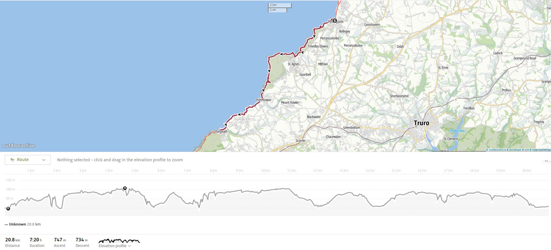
The South West Coast Path from Perranporth to Portreath is a varied and rewarding stage that blends Cornwall’s wild beauty with echoes of its industrial past. Expect rugged clifftop walking, the haunting remains of tin-mining heritage, and a string of small sandy coves that break up the rocky shoreline. Sweeping Atlantic views and steep climbs make this a challenging section at times, but the combination of natural drama and rich history makes every mile worthwhile.
We stayed a second night at the Jasmine House Guest House in Newquay. Today, we had time for breakfast before we left. We packed up and drove to Portreath, where we managed to find a parking spot on the road into the village. We walked down to the seafront and were picked up shortly after by Daz, who took us back to Perranporth.
SWCP 18: The Walk
Challenging – Moderate to Strenuous
21 August 2025
From Perranporth to Cligga Head
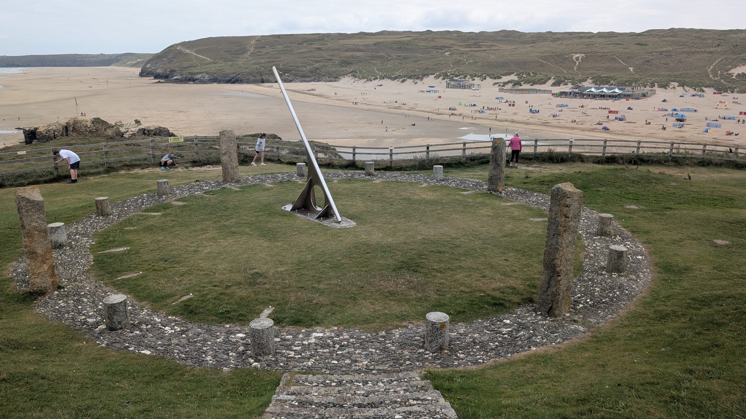
Once we were dropped off, we set out from Perranporth, climbing up past the Millennium sundial above the former Droskyn mine — the dial shows ‘Cornish time’ which is 20 minutes behind GMT- I’m not sure if this is in any way connected to the local phrase ‘Dreckly’ and the county’s laid-back character!
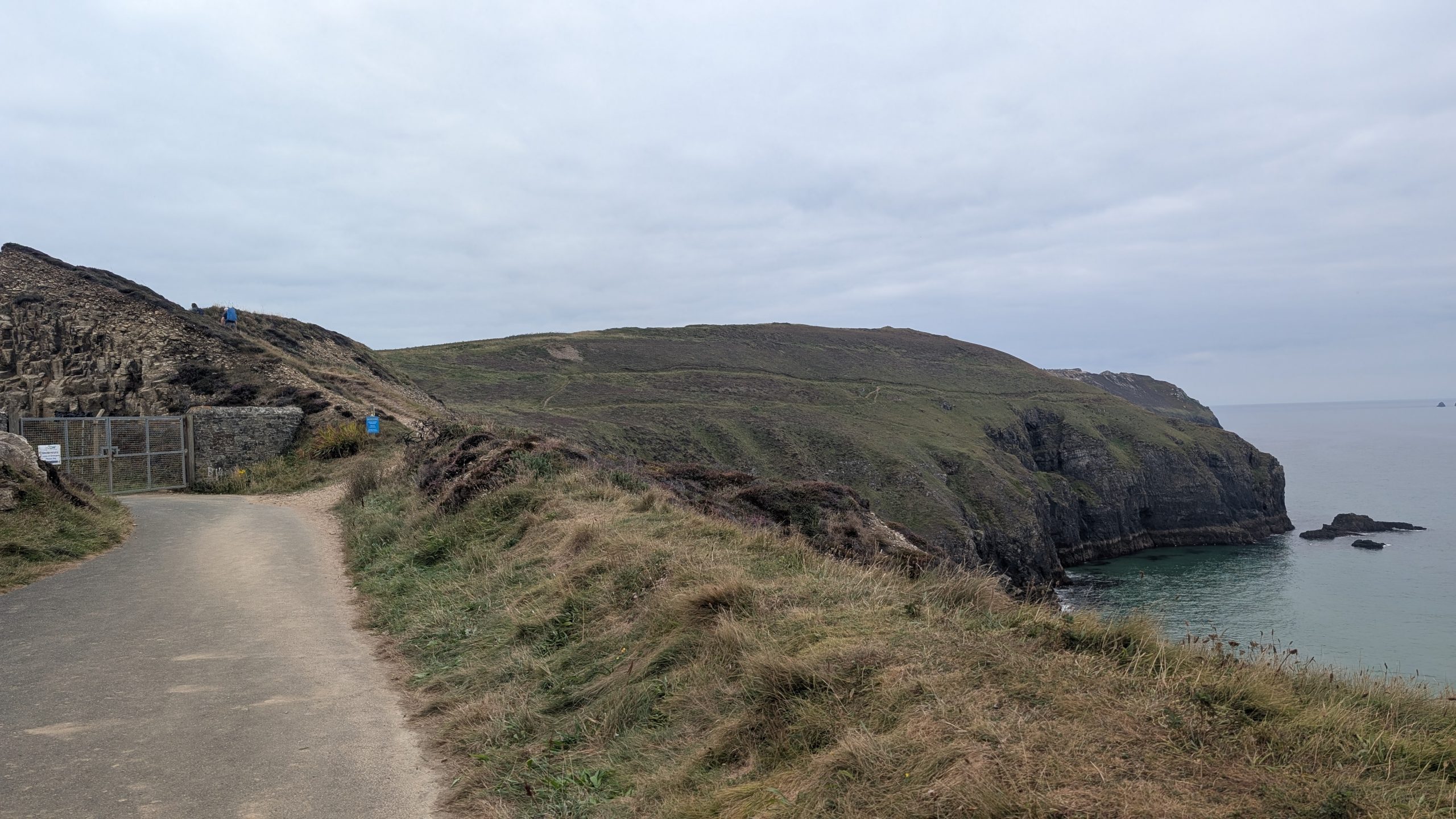
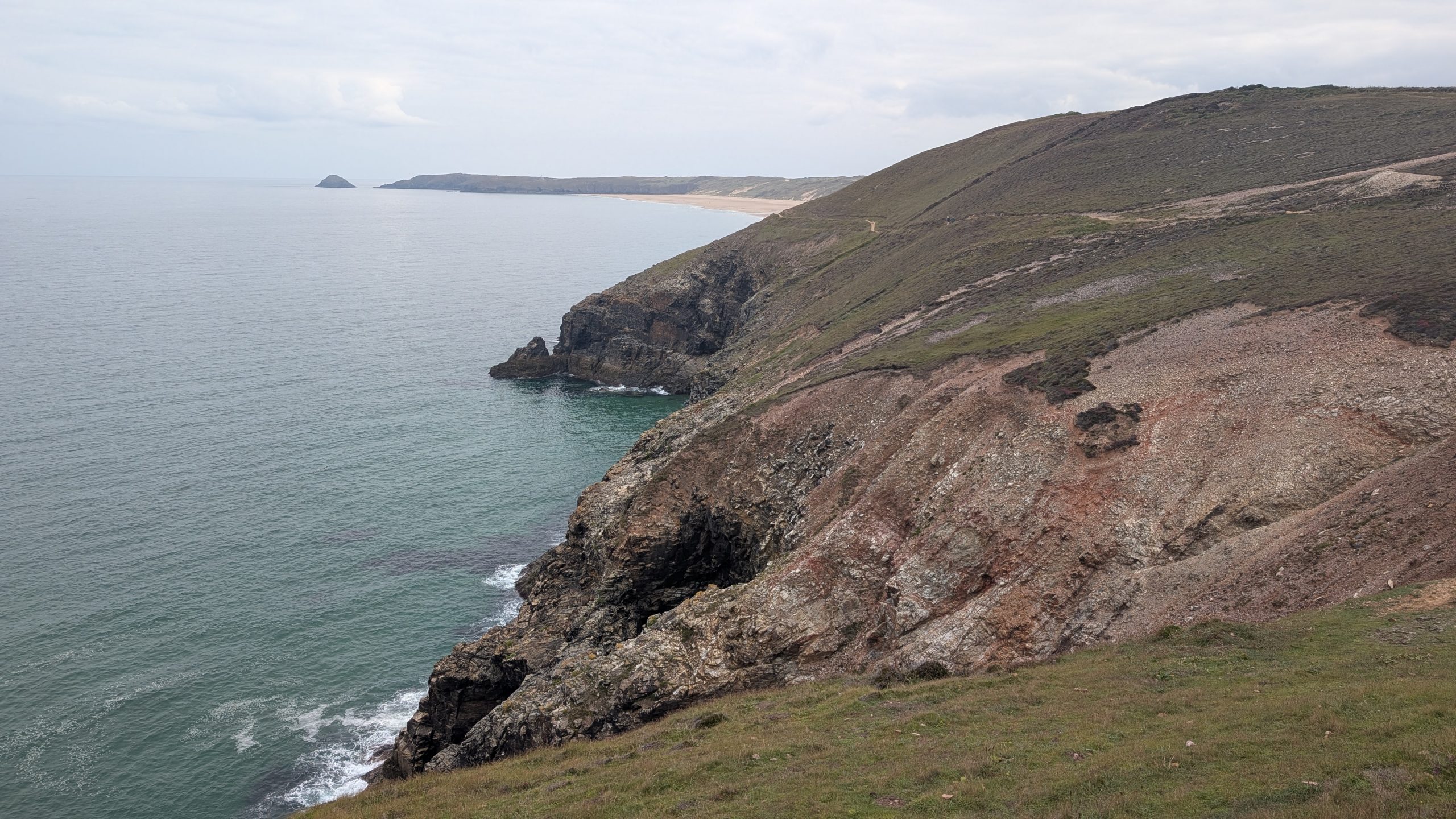
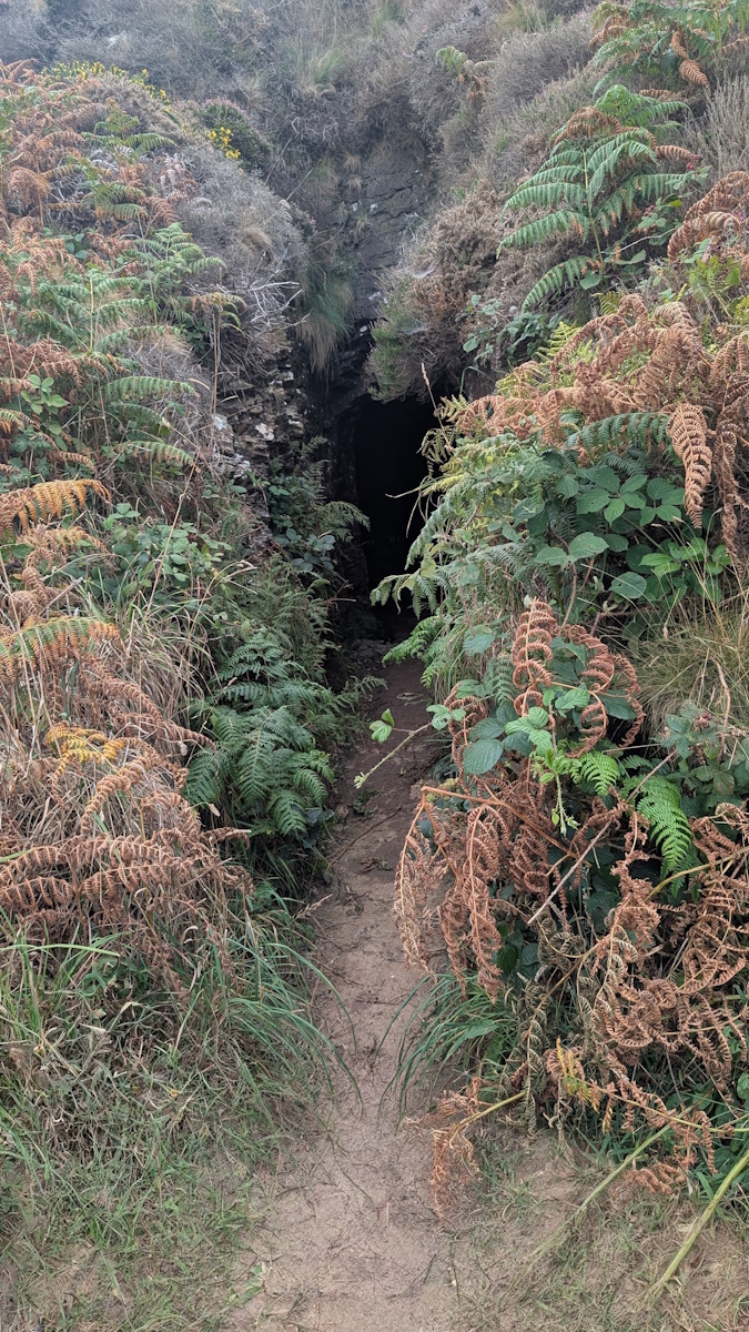
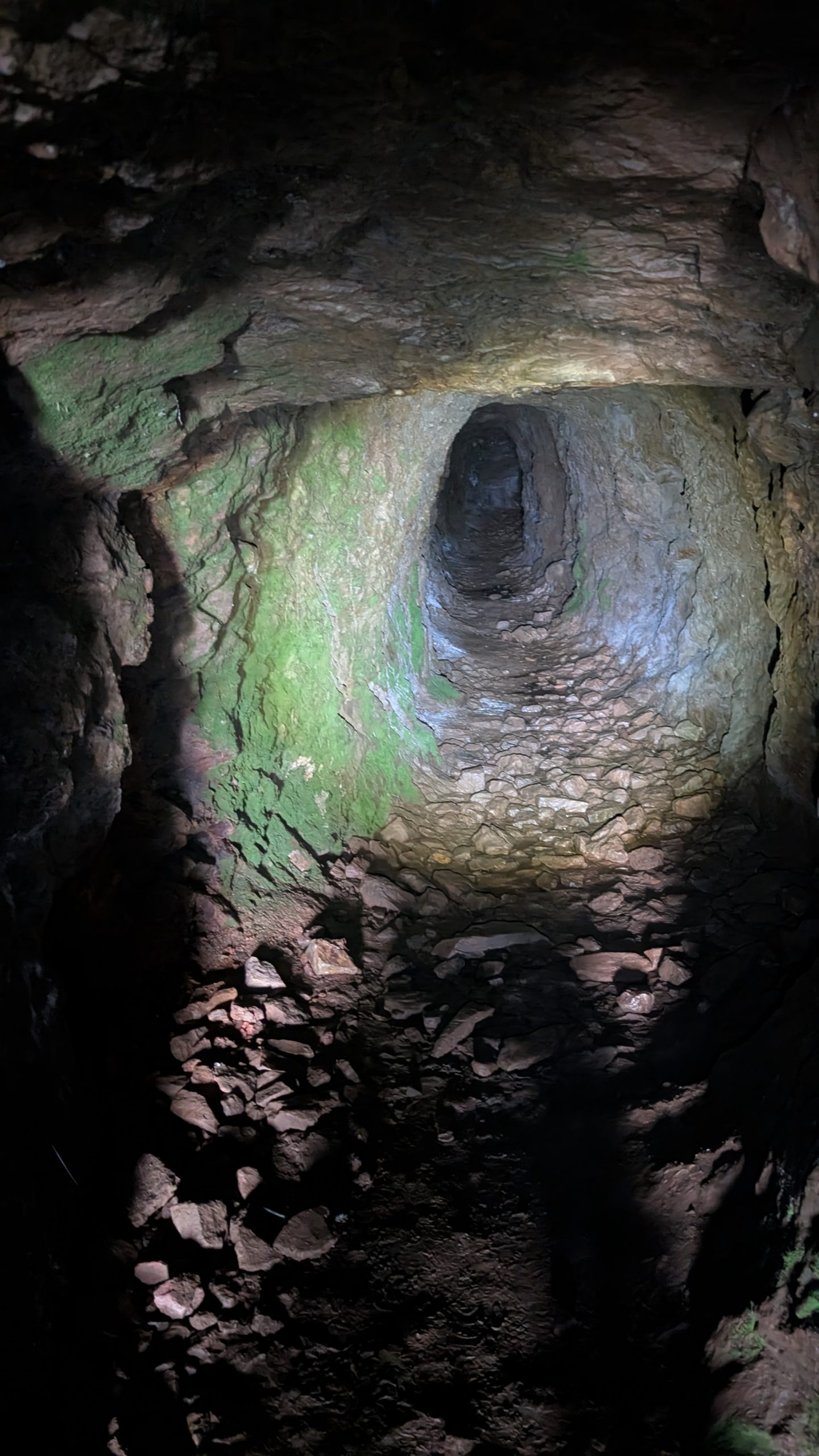
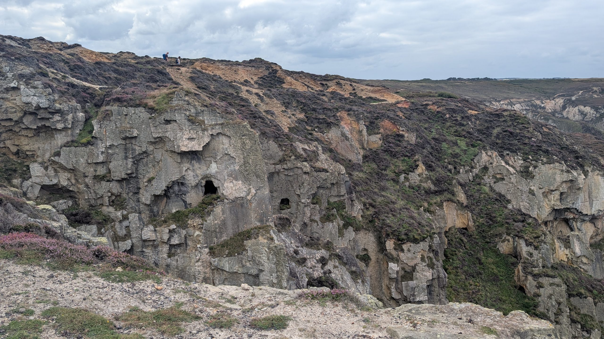
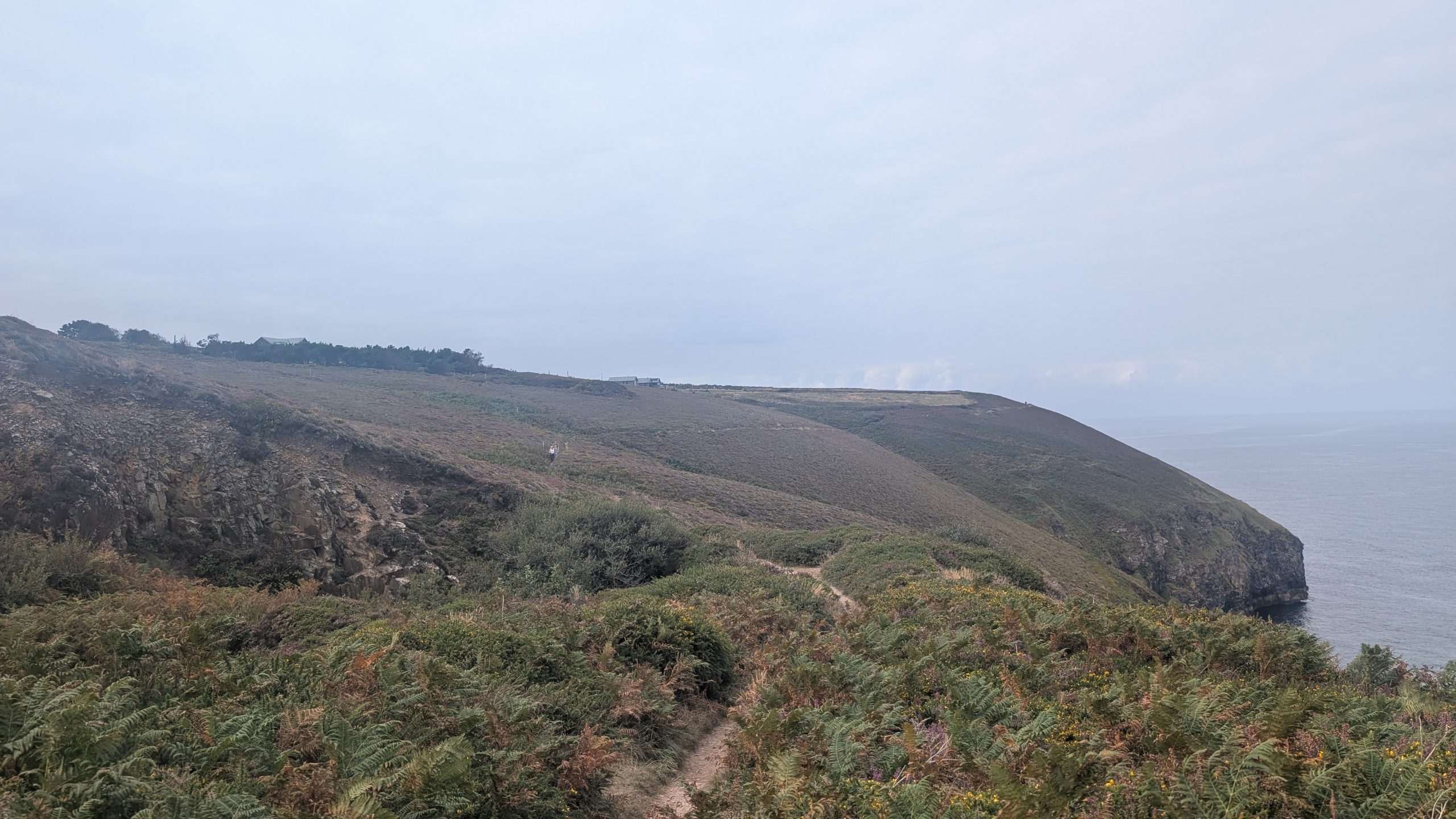
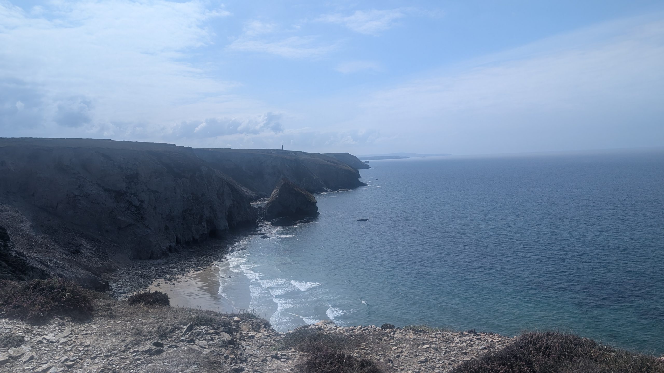
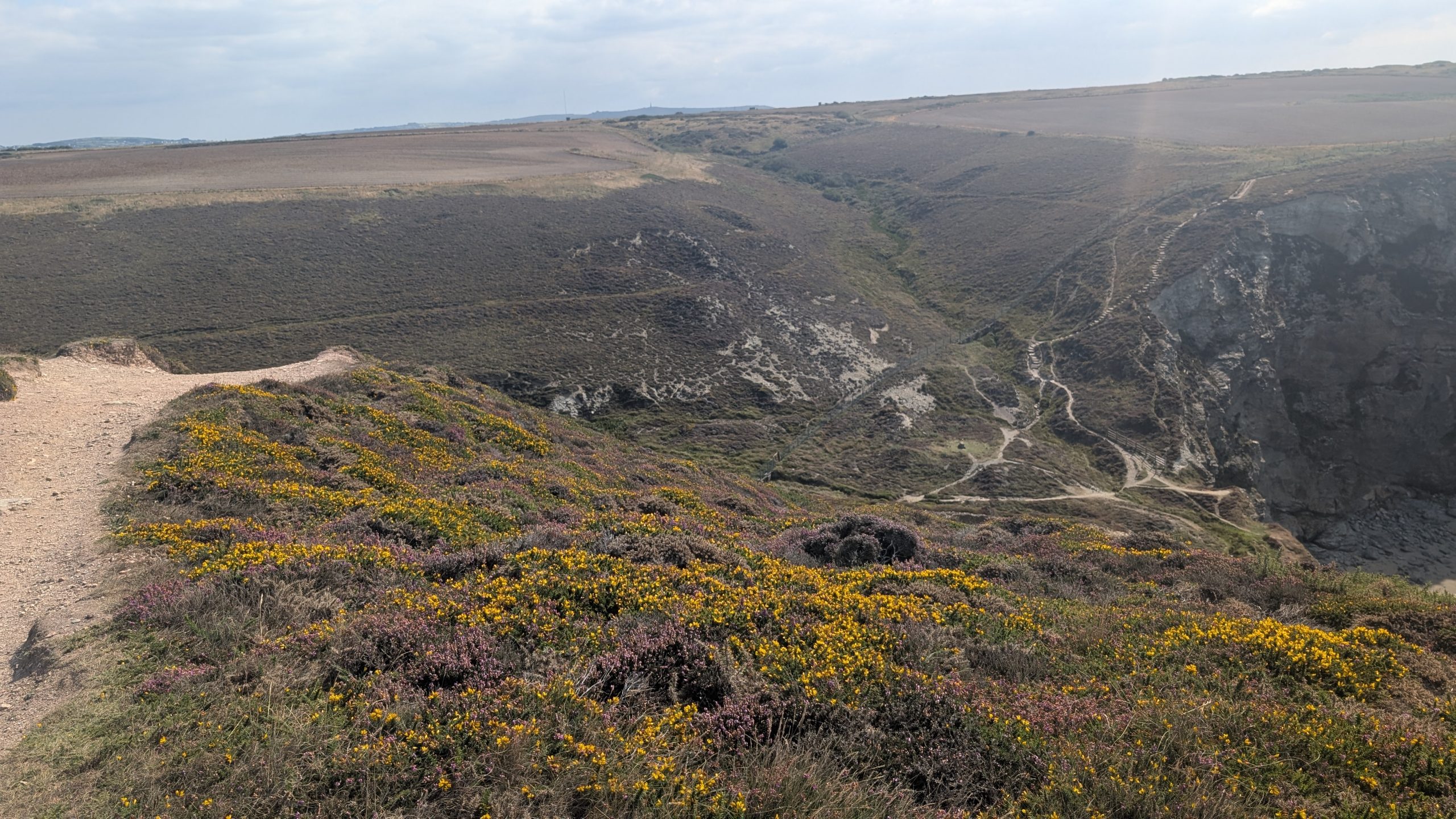
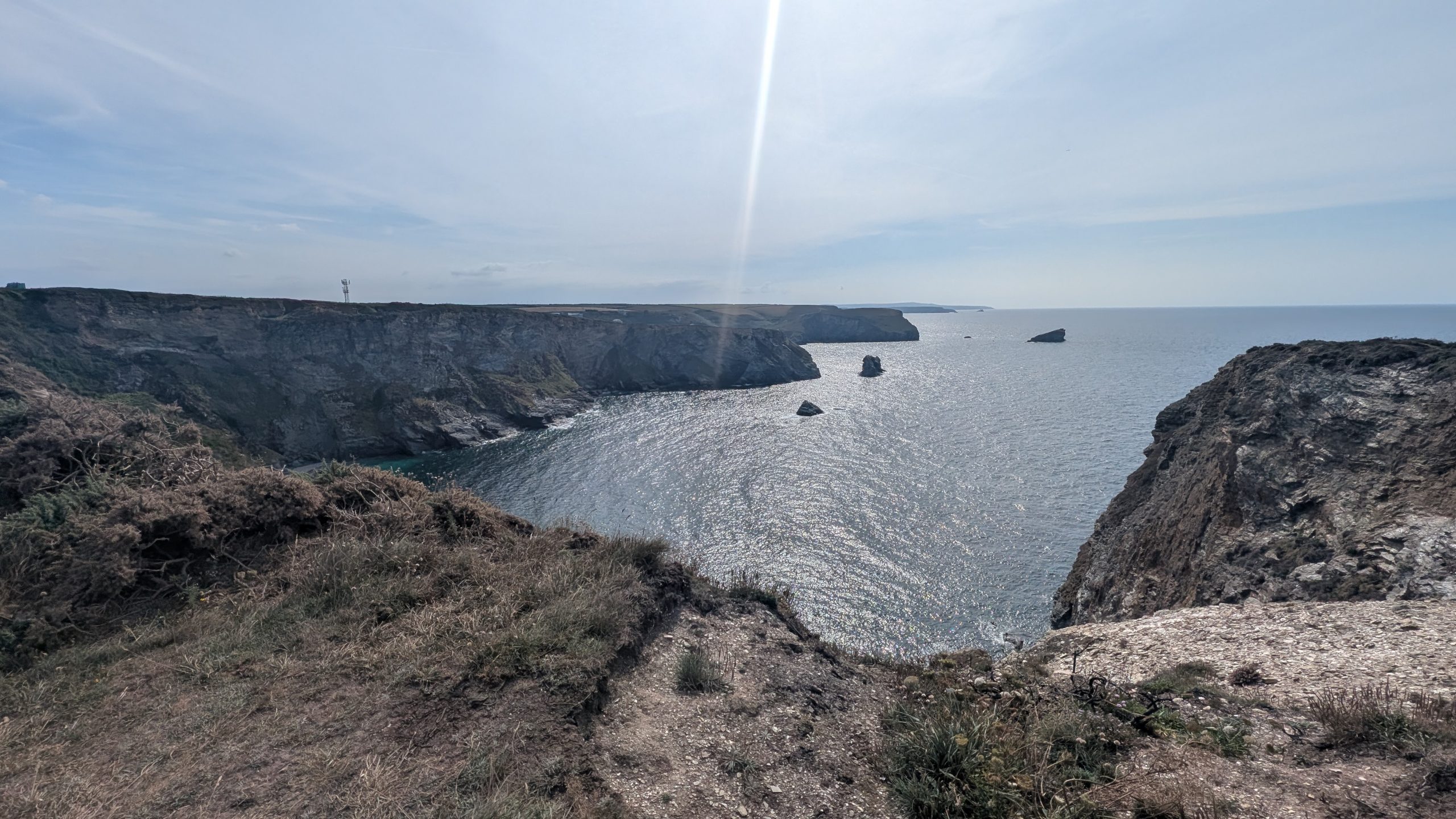
The path wound out past Droskyn Castle and the Youth Hostel before tracing the heather-clad slopes above the beach. Soon we entered an area shaped by mining, with spoil heaps and tunnels marking the legacy of Cligga Head Mine.
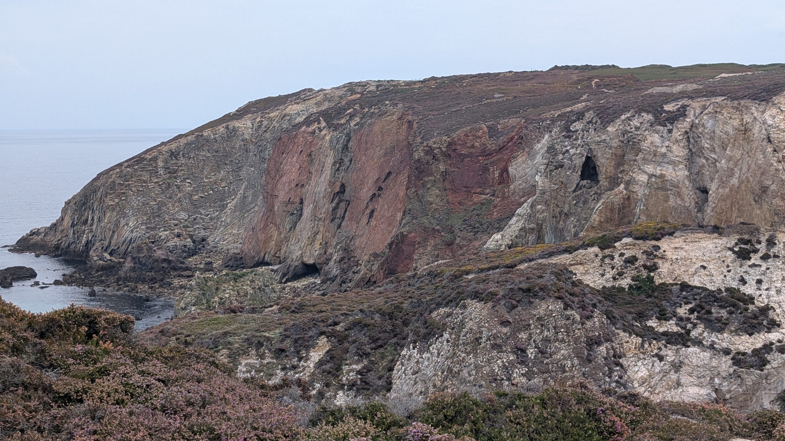
Here the cliffs tell their own geological story: 290 million years ago, granite cracked and hot fluids left behind tin and tungsten ores, later altered into streaks of quartz and copper that still colour the rocks today.
Passing the ruins and concrete foundations of ore processing machinery, we looked back to see the mineral-stained cliffs glowing with rusty reds and turquoise streaks.
Trevellas Porth and St Agnes
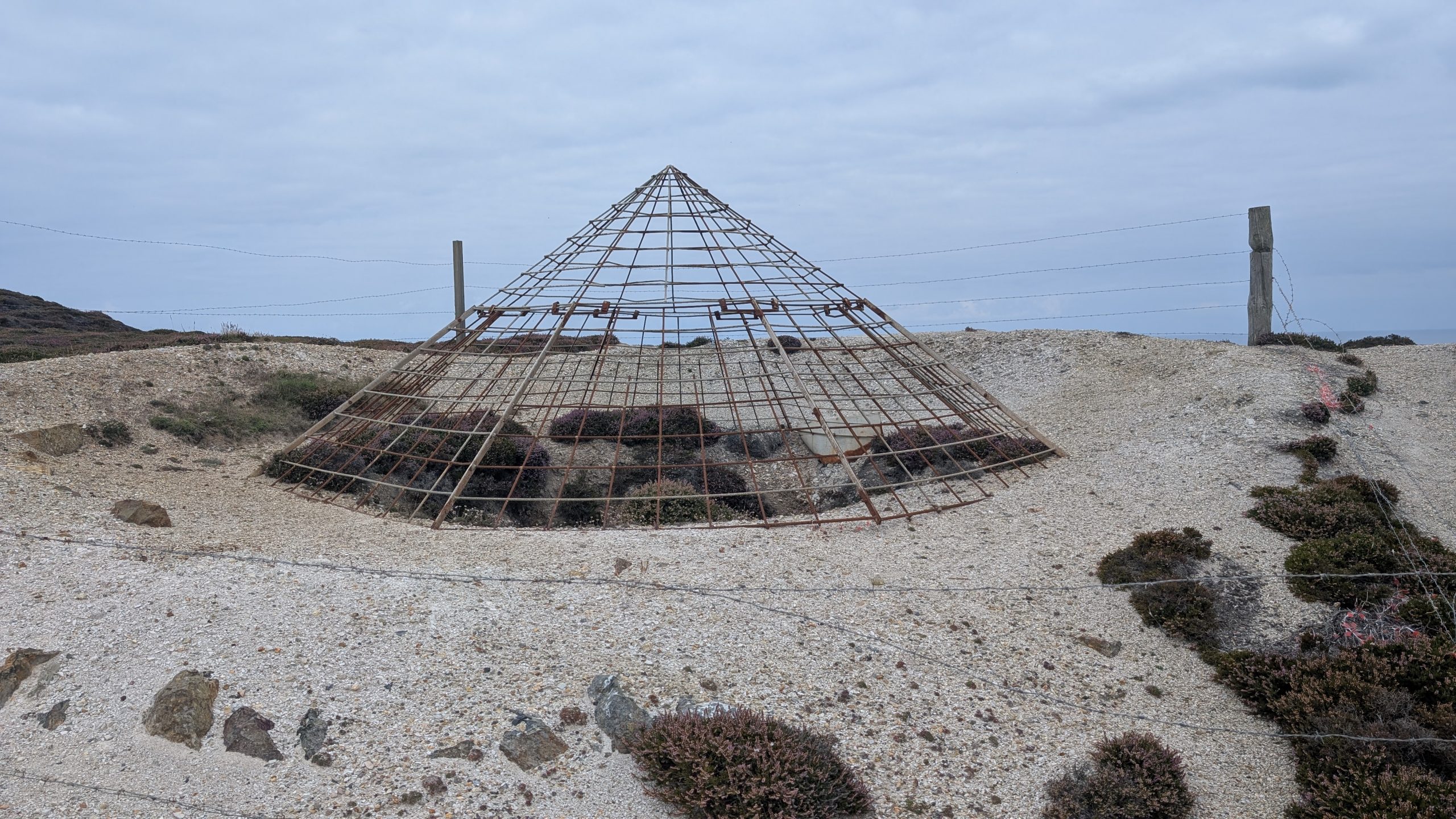
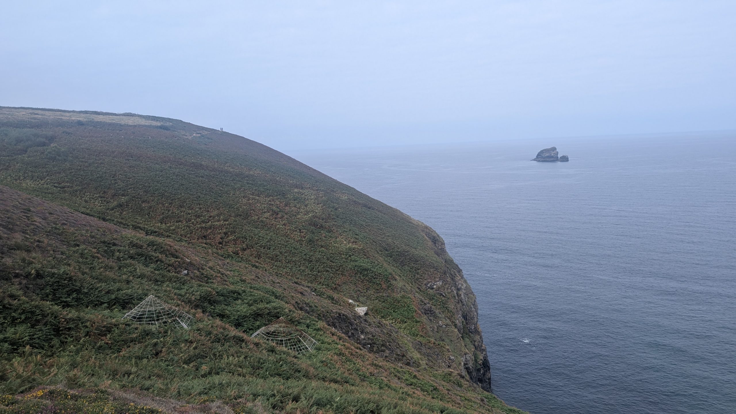
Beyond Cligga Head, the path rolled above Hanover Cove, named after the ship that wrecked here in 1763 with a cargo of gold coins. Conical frames over old mine shafts — now used as bat access — reminded us how deeply the landscape is marked by human industry.
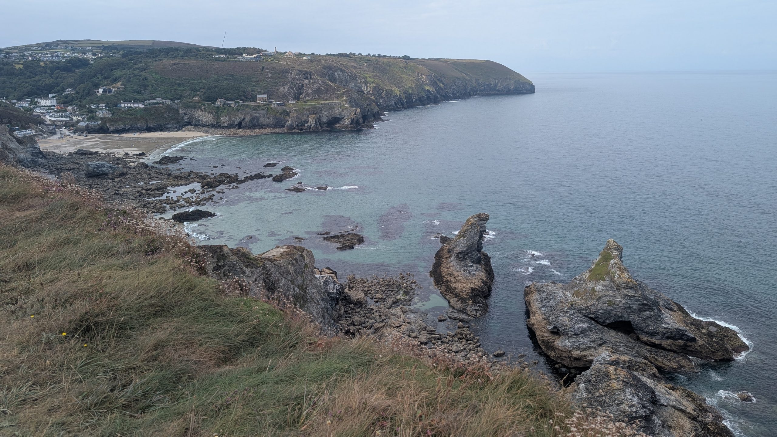
Soon we dropped into Trevellas Porth, overlooked by the Blue Hills Tin Mine. We walked up past the ruins, before turning back towards the coast and, passing through an ornate gate, then climbed up the other side of the valley. Once over the top, we descended some steps down to Trevaunance Cove at the foot of St Agnes.
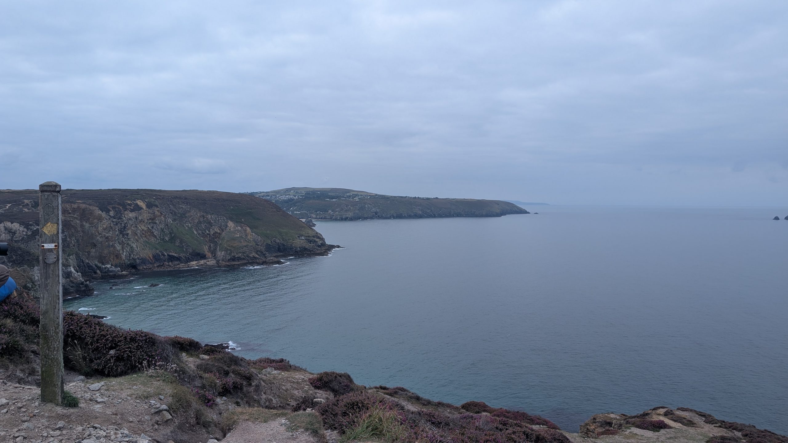
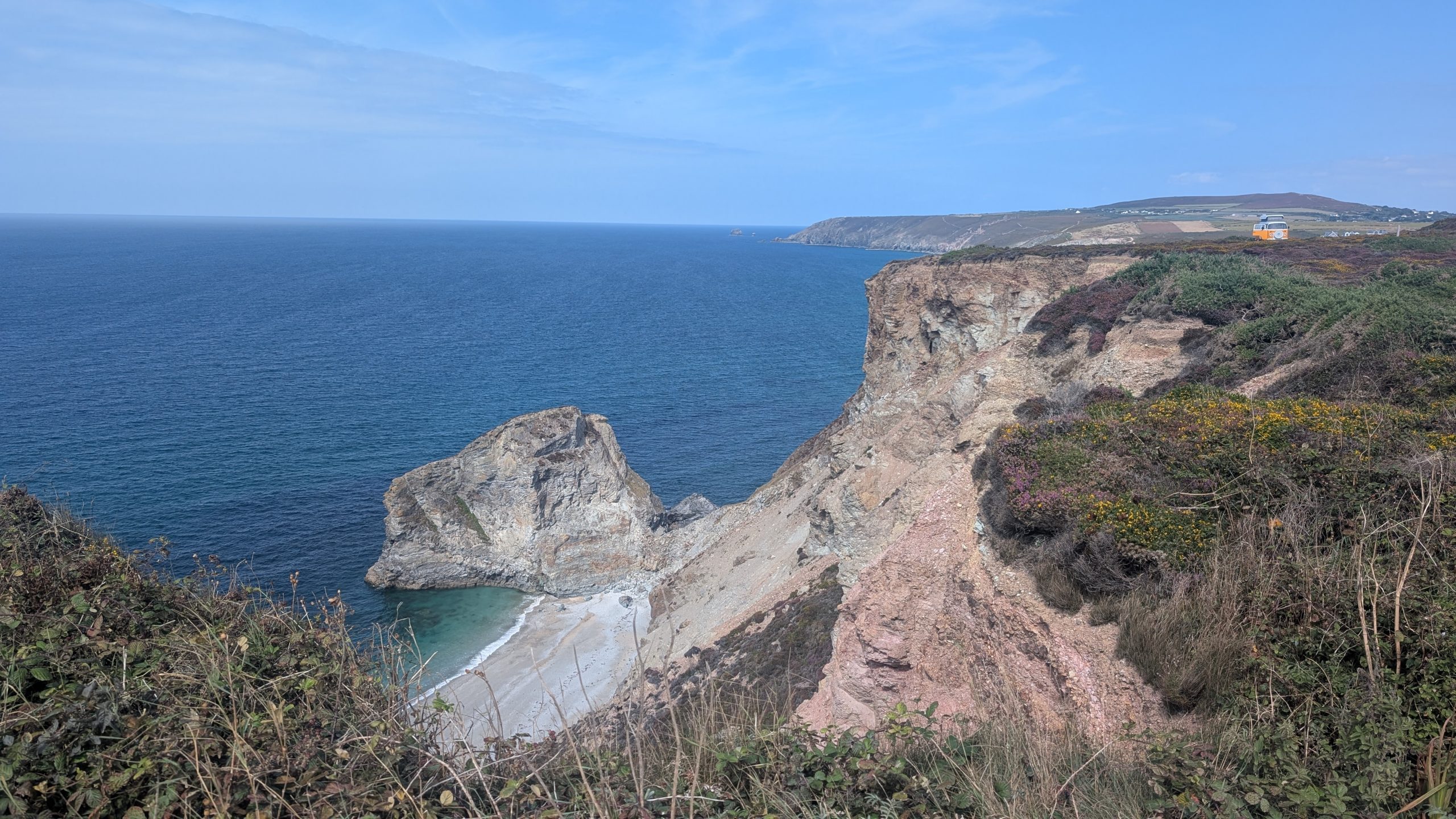
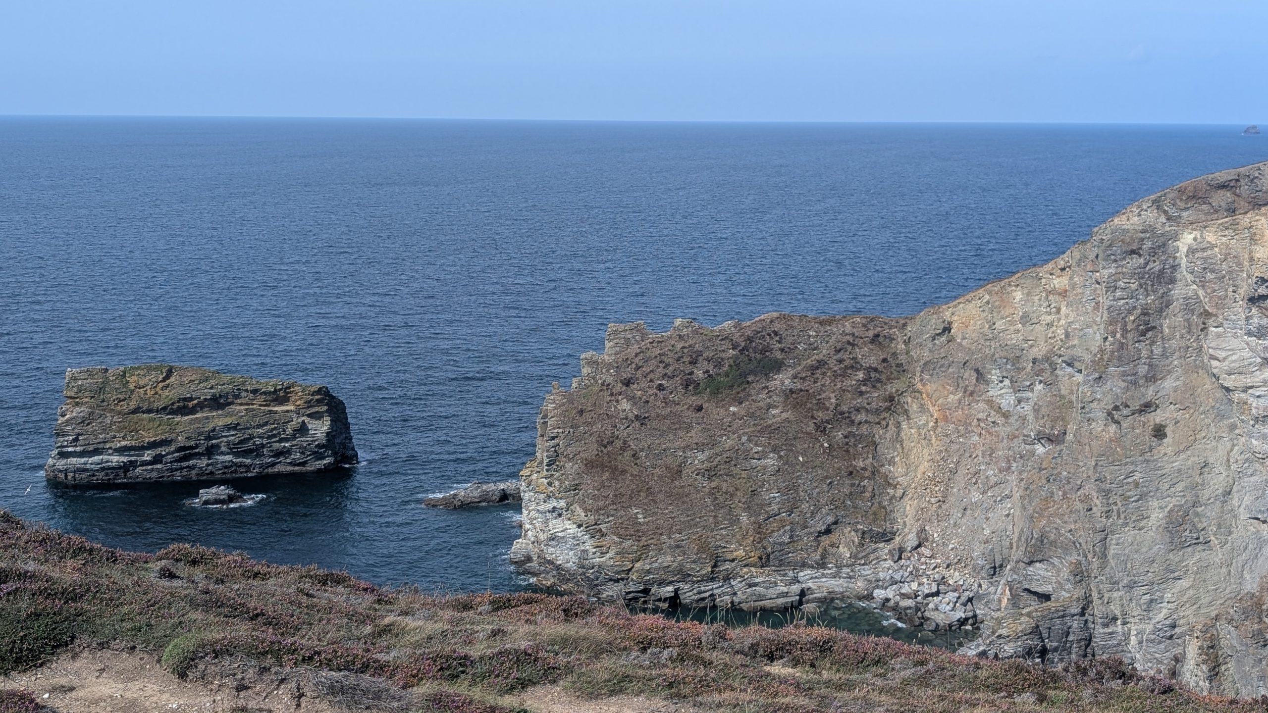
The route out threaded past cottages and holiday apartments, then curved around the headland with views of the Bawden Rocks — “Man and his Man” — standing sentinel offshore.
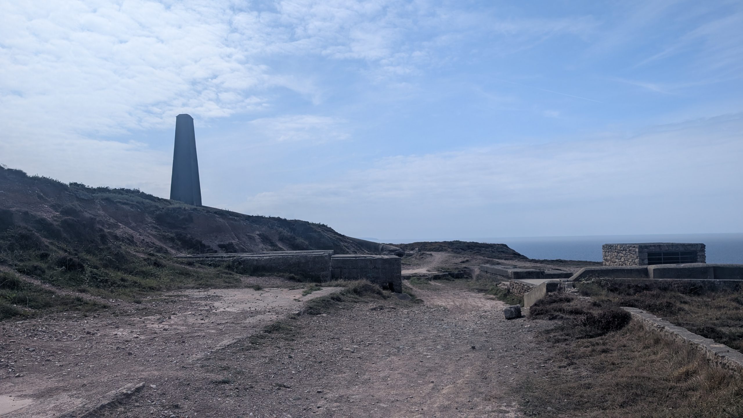
We followed a fairly level track, noting the old lookout up the hill ahead. Eventually, we took a right fork and dropped down to above St Agnes Head.
Wheal Coates and Chapel Porth
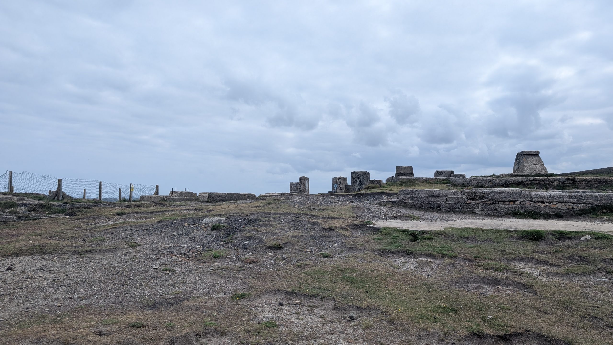
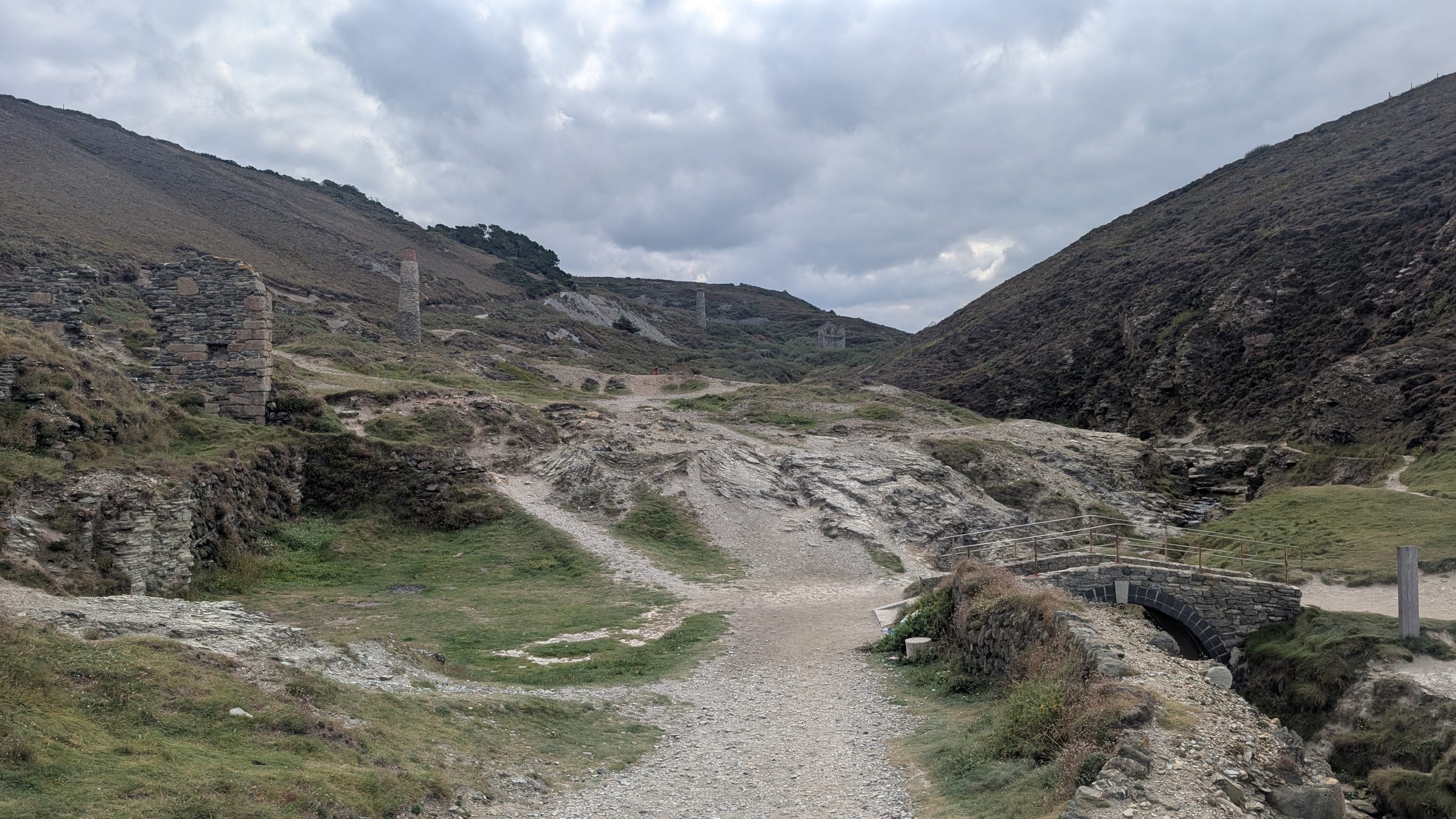
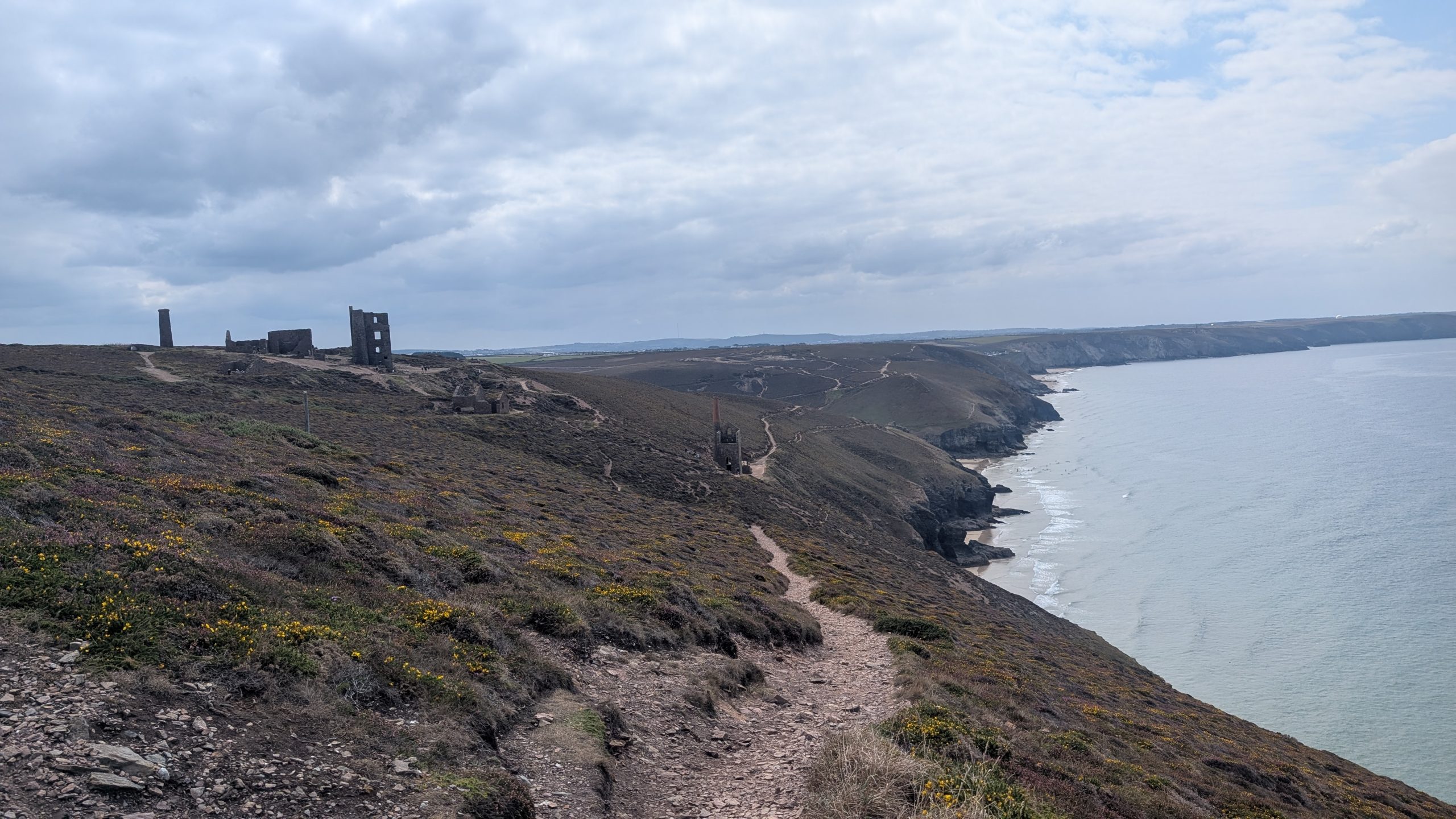
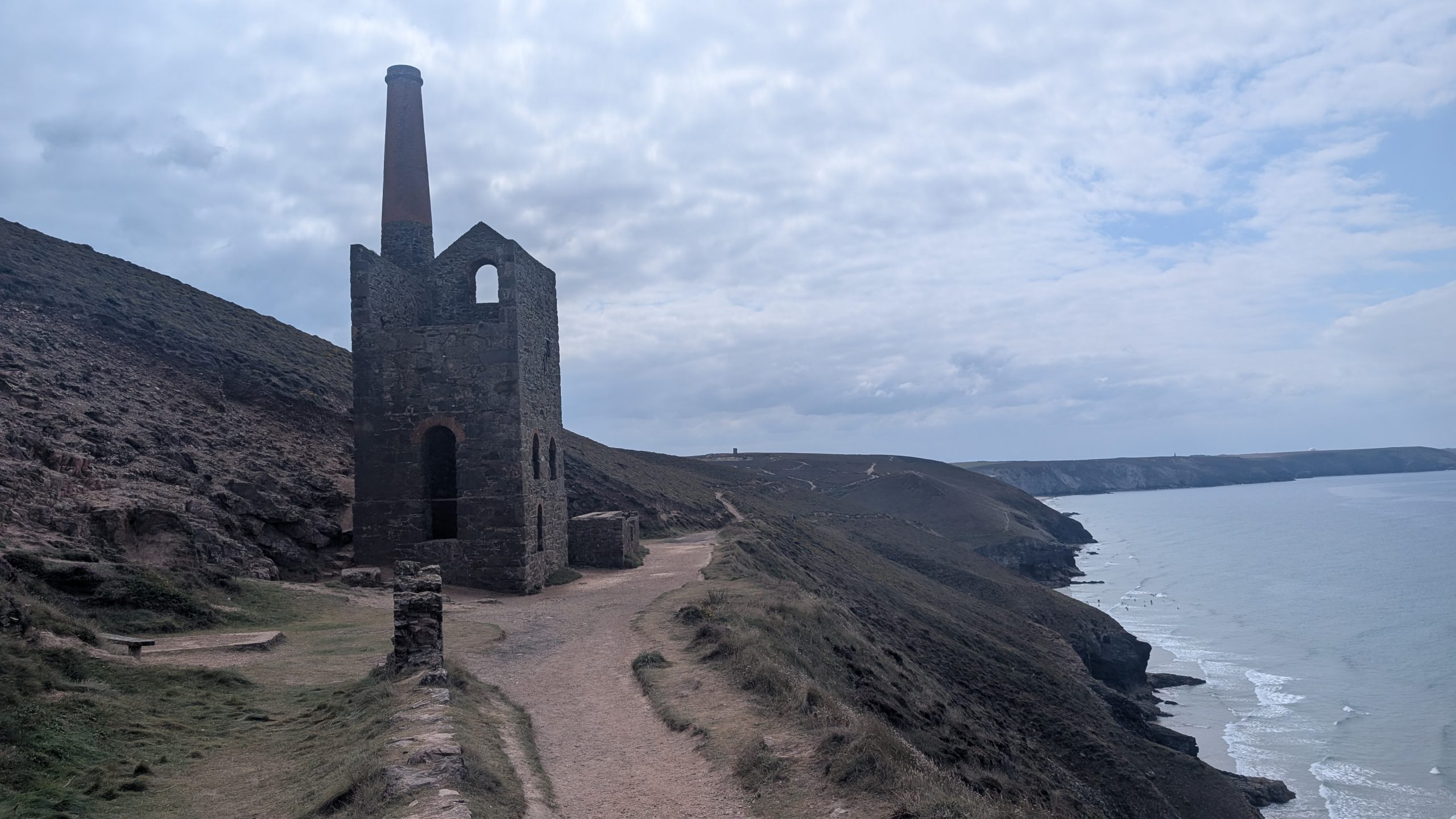
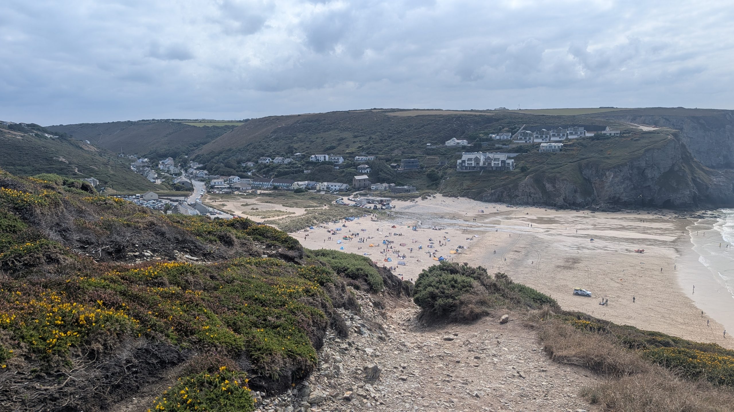
After leaving St Agnes Head, we picked our way up a rugged little path that soon opened onto a wide, straight track bustling with visitors from the nearby car park. For a while, we wondered if we had missed the turning down towards Chapel Porth, but eventually a fork appeared. Taking the right-hand path, we descended, and suddenly the hillside revealed one of Cornwall’s most iconic sights — the Wheal Coates engine house. Perched high above the sea, its weathered stone walls and surrounding mine workings stand as a striking reminder of the tin-mining era.
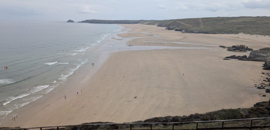
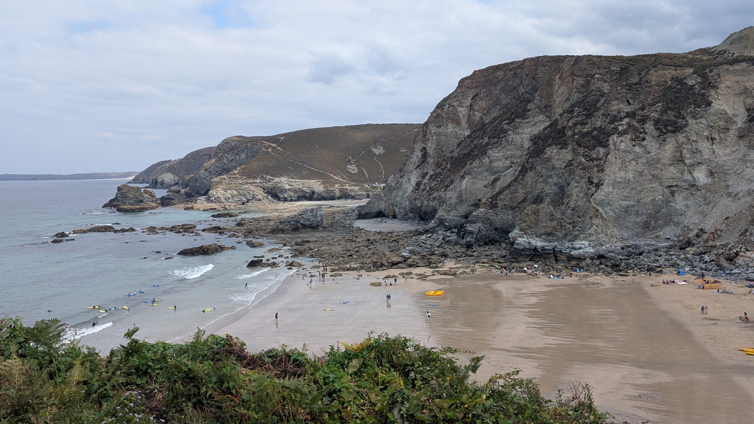
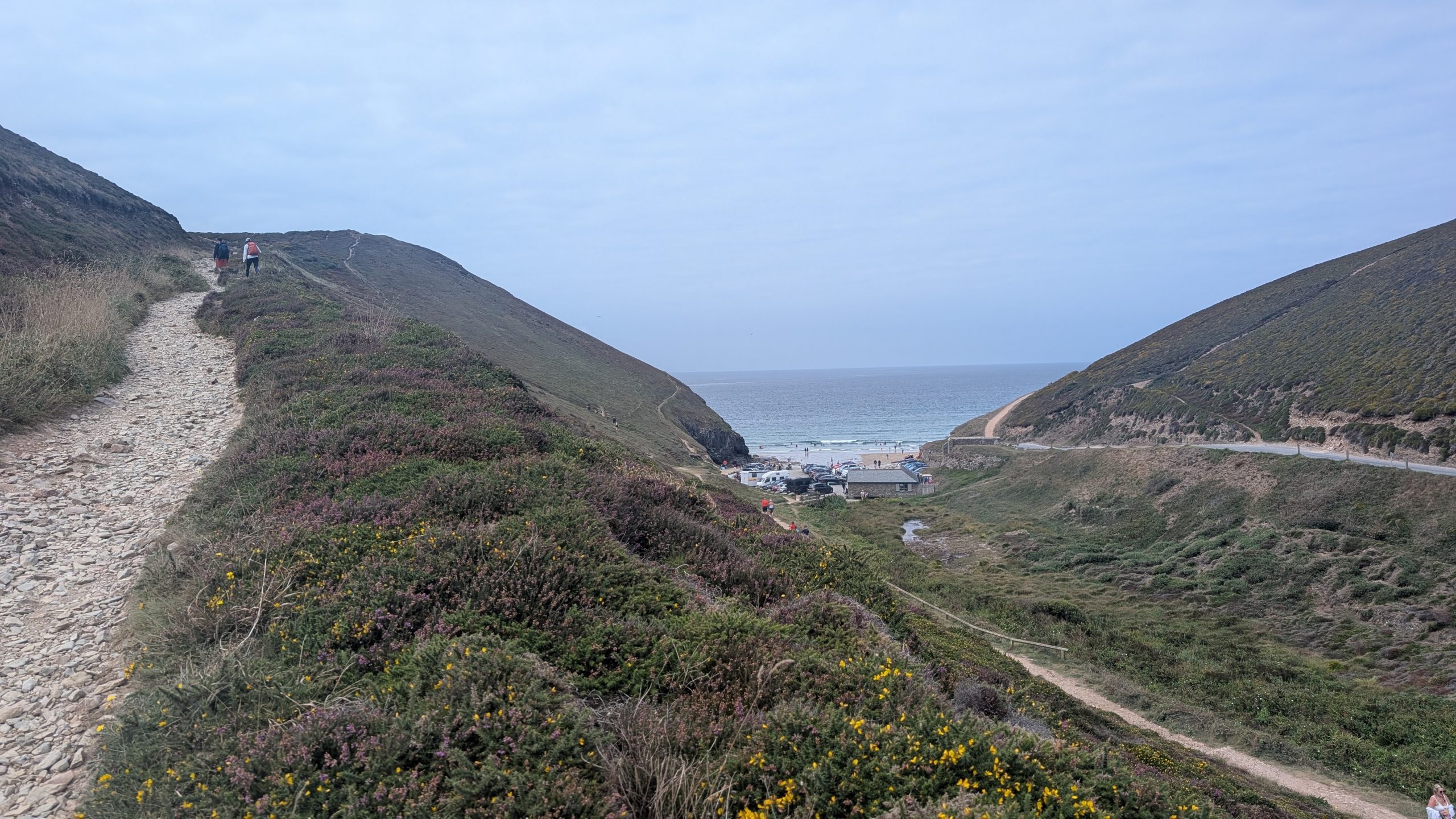
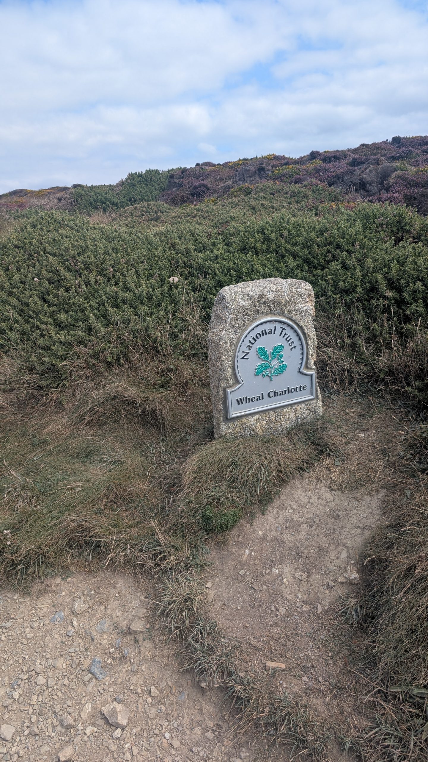
From here, the path descended to Chapel Porth, where Roxie cooled off in the stream — dogs aren’t allowed on the beach during summer. Refreshed, we headed up the valley before turning back towards the coast up a stony path. At the top, we looped past Wheal Charlotte before following the cliff edge towards Porth Towan, one of Cornwall’s last heathland areas.
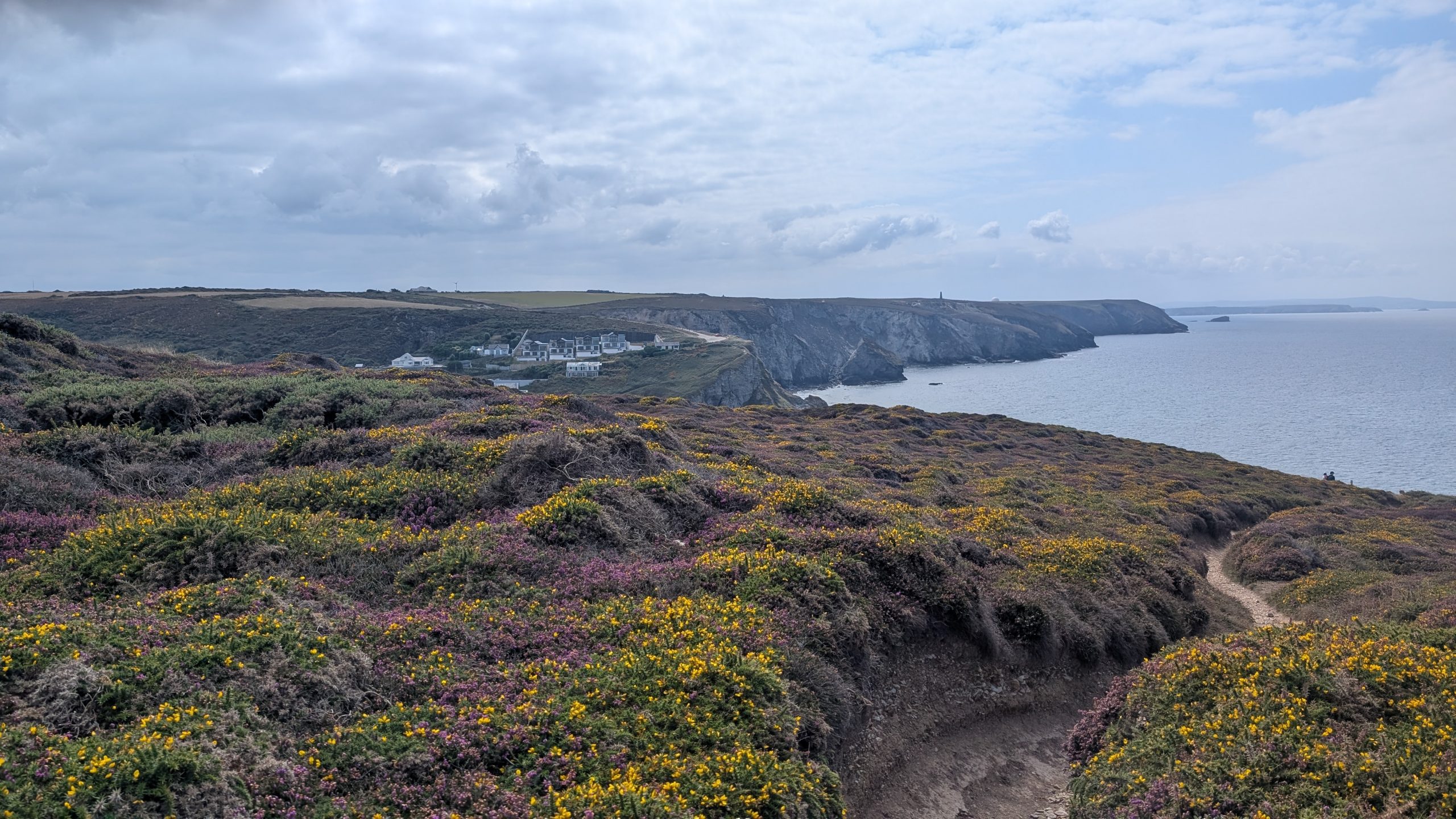
Through Porth Towan and West Wheal Towan
Porth Towan beach was another dog-free zone, though a handy stream gave Roxie her second dip of the day. We headed inland, passed around the Unicorn and climbed up out of the village towards the headland.
The track continued several meters inland from the cliffside, with MoD land and an ever-present fence on our left. As we walked, a chimney stack grew closer until we reached the ruins of the West Wheal Towan mine. The chimney was part of the mine’s ruins, likely from the smelting operation.
Leaving the mine’s ruins, the Path gave way to a stretch along the cliff edge, where the MoD fences and unusual concrete structures hinted at more modern uses of the land.
Sally’s Bottom and Hayle Ulla
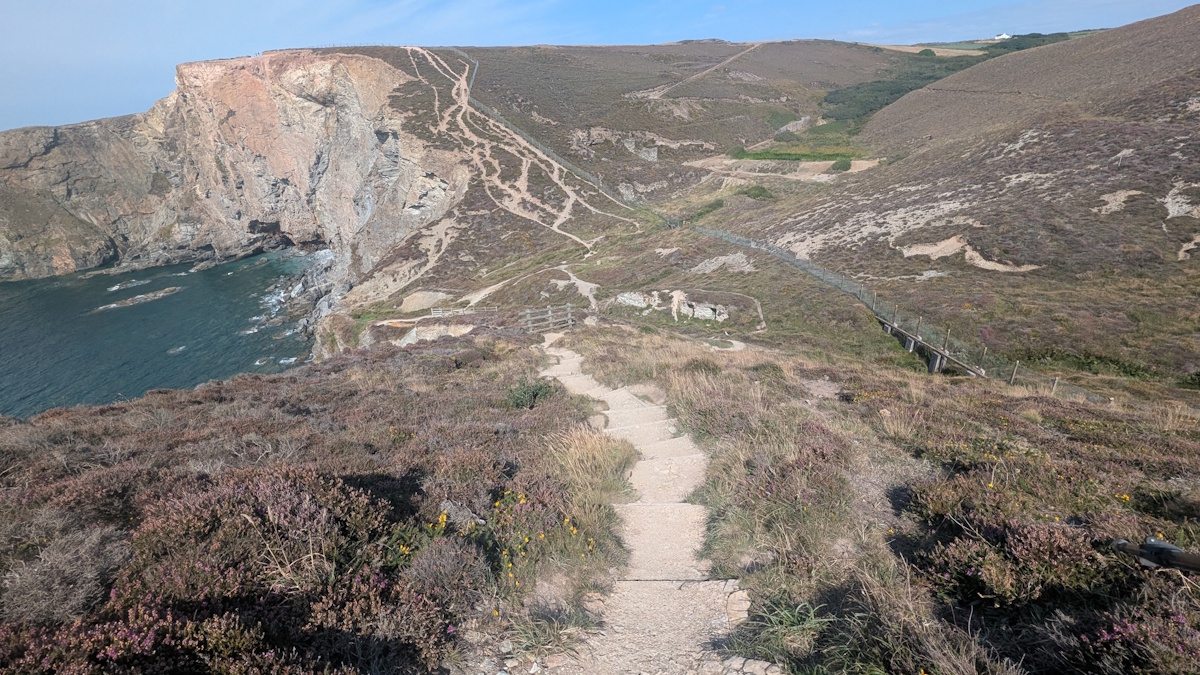
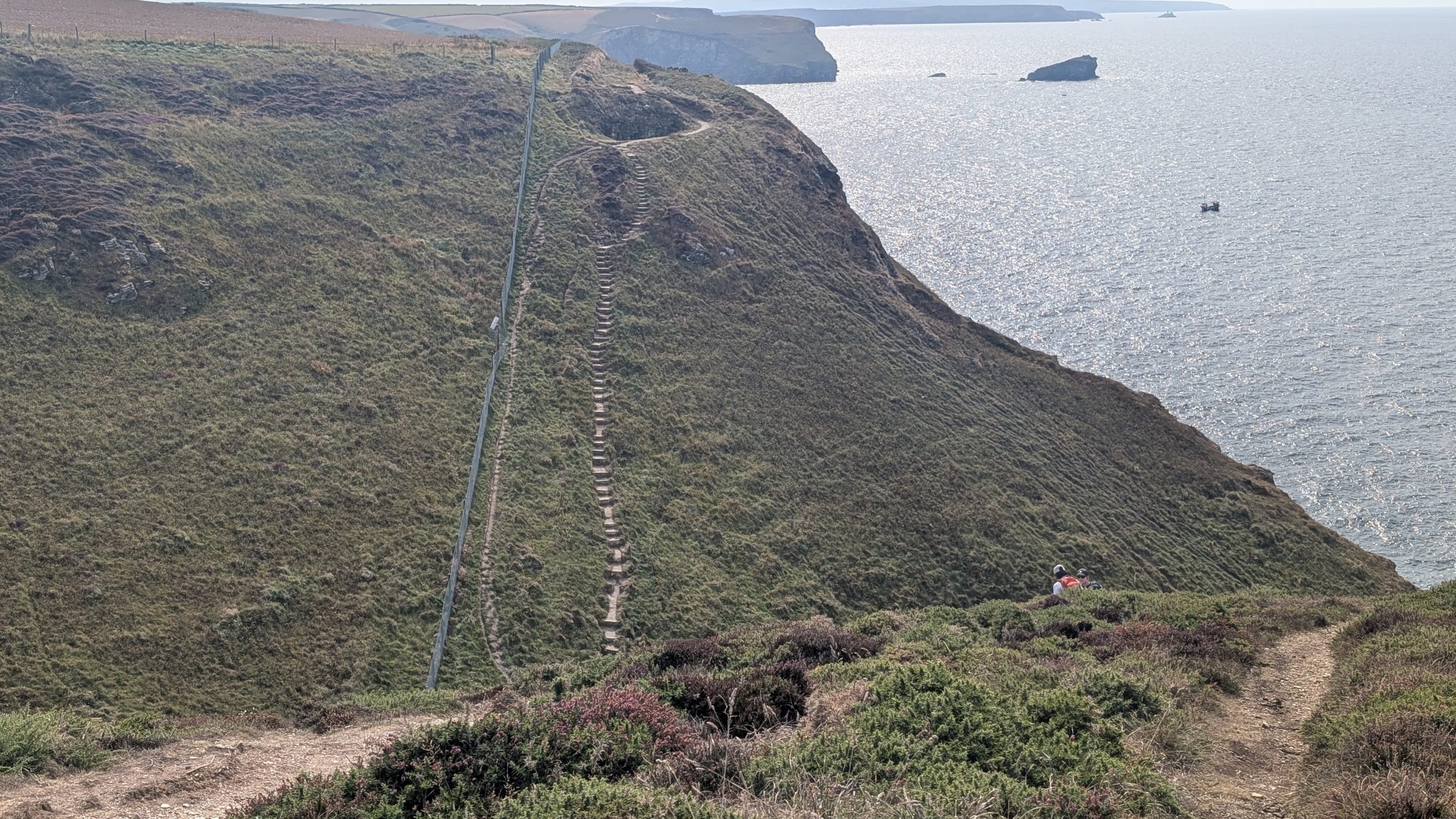
The drama of this section lies in its valleys. At Sally’s Bottom, around 130 steps plunged down one side before 70 more hauled us back up the other. Hard work, but rewarded with sweeping views back across the headland.
Further on, another descent loomed — Hayle Ulla. On the map, its profile looked less daunting, but in reality, the steps were far steeper and demanded slow, careful footwork.
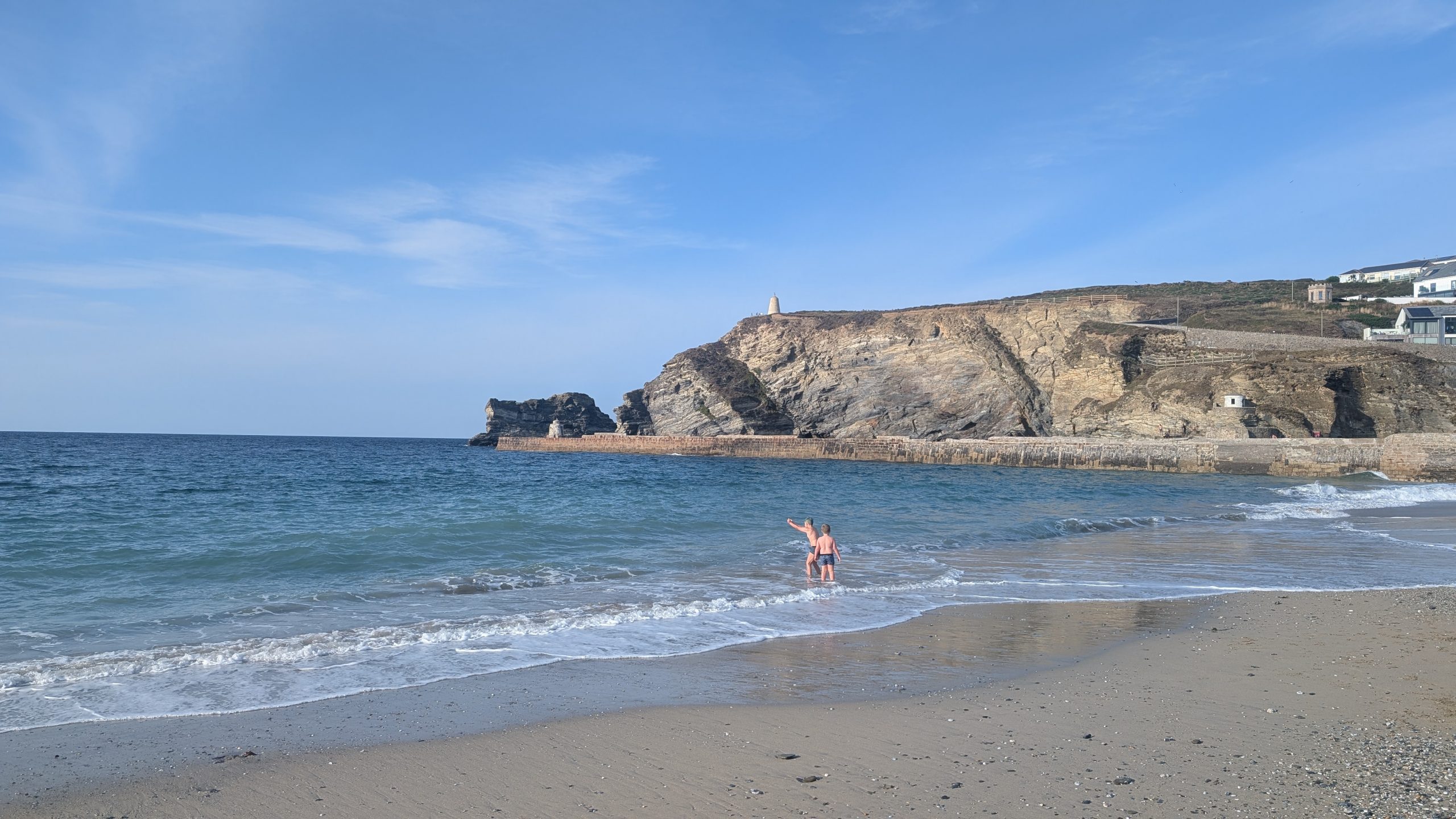
Arrival in Portreath
At last, the headland of Western Hill came into view, with Gull Rock, Horse Rock and Gooden Heane Rock lined up offshore. The path curved towards Portreath, dropping into the village via Lighthouse Hill.
Portreath Beach also had a dog ban during the day, but a friendly local pointed us to harbour steps where Roxie could take another dip, though the depth surprised her and she leapt back out quickly — cooled but unimpressed.
We ended the day with fish of the day and a celebratory drink at the Portreath Arms, before finally stepping onto the beach in the evening when dogs were once again welcome. Roxie had her long-awaited run on the sand.
Portreath grew from a quiet fishing hamlet into a thriving industrial port during Cornwall’s mining boom. In the 18th and 19th centuries, its harbour and stout stone breakwater became vital for exporting copper ore and importing coal to power the local mines. The “Portreath Tramroad,” one of Cornwall’s earliest railways, linked the harbour to the mines inland, making the village a key artery in the industrial landscape. Ships once crowded the quay, and remnants of engine houses and tram routes still hint at that era of intense activity.
Today, Portreath is far removed from its industrial heyday, better known as a family seaside resort and gateway to the North Cornwall coast. The sandy beach is popular with surfers, while the surrounding cliffs and downs form part of the South West Coast Path, offering dramatic views and reminders of the area’s heritage. The village itself retains a friendly, small-community atmosphere, where echoes of its mining past sit alongside its modern role as a holiday destination.
The drive home that night was plagued by road closures and diversions, but the memory of a day of clifftops, coves, and mining ruins made it feel more than worth the effort.
Walk Summary: Perranporth to Portreath
Distance: 20.8 km (12.9 miles)
Elevation Gained: 672 m (2203ft)
Difficulty: Challenging – frequent cliff climbs and descents
Moving Time: 5:14 · Elapsed Time: 6:23
Highlights:
- Droskyn Point – Millennium sundial set to “Cornish time”
- Cligga Head – cliffs streaked with mineral veins and copper stains
- Hanover Cove – site of 1763 shipwreck and treasure legend
- Newdowns Head – lookout for grey seals on rocks below
- St Agnes Head – sweeping clifftop views, popular with hang-gliders
- Bawden Rocks – offshore stacks with seabird colonies
- Wheal Coates – iconic tin mine ruins above the sea
- Chapel Porth – sandy beach and popular surf spot
- Sally’s Bottom – granite steps down to secluded cove
- Pepperpot Daymark – white navigation aid near Portreath
- Portreath – sheltered sandy cove and harbour village